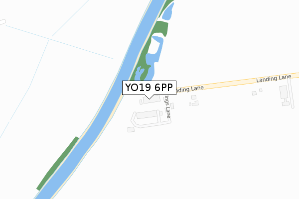
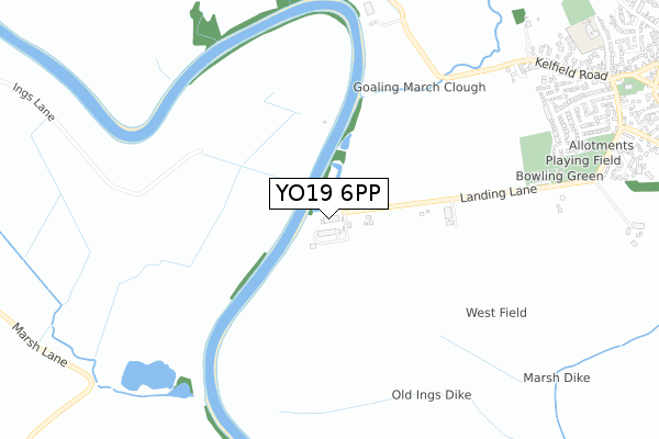
YO19 6PP is located in the Barlby & Riccall electoral ward, within the unitary authority of North Yorkshire and the English Parliamentary constituency of Selby and Ainsty. The Sub Integrated Care Board (ICB) Location is NHS Humber and North Yorkshire ICB - 03Q and the police force is North Yorkshire. This postcode has been in use since October 2017.


GetTheData
Source: OS Open Zoomstack (Ordnance Survey)
Licence: Open Government Licence (requires attribution)
Attribution: Contains OS data © Crown copyright and database right 2025
Source: Open Postcode Geo
Licence: Open Government Licence (requires attribution)
Attribution: Contains OS data © Crown copyright and database right 2025; Contains Royal Mail data © Royal Mail copyright and database right 2025; Source: Office for National Statistics licensed under the Open Government Licence v.3.0
| Easting | 460820 |
| Northing | 437331 |
| Latitude | 53.828712 |
| Longitude | -1.077445 |
GetTheData
Source: Open Postcode Geo
Licence: Open Government Licence
| Country | England |
| Postcode District | YO19 |
➜ See where YO19 is on a map ➜ Where is Riccall? | |
GetTheData
Source: Land Registry Price Paid Data
Licence: Open Government Licence
| Ward | Barlby & Riccall |
| Constituency | Selby And Ainsty |
GetTheData
Source: ONS Postcode Database
Licence: Open Government Licence
| 495 Hail And Ride End (Silver Street) | Riccall | 1,252m |
| Costcutter (Station Road) | Riccall | 1,338m |
| Chapel (Main Street) | Riccall | 1,379m |
| Villa Nurseries (York Road) | Riccall | 1,621m |
| Villa Nurseries (York Road) | Riccall | 1,626m |
GetTheData
Source: NaPTAN
Licence: Open Government Licence
GetTheData
Source: ONS Postcode Database
Licence: Open Government Licence


➜ Get more ratings from the Food Standards Agency
GetTheData
Source: Food Standards Agency
Licence: FSA terms & conditions
| Last Collection | |||
|---|---|---|---|
| Location | Mon-Fri | Sat | Distance |
| Church Street Riccall | 17:50 | 10:20 | 1,170m |
| Riccall Post Office | 17:45 | 10:20 | 1,437m |
| Kelfield Village | 17:45 | 12:15 | 1,687m |
GetTheData
Source: Dracos
Licence: Creative Commons Attribution-ShareAlike
| Risk of YO19 6PP flooding from rivers and sea | High |
| ➜ YO19 6PP flood map | |
GetTheData
Source: Open Flood Risk by Postcode
Licence: Open Government Licence
The below table lists the International Territorial Level (ITL) codes (formerly Nomenclature of Territorial Units for Statistics (NUTS) codes) and Local Administrative Units (LAU) codes for YO19 6PP:
| ITL 1 Code | Name |
|---|---|
| TLE | Yorkshire and The Humber |
| ITL 2 Code | Name |
| TLE2 | North Yorkshire |
| ITL 3 Code | Name |
| TLE22 | North Yorkshire CC |
| LAU 1 Code | Name |
| E07000169 | Selby |
GetTheData
Source: ONS Postcode Directory
Licence: Open Government Licence
The below table lists the Census Output Area (OA), Lower Layer Super Output Area (LSOA), and Middle Layer Super Output Area (MSOA) for YO19 6PP:
| Code | Name | |
|---|---|---|
| OA | E00142159 | |
| LSOA | E01027903 | Selby 003F |
| MSOA | E02005811 | Selby 003 |
GetTheData
Source: ONS Postcode Directory
Licence: Open Government Licence
| YO19 6RZ | Norseman Close | 930m |
| YO19 6NW | Ash Grove | 959m |
| YO19 6RR | The Meadows | 991m |
| YO19 6NS | Romans Close | 992m |
| YO19 6PH | Kelfield Road | 1007m |
| YO19 6RD | Brickyard Cottages | 1014m |
| YO19 6NZ | The Hawthorns | 1026m |
| YO19 6RB | Pond View | 1035m |
| YO19 6PQ | Kelfield Road | 1035m |
| YO19 6PJ | West Court | 1056m |
GetTheData
Source: Open Postcode Geo; Land Registry Price Paid Data
Licence: Open Government Licence