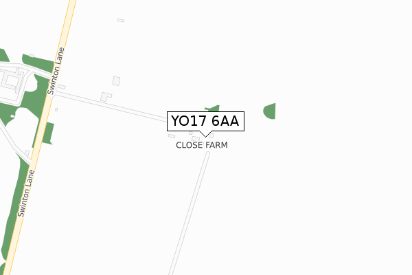
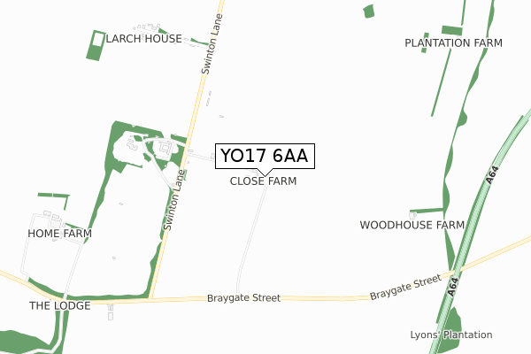
YO17 6AA is located in the Amotherby & Ampleforth electoral ward, within the unitary authority of North Yorkshire and the English Parliamentary constituency of Thirsk and Malton. The Sub Integrated Care Board (ICB) Location is NHS Humber and North Yorkshire ICB - 42D and the police force is North Yorkshire. This postcode has been in use since September 2018.


GetTheData
Source: OS Open Zoomstack (Ordnance Survey)
Licence: Open Government Licence (requires attribution)
Attribution: Contains OS data © Crown copyright and database right 2025
Source: Open Postcode Geo
Licence: Open Government Licence (requires attribution)
Attribution: Contains OS data © Crown copyright and database right 2025; Contains Royal Mail data © Royal Mail copyright and database right 2025; Source: Office for National Statistics licensed under the Open Government Licence v.3.0
| Easting | 476220 |
| Northing | 471794 |
| Latitude | 54.136363 |
| Longitude | -0.834916 |
GetTheData
Source: Open Postcode Geo
Licence: Open Government Licence
| Country | England |
| Postcode District | YO17 |
➜ See where YO17 is on a map | |
GetTheData
Source: Land Registry Price Paid Data
Licence: Open Government Licence
| Ward | Amotherby & Ampleforth |
| Constituency | Thirsk And Malton |
GetTheData
Source: ONS Postcode Database
Licence: Open Government Licence
| Lane End (Moor Lane) | Broughton | 1,330m |
| High Street | Swinton | 1,344m |
| High Street | Swinton | 1,346m |
| Moor Lane (B1257) | Broughton | 1,370m |
| Bus Shelter (High Street) | Swinton | 1,372m |
| Malton Station | 2.5km |
GetTheData
Source: NaPTAN
Licence: Open Government Licence
| Percentage of properties with Next Generation Access | 100.0% |
| Percentage of properties with Superfast Broadband | 0.0% |
| Percentage of properties with Ultrafast Broadband | 0.0% |
| Percentage of properties with Full Fibre Broadband | 0.0% |
Superfast Broadband is between 30Mbps and 300Mbps
Ultrafast Broadband is > 300Mbps
| Percentage of properties unable to receive 2Mbps | 0.0% |
| Percentage of properties unable to receive 5Mbps | 50.0% |
| Percentage of properties unable to receive 10Mbps | 50.0% |
| Percentage of properties unable to receive 30Mbps | 100.0% |
GetTheData
Source: Ofcom
Licence: Ofcom Terms of Use (requires attribution)
GetTheData
Source: ONS Postcode Database
Licence: Open Government Licence


➜ Get more ratings from the Food Standards Agency
GetTheData
Source: Food Standards Agency
Licence: FSA terms & conditions
| Last Collection | |||
|---|---|---|---|
| Location | Mon-Fri | Sat | Distance |
| Swinton Old Post Office | 18:00 | 13:30 | 1,392m |
| Broughton Village | 18:00 | 13:45 | 1,487m |
| York Road Industrial Estate | 17:30 | 13:00 | 1,587m |
GetTheData
Source: Dracos
Licence: Creative Commons Attribution-ShareAlike
The below table lists the International Territorial Level (ITL) codes (formerly Nomenclature of Territorial Units for Statistics (NUTS) codes) and Local Administrative Units (LAU) codes for YO17 6AA:
| ITL 1 Code | Name |
|---|---|
| TLE | Yorkshire and The Humber |
| ITL 2 Code | Name |
| TLE2 | North Yorkshire |
| ITL 3 Code | Name |
| TLE22 | North Yorkshire CC |
| LAU 1 Code | Name |
| E07000167 | Ryedale |
GetTheData
Source: ONS Postcode Directory
Licence: Open Government Licence
The below table lists the Census Output Area (OA), Lower Layer Super Output Area (LSOA), and Middle Layer Super Output Area (MSOA) for YO17 6AA:
| Code | Name | |
|---|---|---|
| OA | E00141445 | |
| LSOA | E01027774 | Ryedale 007A |
| MSOA | E02005794 | Ryedale 007 |
GetTheData
Source: ONS Postcode Directory
Licence: Open Government Licence
| YO17 6QR | 387m | |
| YO17 6QP | 835m | |
| YO17 6TD | 1113m | |
| YO17 6SY | The Green | 1354m |
| YO17 6SQ | Malton Road | 1360m |
| YO17 6SN | The Mount | 1371m |
| YO17 6QQ | Flowery Bank | 1378m |
| YO17 6QG | 1407m | |
| YO17 6SL | Main Street | 1416m |
| YO17 6SW | Highfield Terrace | 1428m |
GetTheData
Source: Open Postcode Geo; Land Registry Price Paid Data
Licence: Open Government Licence