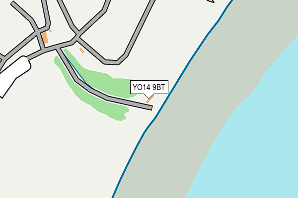
YO14 9BT is located in the Filey electoral ward, within the unitary authority of North Yorkshire and the English Parliamentary constituency of Thirsk and Malton. The Sub Integrated Care Board (ICB) Location is NHS Humber and North Yorkshire ICB - 42D and the police force is North Yorkshire. This postcode has been in use since June 2017.


GetTheData
Source: OS OpenMap – Local (Ordnance Survey)
Source: OS VectorMap District (Ordnance Survey)
Licence: Open Government Licence (requires attribution)
| Easting | 512230 |
| Northing | 481300 |
| Latitude | 54.215168 |
| Longitude | -0.280457 |
GetTheData
Source: Open Postcode Geo
Licence: Open Government Licence
| Country | England |
| Postcode District | YO14 |
➜ See where YO14 is on a map | |
GetTheData
Source: Land Registry Price Paid Data
Licence: Open Government Licence
| Ward | Filey |
| Constituency | Thirsk And Malton |
GetTheData
Source: ONS Postcode Database
Licence: Open Government Licence
| Country Park (Cliff Drive) | Filey | 261m |
| Wooldale Drive (Arndale Way) | Filey | 637m |
| The Beach (The Beach Road) | Filey | 723m |
| The Beach (The Beach Road) | Filey | 734m |
| The Croft (A1039) | Filey | 755m |
| Filey Station | 1.1km |
| Hunmanby Station | 5.1km |
GetTheData
Source: NaPTAN
Licence: Open Government Licence
GetTheData
Source: ONS Postcode Database
Licence: Open Government Licence


➜ Get more ratings from the Food Standards Agency
GetTheData
Source: Food Standards Agency
Licence: FSA terms & conditions
| Last Collection | |||
|---|---|---|---|
| Location | Mon-Fri | Sat | Distance |
| Firtree Drive | 17:30 | 13:00 | 799m |
| Filey Delivery Office | 17:30 | 13:00 | 800m |
| 16 Station Road Filey | 17:30 | 13:00 | 801m |
GetTheData
Source: Dracos
Licence: Creative Commons Attribution-ShareAlike
The below table lists the International Territorial Level (ITL) codes (formerly Nomenclature of Territorial Units for Statistics (NUTS) codes) and Local Administrative Units (LAU) codes for YO14 9BT:
| ITL 1 Code | Name |
|---|---|
| TLE | Yorkshire and The Humber |
| ITL 2 Code | Name |
| TLE2 | North Yorkshire |
| ITL 3 Code | Name |
| TLE22 | North Yorkshire CC |
| LAU 1 Code | Name |
| E07000168 | Scarborough |
GetTheData
Source: ONS Postcode Directory
Licence: Open Government Licence
The below table lists the Census Output Area (OA), Lower Layer Super Output Area (LSOA), and Middle Layer Super Output Area (MSOA) for YO14 9BT:
| Code | Name | |
|---|---|---|
| OA | E00141762 | |
| LSOA | E01027827 | Scarborough 014A |
| MSOA | E02005808 | Scarborough 014 |
GetTheData
Source: ONS Postcode Directory
Licence: Open Government Licence
| YO14 9ET | 502m | |
| YO14 9HN | Sand Hill Lane | 527m |
| YO14 9LD | The Beach | 554m |
| YO14 9HE | Queen Street | 575m |
| YO14 9HG | Cliff Top | 581m |
| YO14 9HA | Ravine Top | 593m |
| YO14 9LE | The Beach | 601m |
| YO14 9EX | Ravine Hill | 610m |
| YO14 9EZ | Ebenezer Terrace | 623m |
| YO14 9EY | St Oswalds Court | 635m |
GetTheData
Source: Open Postcode Geo; Land Registry Price Paid Data
Licence: Open Government Licence