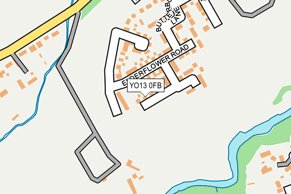
YO13 0FB is located in the Scalby & the Coast electoral ward, within the unitary authority of North Yorkshire and the English Parliamentary constituency of Scarborough and Whitby. The Sub Integrated Care Board (ICB) Location is NHS Humber and North Yorkshire ICB - 42D and the police force is North Yorkshire. This postcode has been in use since July 2017.


GetTheData
Source: OS OpenMap – Local (Ordnance Survey)
Source: OS VectorMap District (Ordnance Survey)
Licence: Open Government Licence (requires attribution)
| Easting | 502199 |
| Northing | 490733 |
| Latitude | 54.302008 |
| Longitude | -0.431004 |
GetTheData
Source: Open Postcode Geo
Licence: Open Government Licence
| Country | England |
| Postcode District | YO13 |
➜ See where YO13 is on a map ➜ Where is Scalby? | |
GetTheData
Source: Land Registry Price Paid Data
Licence: Open Government Licence
| Ward | Scalby & The Coast |
| Constituency | Scarborough And Whitby |
GetTheData
Source: ONS Postcode Database
Licence: Open Government Licence
2, SUNFLOWER DRIVE, SCALBY, SCARBOROUGH, YO13 0FB 2018 30 MAY £319,950 |
8, SUNFLOWER DRIVE, SCALBY, SCARBOROUGH, YO13 0FB 2018 17 MAY £319,950 |
4, SUNFLOWER DRIVE, SCALBY, SCARBOROUGH, YO13 0FB 2017 28 JUL £349,950 |
6, SUNFLOWER DRIVE, SCALBY, SCARBOROUGH, YO13 0FB 2017 27 JUL £304,950 |
GetTheData
Source: HM Land Registry Price Paid Data
Licence: Contains HM Land Registry data © Crown copyright and database right 2024. This data is licensed under the Open Government Licence v3.0.
| Ridge Green (Station Road) | Scalby | 352m |
| Ridge Green (Station Road) | Scalby | 473m |
| Caravan Park (Field Lane) | Scalby | 504m |
| Caravan Park (Field Lane) | Scalby | 508m |
| Field Lane (Burniston Road) | Scalby | 554m |
| Scarborough Station | 3km |
GetTheData
Source: NaPTAN
Licence: Open Government Licence
| Percentage of properties with Next Generation Access | 100.0% |
| Percentage of properties with Superfast Broadband | 100.0% |
| Percentage of properties with Ultrafast Broadband | 0.0% |
| Percentage of properties with Full Fibre Broadband | 0.0% |
Superfast Broadband is between 30Mbps and 300Mbps
Ultrafast Broadband is > 300Mbps
| Percentage of properties unable to receive 2Mbps | 0.0% |
| Percentage of properties unable to receive 5Mbps | 0.0% |
| Percentage of properties unable to receive 10Mbps | 0.0% |
| Percentage of properties unable to receive 30Mbps | 0.0% |
GetTheData
Source: Ofcom
Licence: Ofcom Terms of Use (requires attribution)
GetTheData
Source: ONS Postcode Database
Licence: Open Government Licence


➜ Get more ratings from the Food Standards Agency
GetTheData
Source: Food Standards Agency
Licence: FSA terms & conditions
| Last Collection | |||
|---|---|---|---|
| Location | Mon-Fri | Sat | Distance |
| Scalby Post Office | 17:00 | 12:25 | 946m |
| 1 Jubilee Terrace Scalby | 17:10 | 12:45 | 1,575m |
| 9 Broadway Scarborough | 17:40 | 12:40 | 1,812m |
GetTheData
Source: Dracos
Licence: Creative Commons Attribution-ShareAlike
The below table lists the International Territorial Level (ITL) codes (formerly Nomenclature of Territorial Units for Statistics (NUTS) codes) and Local Administrative Units (LAU) codes for YO13 0FB:
| ITL 1 Code | Name |
|---|---|
| TLE | Yorkshire and The Humber |
| ITL 2 Code | Name |
| TLE2 | North Yorkshire |
| ITL 3 Code | Name |
| TLE22 | North Yorkshire CC |
| LAU 1 Code | Name |
| E07000168 | Scarborough |
GetTheData
Source: ONS Postcode Directory
Licence: Open Government Licence
The below table lists the Census Output Area (OA), Lower Layer Super Output Area (LSOA), and Middle Layer Super Output Area (MSOA) for YO13 0FB:
| Code | Name | |
|---|---|---|
| OA | E00141914 | |
| LSOA | E01027855 | Scarborough 005E |
| MSOA | E02005799 | Scarborough 005 |
GetTheData
Source: ONS Postcode Directory
Licence: Open Government Licence
| YO13 0BG | Mill Way | 102m |
| YO13 0BY | Elderflower Road | 109m |
| YO13 0BX | Butterbur Lane | 178m |
| YO13 0BU | Bramble Way | 221m |
| YO13 0QG | Station Road | 268m |
| YO12 6RJ | Fairway | 356m |
| YO13 0QE | East Avenue | 369m |
| YO12 6RN | High Mill Drive | 383m |
| YO12 6RL | Hillcrest Grove | 436m |
| YO12 6RQ | Hillcrest Avenue | 461m |
GetTheData
Source: Open Postcode Geo; Land Registry Price Paid Data
Licence: Open Government Licence