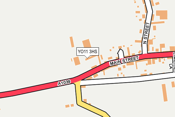
YO11 3HS is located in the Hunmanby & Sherburn electoral ward, within the unitary authority of North Yorkshire and the English Parliamentary constituency of Thirsk and Malton. The Sub Integrated Care Board (ICB) Location is NHS Humber and North Yorkshire ICB - 42D and the police force is North Yorkshire. This postcode has been in use since July 2017.


GetTheData
Source: OS OpenMap – Local (Ordnance Survey)
Source: OS VectorMap District (Ordnance Survey)
Licence: Open Government Licence (requires attribution)
| Easting | 503878 |
| Northing | 479637 |
| Latitude | 54.201986 |
| Longitude | -0.409053 |
GetTheData
Source: Open Postcode Geo
Licence: Open Government Licence
| Country | England |
| Postcode District | YO11 |
➜ See where YO11 is on a map ➜ Where is Flixton? | |
GetTheData
Source: Land Registry Price Paid Data
Licence: Open Government Licence
| Ward | Hunmanby & Sherburn |
| Constituency | Thirsk And Malton |
GetTheData
Source: ONS Postcode Database
Licence: Open Government Licence
| Welborn Court (Main Street) | Flixton | 110m |
| Main Street | Flixton | 185m |
| Main Street | Flixton | 186m |
| Filey Road | Folkton | 1,373m |
| Filey Road | Folkton | 1,374m |
| Seamer Station | 4.3km |
GetTheData
Source: NaPTAN
Licence: Open Government Licence
| Percentage of properties with Next Generation Access | 100.0% |
| Percentage of properties with Superfast Broadband | 100.0% |
| Percentage of properties with Ultrafast Broadband | 0.0% |
| Percentage of properties with Full Fibre Broadband | 0.0% |
Superfast Broadband is between 30Mbps and 300Mbps
Ultrafast Broadband is > 300Mbps
| Percentage of properties unable to receive 2Mbps | 0.0% |
| Percentage of properties unable to receive 5Mbps | 0.0% |
| Percentage of properties unable to receive 10Mbps | 0.0% |
| Percentage of properties unable to receive 30Mbps | 0.0% |
GetTheData
Source: Ofcom
Licence: Ofcom Terms of Use (requires attribution)
GetTheData
Source: ONS Postcode Database
Licence: Open Government Licence


➜ Get more ratings from the Food Standards Agency
GetTheData
Source: Food Standards Agency
Licence: FSA terms & conditions
| Last Collection | |||
|---|---|---|---|
| Location | Mon-Fri | Sat | Distance |
| Flixton Village | 17:30 | 11:30 | 180m |
| Flixton Ings | 17:30 | 11:30 | 706m |
| Grange View Folkton | 17:45 | 11:30 | 1,448m |
GetTheData
Source: Dracos
Licence: Creative Commons Attribution-ShareAlike
The below table lists the International Territorial Level (ITL) codes (formerly Nomenclature of Territorial Units for Statistics (NUTS) codes) and Local Administrative Units (LAU) codes for YO11 3HS:
| ITL 1 Code | Name |
|---|---|
| TLE | Yorkshire and The Humber |
| ITL 2 Code | Name |
| TLE2 | North Yorkshire |
| ITL 3 Code | Name |
| TLE22 | North Yorkshire CC |
| LAU 1 Code | Name |
| E07000168 | Scarborough |
GetTheData
Source: ONS Postcode Directory
Licence: Open Government Licence
The below table lists the Census Output Area (OA), Lower Layer Super Output Area (LSOA), and Middle Layer Super Output Area (MSOA) for YO11 3HS:
| Code | Name | |
|---|---|---|
| OA | E00141790 | |
| LSOA | E01027835 | Scarborough 014G |
| MSOA | E02005808 | Scarborough 014 |
GetTheData
Source: ONS Postcode Directory
Licence: Open Government Licence
| YO11 3XA | Welborn Court | 118m |
| YO11 3UB | Main Street | 119m |
| YO11 3UA | North Street | 244m |
| YO11 3UE | Back Lane | 422m |
| YO11 3UF | Filey Road | 624m |
| YO11 3UD | Main Street | 794m |
| YO11 3UG | 1158m | |
| YO12 4NW | Spital Road | 1531m |
| YO12 4NN | Merrylees | 1625m |
| YO11 3UH | 1643m |
GetTheData
Source: Open Postcode Geo; Land Registry Price Paid Data
Licence: Open Government Licence