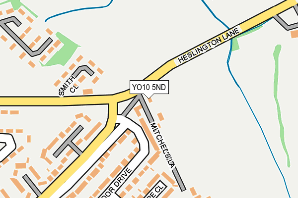
YO10 5ND lies on Heslington Lane in York. YO10 5ND is located in the Fulford & Heslington electoral ward, within the unitary authority of York and the English Parliamentary constituency of York Outer. The Sub Integrated Care Board (ICB) Location is NHS Humber and North Yorkshire ICB - 03Q and the police force is North Yorkshire. This postcode has been in use since June 1998.


GetTheData
Source: OS OpenMap – Local (Ordnance Survey)
Source: OS VectorMap District (Ordnance Survey)
Licence: Open Government Licence (requires attribution)
| Easting | 461820 |
| Northing | 449812 |
| Latitude | 53.940738 |
| Longitude | -1.059736 |
GetTheData
Source: Open Postcode Geo
Licence: Open Government Licence
| Street | Heslington Lane |
| Town/City | York |
| Country | England |
| Postcode District | YO10 |
➜ See where YO10 is on a map ➜ Where is York? | |
GetTheData
Source: Land Registry Price Paid Data
Licence: Open Government Licence
Elevation or altitude of YO10 5ND as distance above sea level:
| Metres | Feet | |
|---|---|---|
| Elevation | 10m | 33ft |
Elevation is measured from the approximate centre of the postcode, to the nearest point on an OS contour line from OS Terrain 50, which has contour spacing of ten vertical metres.
➜ How high above sea level am I? Find the elevation of your current position using your device's GPS.
GetTheData
Source: Open Postcode Elevation
Licence: Open Government Licence
| Ward | Fulford & Heslington |
| Constituency | York Outer |
GetTheData
Source: ONS Postcode Database
Licence: Open Government Licence
KANONI, 138, HESLINGTON LANE, YORK, YO10 5ND 2023 25 JAN £850,000 |
136, HESLINGTON LANE, YORK, YO10 5ND 2021 14 JUN £400,000 |
2009 28 AUG £480,000 |
2006 14 SEP £445,000 |
2001 30 MAR £235,035 |
GetTheData
Source: HM Land Registry Price Paid Data
Licence: Contains HM Land Registry data © Crown copyright and database right 2025. This data is licensed under the Open Government Licence v3.0.
| Mitchel's Lane (Heslington Lane) | Broadway | 40m |
| Mitchel's Lane (Heslington Lane) | Broadway | 46m |
| Smith Close (Broadway) | Broadway | 232m |
| Smith Close (Broadway) | Broadway | 233m |
| Stirling Grove (Heslington Lane) | Fulford | 252m |
| York Station | 2.9km |
GetTheData
Source: NaPTAN
Licence: Open Government Licence
| Percentage of properties with Next Generation Access | 100.0% |
| Percentage of properties with Superfast Broadband | 100.0% |
| Percentage of properties with Ultrafast Broadband | 100.0% |
| Percentage of properties with Full Fibre Broadband | 100.0% |
Superfast Broadband is between 30Mbps and 300Mbps
Ultrafast Broadband is > 300Mbps
| Percentage of properties unable to receive 2Mbps | 0.0% |
| Percentage of properties unable to receive 5Mbps | 0.0% |
| Percentage of properties unable to receive 10Mbps | 0.0% |
| Percentage of properties unable to receive 30Mbps | 0.0% |
GetTheData
Source: Ofcom
Licence: Ofcom Terms of Use (requires attribution)
GetTheData
Source: ONS Postcode Database
Licence: Open Government Licence


➜ Get more ratings from the Food Standards Agency
GetTheData
Source: Food Standards Agency
Licence: FSA terms & conditions
| Last Collection | |||
|---|---|---|---|
| Location | Mon-Fri | Sat | Distance |
| Heathmoor | 17:30 | 12:00 | 301m |
| Students Union University | 17:30 | 11:30 | 639m |
| Holmefield Heslington | 17:30 | 11:30 | 646m |
GetTheData
Source: Dracos
Licence: Creative Commons Attribution-ShareAlike
The below table lists the International Territorial Level (ITL) codes (formerly Nomenclature of Territorial Units for Statistics (NUTS) codes) and Local Administrative Units (LAU) codes for YO10 5ND:
| ITL 1 Code | Name |
|---|---|
| TLE | Yorkshire and The Humber |
| ITL 2 Code | Name |
| TLE2 | North Yorkshire |
| ITL 3 Code | Name |
| TLE21 | York |
| LAU 1 Code | Name |
| E06000014 | York |
GetTheData
Source: ONS Postcode Directory
Licence: Open Government Licence
The below table lists the Census Output Area (OA), Lower Layer Super Output Area (LSOA), and Middle Layer Super Output Area (MSOA) for YO10 5ND:
| Code | Name | |
|---|---|---|
| OA | E00067461 | |
| LSOA | E01013365 | York 023A |
| MSOA | E02002794 | York 023 |
GetTheData
Source: ONS Postcode Directory
Licence: Open Government Licence
| YO10 4NE | Heath Moor Drive | 127m |
| YO10 4HU | Wilsthorpe Grove | 193m |
| YO10 4NG | Tilmire Close | 198m |
| YO10 4ND | Heslington Lane | 200m |
| YO10 4NF | Heath Moor Drive | 214m |
| YO10 4HS | Heslington Lane | 215m |
| YO10 4NQ | Heath Moor Drive | 306m |
| YO10 4HT | Stirling Grove | 313m |
| YO10 4NH | Low Moor Avenue | 330m |
| YO10 4HR | Nevinson Grove | 386m |
GetTheData
Source: Open Postcode Geo; Land Registry Price Paid Data
Licence: Open Government Licence