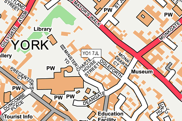
YO1 7JL is located in the Guildhall electoral ward, within the unitary authority of York and the English Parliamentary constituency of York Central. The Sub Integrated Care Board (ICB) Location is NHS Humber and North Yorkshire ICB - 03Q and the police force is North Yorkshire. This postcode has been in use since June 1999.


GetTheData
Source: OS OpenMap – Local (Ordnance Survey)
Source: OS VectorMap District (Ordnance Survey)
Licence: Open Government Licence (requires attribution)
| Easting | 460427 |
| Northing | 452258 |
| Latitude | 53.962901 |
| Longitude | -1.080479 |
GetTheData
Source: Open Postcode Geo
Licence: Open Government Licence
| Country | England |
| Postcode District | YO1 |
➜ See where YO1 is on a map ➜ Where is York? | |
GetTheData
Source: Land Registry Price Paid Data
Licence: Open Government Licence
Elevation or altitude of YO1 7JL as distance above sea level:
| Metres | Feet | |
|---|---|---|
| Elevation | 20m | 66ft |
Elevation is measured from the approximate centre of the postcode, to the nearest point on an OS contour line from OS Terrain 50, which has contour spacing of ten vertical metres.
➜ How high above sea level am I? Find the elevation of your current position using your device's GPS.
GetTheData
Source: Open Postcode Elevation
Licence: Open Government Licence
| Ward | Guildhall |
| Constituency | York Central |
GetTheData
Source: ONS Postcode Database
Licence: Open Government Licence
| Lord Mayor's Walk | York | 100m |
| Monk Bar (Monkgate) | York | 196m |
| Gillygate | York | 265m |
| Gillygate | York | 285m |
| Theatre Royal (St Leonard's Place) | York | 335m |
| York Station | 1km |
| Poppleton Station | 4.7km |
GetTheData
Source: NaPTAN
Licence: Open Government Licence
GetTheData
Source: ONS Postcode Database
Licence: Open Government Licence


➜ Get more ratings from the Food Standards Agency
GetTheData
Source: Food Standards Agency
Licence: FSA terms & conditions
| Last Collection | |||
|---|---|---|---|
| Location | Mon-Fri | Sat | Distance |
| 4 Minster Yard | 18:45 | 12:45 | 47m |
| The Minster Duncombe Place | 18:30 | 12:45 | 282m |
| Kings Square Right 2nd Aperture Stamped | 18:30 | 12:00 | 324m |
GetTheData
Source: Dracos
Licence: Creative Commons Attribution-ShareAlike
The below table lists the International Territorial Level (ITL) codes (formerly Nomenclature of Territorial Units for Statistics (NUTS) codes) and Local Administrative Units (LAU) codes for YO1 7JL:
| ITL 1 Code | Name |
|---|---|
| TLE | Yorkshire and The Humber |
| ITL 2 Code | Name |
| TLE2 | North Yorkshire |
| ITL 3 Code | Name |
| TLE21 | York |
| LAU 1 Code | Name |
| E06000014 | York |
GetTheData
Source: ONS Postcode Directory
Licence: Open Government Licence
The below table lists the Census Output Area (OA), Lower Layer Super Output Area (LSOA), and Middle Layer Super Output Area (MSOA) for YO1 7JL:
| Code | Name | |
|---|---|---|
| OA | E00067488 | |
| LSOA | E01013366 | York 013A |
| MSOA | E02002784 | York 013 |
GetTheData
Source: ONS Postcode Directory
Licence: Open Government Licence
| YO1 7JH | Chapter House Street | 10m |
| YO1 7JW | Ogleforth Mews | 70m |
| YO1 7JG | Ogleforth | 76m |
| YO1 7LH | Monk Bar Court | 95m |
| YO1 7LG | Goodramgate | 109m |
| YO1 7LQ | Goodramgate | 114m |
| YO31 7HA | Lord Mayors Walk | 117m |
| YO31 7PD | Monkgate | 120m |
| YO31 7QS | High Newbiggin Street | 135m |
| YO1 7LJ | Goodramgate | 135m |
GetTheData
Source: Open Postcode Geo; Land Registry Price Paid Data
Licence: Open Government Licence