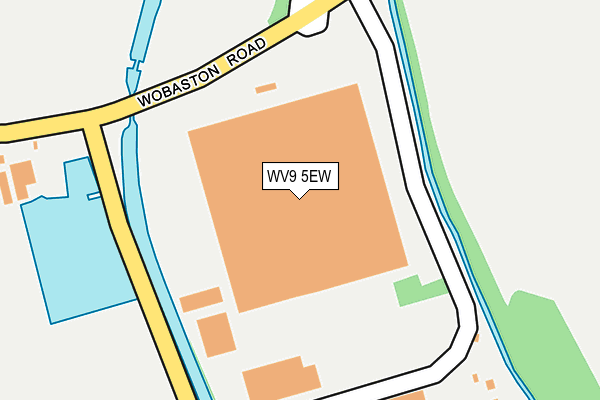
WV9 5EW is located in the Bilbrook electoral ward, within the local authority district of South Staffordshire and the English Parliamentary constituency of South Staffordshire. The Sub Integrated Care Board (ICB) Location is NHS Staffordshire and Stoke-on-Trent ICB - 05Q and the police force is Staffordshire. This postcode has been in use since January 1995.


GetTheData
Source: OS OpenMap – Local (Ordnance Survey)
Source: OS VectorMap District (Ordnance Survey)
Licence: Open Government Licence (requires attribution)
| Easting | 388980 |
| Northing | 303319 |
| Latitude | 52.627515 |
| Longitude | -2.164239 |
GetTheData
Source: Open Postcode Geo
Licence: Open Government Licence
| Country | England |
| Postcode District | WV9 |
➜ See where WV9 is on a map | |
GetTheData
Source: Land Registry Price Paid Data
Licence: Open Government Licence
Elevation or altitude of WV9 5EW as distance above sea level:
| Metres | Feet | |
|---|---|---|
| Elevation | 100m | 328ft |
Elevation is measured from the approximate centre of the postcode, to the nearest point on an OS contour line from OS Terrain 50, which has contour spacing of ten vertical metres.
➜ How high above sea level am I? Find the elevation of your current position using your device's GPS.
GetTheData
Source: Open Postcode Elevation
Licence: Open Government Licence
| Ward | Bilbrook |
| Constituency | South Staffordshire |
GetTheData
Source: ONS Postcode Database
Licence: Open Government Licence
| Droveway (Ryefield) | Pendeford | 752m |
| Leybourne Crescent (The Droveway) | Pendeford | 764m |
| Leybourne Crescent (The Droveway) | Pendeford | 785m |
| Droveway (Ryefield) | Pendeford | 803m |
| Caravan Park (Pendeford Hall Lane) | Pendleford Hall | 822m |
| Bilbrook Station | 1.5km |
| Codsall Station | 2.5km |
| Wolverhampton Station | 5.4km |
GetTheData
Source: NaPTAN
Licence: Open Government Licence
GetTheData
Source: ONS Postcode Database
Licence: Open Government Licence


➜ Get more ratings from the Food Standards Agency
GetTheData
Source: Food Standards Agency
Licence: FSA terms & conditions
| Last Collection | |||
|---|---|---|---|
| Location | Mon-Fri | Sat | Distance |
| Oaken Lane | 17:00 | 12:00 | 1,040m |
| Leybourne Crescent | 17:00 | 12:45 | 1,364m |
| Elliots Lane | 16:45 | 12:30 | 2,143m |
GetTheData
Source: Dracos
Licence: Creative Commons Attribution-ShareAlike
The below table lists the International Territorial Level (ITL) codes (formerly Nomenclature of Territorial Units for Statistics (NUTS) codes) and Local Administrative Units (LAU) codes for WV9 5EW:
| ITL 1 Code | Name |
|---|---|
| TLG | West Midlands (England) |
| ITL 2 Code | Name |
| TLG2 | Shropshire and Staffordshire |
| ITL 3 Code | Name |
| TLG24 | Staffordshire CC |
| LAU 1 Code | Name |
| E07000196 | South Staffordshire |
GetTheData
Source: ONS Postcode Directory
Licence: Open Government Licence
The below table lists the Census Output Area (OA), Lower Layer Super Output Area (LSOA), and Middle Layer Super Output Area (MSOA) for WV9 5EW:
| Code | Name | |
|---|---|---|
| OA | E00150892 | |
| LSOA | E01029613 | South Staffordshire 008A |
| MSOA | E02006181 | South Staffordshire 008 |
GetTheData
Source: ONS Postcode Directory
Licence: Open Government Licence
| WV8 1RR | Pendeford Mill Lane | 517m |
| WV8 1JJ | Joeys Lane | 708m |
| WV8 1UA | The Droveway | 738m |
| WV8 1TB | Wayside | 742m |
| WV9 5RB | Tranwell Close | 748m |
| WV9 5RA | Weyhill Close | 764m |
| WV8 1UB | Ryefield | 769m |
| WV8 1JH | Mill Grove | 775m |
| WV8 1TA | Fallowfield | 786m |
| WV9 5HB | Westrand | 806m |
GetTheData
Source: Open Postcode Geo; Land Registry Price Paid Data
Licence: Open Government Licence