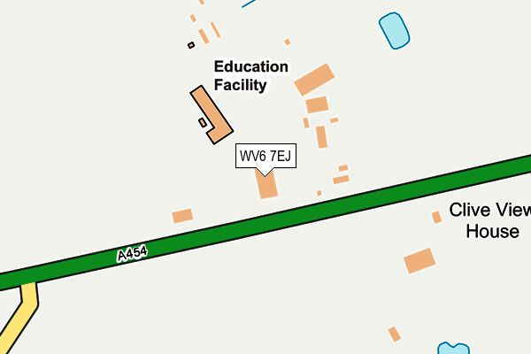
WV6 7EJ is located in the Pattingham, Trysull, Bobbington & Lower Penn electoral ward, within the local authority district of South Staffordshire and the English Parliamentary constituency of South Staffordshire. The Sub Integrated Care Board (ICB) Location is NHS Staffordshire and Stoke-on-Trent ICB - 05Q and the police force is Staffordshire. This postcode has been in use since January 1995.


GetTheData
Source: OS OpenMap – Local (Ordnance Survey)
Source: OS VectorMap District (Ordnance Survey)
Licence: Open Government Licence (requires attribution)
| Easting | 382042 |
| Northing | 295966 |
| Latitude | 52.561227 |
| Longitude | -2.266335 |
GetTheData
Source: Open Postcode Geo
Licence: Open Government Licence
| Country | England |
| Postcode District | WV6 |
➜ See where WV6 is on a map | |
GetTheData
Source: Land Registry Price Paid Data
Licence: Open Government Licence
Elevation or altitude of WV6 7EJ as distance above sea level:
| Metres | Feet | |
|---|---|---|
| Elevation | 110m | 361ft |
Elevation is measured from the approximate centre of the postcode, to the nearest point on an OS contour line from OS Terrain 50, which has contour spacing of ten vertical metres.
➜ How high above sea level am I? Find the elevation of your current position using your device's GPS.
GetTheData
Source: Open Postcode Elevation
Licence: Open Government Licence
| Ward | Pattingham, Trysull, Bobbington & Lower Penn |
| Constituency | South Staffordshire |
GetTheData
Source: ONS Postcode Database
Licence: Open Government Licence
| Gardenlands Garden Centre (Bridgnorth Road) | Shipley | 45m |
| Gardenlands Garden Centre (Bridgnorth Road) | Shipley | 78m |
| The Fox Inn Ph (Bridgnorth Road) | Shipley | 498m |
| The Fox Inn Ph (Bridgnorth Road) | Shipley | 506m |
| Garden Centre (Bridgnorth Road) | Trescott | 1,548m |
GetTheData
Source: NaPTAN
Licence: Open Government Licence
GetTheData
Source: ONS Postcode Database
Licence: Open Government Licence


➜ Get more ratings from the Food Standards Agency
GetTheData
Source: Food Standards Agency
Licence: FSA terms & conditions
| Last Collection | |||
|---|---|---|---|
| Location | Mon-Fri | Sat | Distance |
| Spoonley Gate | 16:15 | 10:30 | 1,710m |
| Seisdon Post Office | 16:30 | 12:00 | 2,073m |
| Dartmouth Avenue | 16:45 | 11:45 | 2,851m |
GetTheData
Source: Dracos
Licence: Creative Commons Attribution-ShareAlike
The below table lists the International Territorial Level (ITL) codes (formerly Nomenclature of Territorial Units for Statistics (NUTS) codes) and Local Administrative Units (LAU) codes for WV6 7EJ:
| ITL 1 Code | Name |
|---|---|
| TLG | West Midlands (England) |
| ITL 2 Code | Name |
| TLG2 | Shropshire and Staffordshire |
| ITL 3 Code | Name |
| TLG24 | Staffordshire CC |
| LAU 1 Code | Name |
| E07000196 | South Staffordshire |
GetTheData
Source: ONS Postcode Directory
Licence: Open Government Licence
The below table lists the Census Output Area (OA), Lower Layer Super Output Area (LSOA), and Middle Layer Super Output Area (MSOA) for WV6 7EJ:
| Code | Name | |
|---|---|---|
| OA | E00151171 | |
| LSOA | E01029667 | South Staffordshire 013B |
| MSOA | E02006186 | South Staffordshire 013 |
GetTheData
Source: ONS Postcode Directory
Licence: Open Government Licence
| WV6 7EH | Bridgnorth Road | 80m |
| WV6 7EL | Fox Road | 746m |
| WV6 7EQ | Bridgnorth Road | 1225m |
| WV5 7DQ | 1506m | |
| WV6 7EZ | Bridgnorth Road | 1580m |
| WV6 7EN | Clive Road | 1593m |
| WV6 7EB | Lower Rudge | 1648m |
| WV5 7DG | 1753m | |
| WV6 7ED | Spoonley Gate | 1754m |
| WV5 7HD | Fox Road | 1806m |
GetTheData
Source: Open Postcode Geo; Land Registry Price Paid Data
Licence: Open Government Licence