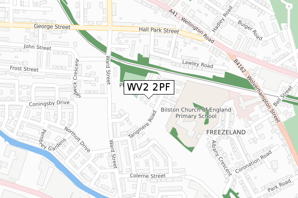
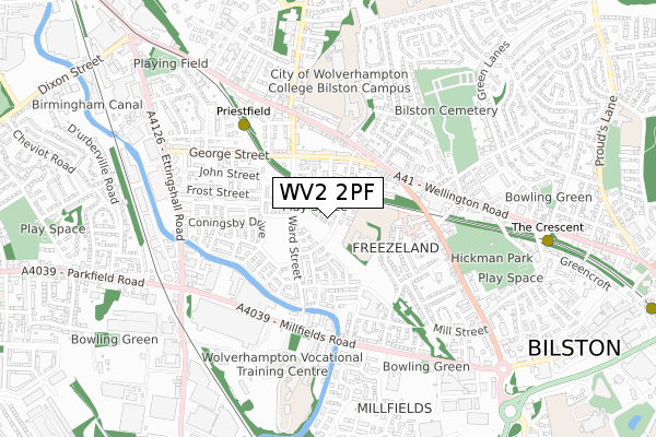
WV2 2PF is located in the Ettingshall North electoral ward, within the metropolitan district of Wolverhampton and the English Parliamentary constituency of Wolverhampton South East. The Sub Integrated Care Board (ICB) Location is NHS Black Country ICB - D2P2L and the police force is West Midlands. This postcode has been in use since January 2018.


GetTheData
Source: OS Open Zoomstack (Ordnance Survey)
Licence: Open Government Licence (requires attribution)
Attribution: Contains OS data © Crown copyright and database right 2025
Source: Open Postcode Geo
Licence: Open Government Licence (requires attribution)
Attribution: Contains OS data © Crown copyright and database right 2025; Contains Royal Mail data © Royal Mail copyright and database right 2025; Source: Office for National Statistics licensed under the Open Government Licence v.3.0
| Easting | 393804 |
| Northing | 296762 |
| Latitude | 52.568662 |
| Longitude | -2.092840 |
GetTheData
Source: Open Postcode Geo
Licence: Open Government Licence
| Country | England |
| Postcode District | WV2 |
➜ See where WV2 is on a map ➜ Where is Bilston? | |
GetTheData
Source: Land Registry Price Paid Data
Licence: Open Government Licence
| Ward | Ettingshall North |
| Constituency | Wolverhampton South East |
GetTheData
Source: ONS Postcode Database
Licence: Open Government Licence
2024 26 APR £296,000 |
2023 11 SEP £280,000 |
2023 17 FEB £317,000 |
2022 30 SEP £273,000 |
12, TANGMERE ROAD, WOLVERHAMPTON, WV2 2PF 2020 30 OCT £244,950 |
14, TANGMERE ROAD, WOLVERHAMPTON, WV2 2PF 2020 30 OCT £244,950 |
10, TANGMERE ROAD, WOLVERHAMPTON, WV2 2PF 2020 31 JUL £199,950 |
101, TANGMERE ROAD, WOLVERHAMPTON, WV2 2PF 2020 20 MAR £194,950 |
103, TANGMERE ROAD, WOLVERHAMPTON, WV2 2PF 2020 13 MAR £194,950 |
95, TANGMERE ROAD, WOLVERHAMPTON, WV2 2PF 2020 28 FEB £237,500 |
GetTheData
Source: HM Land Registry Price Paid Data
Licence: Contains HM Land Registry data © Crown copyright and database right 2025. This data is licensed under the Open Government Licence v3.0.
| Hall Park St (Wellington Rd) | Priestfield | 277m |
| Hall Park St (Wellington Rd) | Priestfield | 293m |
| Bilston Cemetery (Wellington Rd) | Priestfield | 350m |
| Merstone Close (Wolverhampton Street) | Priestfield | 430m |
| Bilston Cemetery (Wellington Rd) | Priestfield | 431m |
| Priestfield (Midland Metro Stop) (Junction Rd) | Priestfield | 465m |
| The Crescent (Midland Metro Stop) (The Crescent) | Bilston | 824m |
| Bilston Central (Midland Metro Stop) (Church St) | Bilston | 1,256m |
| Coseley Station | 2.7km |
| Wolverhampton Station | 2.8km |
| Tipton Station | 4.6km |
GetTheData
Source: NaPTAN
Licence: Open Government Licence
| Percentage of properties with Next Generation Access | 100.0% |
| Percentage of properties with Superfast Broadband | 97.4% |
| Percentage of properties with Ultrafast Broadband | 48.7% |
| Percentage of properties with Full Fibre Broadband | 48.7% |
Superfast Broadband is between 30Mbps and 300Mbps
Ultrafast Broadband is > 300Mbps
| Percentage of properties unable to receive 2Mbps | 0.0% |
| Percentage of properties unable to receive 5Mbps | 0.0% |
| Percentage of properties unable to receive 10Mbps | 0.0% |
| Percentage of properties unable to receive 30Mbps | 2.6% |
GetTheData
Source: Ofcom
Licence: Ofcom Terms of Use (requires attribution)
GetTheData
Source: ONS Postcode Database
Licence: Open Government Licence


➜ Get more ratings from the Food Standards Agency
GetTheData
Source: Food Standards Agency
Licence: FSA terms & conditions
| Last Collection | |||
|---|---|---|---|
| Location | Mon-Fri | Sat | Distance |
| Ettingshall Post Office | 17:30 | 12:00 | 403m |
| Lyndhurst | 18:45 | 11:15 | 588m |
| Village Way | 19:00 | 12:00 | 588m |
GetTheData
Source: Dracos
Licence: Creative Commons Attribution-ShareAlike
The below table lists the International Territorial Level (ITL) codes (formerly Nomenclature of Territorial Units for Statistics (NUTS) codes) and Local Administrative Units (LAU) codes for WV2 2PF:
| ITL 1 Code | Name |
|---|---|
| TLG | West Midlands (England) |
| ITL 2 Code | Name |
| TLG3 | West Midlands |
| ITL 3 Code | Name |
| TLG39 | Wolverhampton |
| LAU 1 Code | Name |
| E08000031 | Wolverhampton |
GetTheData
Source: ONS Postcode Directory
Licence: Open Government Licence
The below table lists the Census Output Area (OA), Lower Layer Super Output Area (LSOA), and Middle Layer Super Output Area (MSOA) for WV2 2PF:
| Code | Name | |
|---|---|---|
| OA | E00052766 | |
| LSOA | E01010450 | Wolverhampton 029B |
| MSOA | E02002177 | Wolverhampton 029 |
GetTheData
Source: ONS Postcode Directory
Licence: Open Government Licence
| WV14 0NE | Priestfield Street | 140m |
| WV2 2NT | Ward Street | 141m |
| WV14 0NB | Lawley Road | 167m |
| WV2 2NS | Ward Street | 185m |
| WV14 0ND | Freezeland Street | 185m |
| WV14 0NF | Herbert Street | 191m |
| WV14 0HX | Talbot Place | 230m |
| WV14 0NG | Hall Park Street | 235m |
| WV2 2NX | Sidwick Crescent | 263m |
| WV14 6BG | Wellington Road | 264m |
GetTheData
Source: Open Postcode Geo; Land Registry Price Paid Data
Licence: Open Government Licence