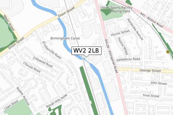
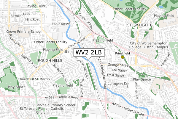
WV2 2LB is located in the Ettingshall North electoral ward, within the metropolitan district of Wolverhampton and the English Parliamentary constituency of Wolverhampton South East. The Sub Integrated Care Board (ICB) Location is NHS Black Country ICB - D2P2L and the police force is West Midlands. This postcode has been in use since August 2019.


GetTheData
Source: OS Open Zoomstack (Ordnance Survey)
Licence: Open Government Licence (requires attribution)
Attribution: Contains OS data © Crown copyright and database right 2025
Source: Open Postcode Geo
Licence: Open Government Licence (requires attribution)
Attribution: Contains OS data © Crown copyright and database right 2025; Contains Royal Mail data © Royal Mail copyright and database right 2025; Source: Office for National Statistics licensed under the Open Government Licence v.3.0
| Easting | 392985 |
| Northing | 297091 |
| Latitude | 52.571610 |
| Longitude | -2.104931 |
GetTheData
Source: Open Postcode Geo
Licence: Open Government Licence
| Country | England |
| Postcode District | WV2 |
➜ See where WV2 is on a map ➜ Where is Wolverhampton? | |
GetTheData
Source: Land Registry Price Paid Data
Licence: Open Government Licence
| Ward | Ettingshall North |
| Constituency | Wolverhampton South East |
GetTheData
Source: ONS Postcode Database
Licence: Open Government Licence
| Rough Hills Rd (Durberville Rd) | Rough Hills | 215m |
| Rough Hills Rd (Cheviot Rd) | Rough Hills | 223m |
| Rough Hills Rd (Cheviot Rd) | Rough Hills | 239m |
| Rough Hills Rd (Durberville Rd) | Rough Hills | 243m |
| Thorne St (Hincks St) | Ettingshall | 247m |
| Priestfield (Midland Metro Stop) (Junction Rd) | Priestfield | 493m |
| The Royal (Midland Metro Stop) (Bilston St) | Wolverhampton | 1,388m |
| Wolverhampton St George's (Midland Metro Stop) (Bilston St) | Wolverhampton | 1,907m |
| Wolverhampton Station | 2.1km |
| Coseley Station | 3.2km |
| Tipton Station | 5.3km |
GetTheData
Source: NaPTAN
Licence: Open Government Licence
| Percentage of properties with Next Generation Access | 100.0% |
| Percentage of properties with Superfast Broadband | 100.0% |
| Percentage of properties with Ultrafast Broadband | 0.0% |
| Percentage of properties with Full Fibre Broadband | 0.0% |
Superfast Broadband is between 30Mbps and 300Mbps
Ultrafast Broadband is > 300Mbps
| Percentage of properties unable to receive 2Mbps | 0.0% |
| Percentage of properties unable to receive 5Mbps | 0.0% |
| Percentage of properties unable to receive 10Mbps | 0.0% |
| Percentage of properties unable to receive 30Mbps | 0.0% |
GetTheData
Source: Ofcom
Licence: Ofcom Terms of Use (requires attribution)
GetTheData
Source: ONS Postcode Database
Licence: Open Government Licence


➜ Get more ratings from the Food Standards Agency
GetTheData
Source: Food Standards Agency
Licence: FSA terms & conditions
| Last Collection | |||
|---|---|---|---|
| Location | Mon-Fri | Sat | Distance |
| Ettingshall Road | 17:30 | 12:00 | 162m |
| Ettingshall Post Office | 17:30 | 12:00 | 482m |
| Dixon Street | 17:00 | 12:30 | 556m |
GetTheData
Source: Dracos
Licence: Creative Commons Attribution-ShareAlike
The below table lists the International Territorial Level (ITL) codes (formerly Nomenclature of Territorial Units for Statistics (NUTS) codes) and Local Administrative Units (LAU) codes for WV2 2LB:
| ITL 1 Code | Name |
|---|---|
| TLG | West Midlands (England) |
| ITL 2 Code | Name |
| TLG3 | West Midlands |
| ITL 3 Code | Name |
| TLG39 | Wolverhampton |
| LAU 1 Code | Name |
| E08000031 | Wolverhampton |
GetTheData
Source: ONS Postcode Directory
Licence: Open Government Licence
The below table lists the Census Output Area (OA), Lower Layer Super Output Area (LSOA), and Middle Layer Super Output Area (MSOA) for WV2 2LB:
| Code | Name | |
|---|---|---|
| OA | E00052774 | |
| LSOA | E01010452 | Wolverhampton 029D |
| MSOA | E02002177 | Wolverhampton 029 |
GetTheData
Source: ONS Postcode Directory
Licence: Open Government Licence
| WV2 2EY | St Saviours Close | 186m |
| WV2 2ND | Thorne Street | 212m |
| WV2 2HJ | Rough Hills Road | 213m |
| WV2 2EZ | Durberville Road | 214m |
| WV2 2ES | Durberville Road | 215m |
| WV2 2HL | Cheviot Road | 219m |
| WV2 2JZ | Hincks Street | 230m |
| WV2 2LW | George Street | 243m |
| WV2 2NB | Sweetbriar Road | 243m |
| WV2 2JP | Ettingshall Road | 249m |
GetTheData
Source: Open Postcode Geo; Land Registry Price Paid Data
Licence: Open Government Licence