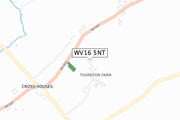
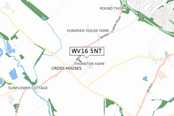
WV16 5NT is located in the Bridgnorth West and Tasley electoral ward, within the unitary authority of Shropshire and the English Parliamentary constituency of Ludlow. The Sub Integrated Care Board (ICB) Location is NHS Shropshire, Telford and Wrekin ICB - M2L0M and the police force is West Mercia. This postcode has been in use since October 2019.


GetTheData
Source: OS Open Zoomstack (Ordnance Survey)
Licence: Open Government Licence (requires attribution)
Attribution: Contains OS data © Crown copyright and database right 2025
Source: Open Postcode Geo
Licence: Open Government Licence (requires attribution)
Attribution: Contains OS data © Crown copyright and database right 2025; Contains Royal Mail data © Royal Mail copyright and database right 2025; Source: Office for National Statistics licensed under the Open Government Licence v.3.0
| Easting | 369918 |
| Northing | 291986 |
| Latitude | 52.524926 |
| Longitude | -2.444811 |
GetTheData
Source: Open Postcode Geo
Licence: Open Government Licence
| Country | England |
| Postcode District | WV16 |
➜ See where WV16 is on a map | |
GetTheData
Source: Land Registry Price Paid Data
Licence: Open Government Licence
| Ward | Bridgnorth West And Tasley |
| Constituency | Ludlow |
GetTheData
Source: ONS Postcode Database
Licence: Open Government Licence
| The Punchbowl Inn (B4364) | Oldbury | 323m |
| The Punchbowl Inn (B4364) | Oldbury | 332m |
| Church (B4363) | Oldbury | 1,189m |
| Church (B4363) | Oldbury | 1,191m |
| Oldbury Wells School (Oldbury Wells) | Oldbury | 1,325m |
GetTheData
Source: NaPTAN
Licence: Open Government Licence
GetTheData
Source: ONS Postcode Database
Licence: Open Government Licence


➜ Get more ratings from the Food Standards Agency
GetTheData
Source: Food Standards Agency
Licence: FSA terms & conditions
| Last Collection | |||
|---|---|---|---|
| Location | Mon-Fri | Sat | Distance |
| Oldbury | 16:00 | 08:00 | 1,110m |
| Conduit Lane | 16:45 | 10:30 | 1,228m |
| Eversley | 16:00 | 10:00 | 1,491m |
GetTheData
Source: Dracos
Licence: Creative Commons Attribution-ShareAlike
The below table lists the International Territorial Level (ITL) codes (formerly Nomenclature of Territorial Units for Statistics (NUTS) codes) and Local Administrative Units (LAU) codes for WV16 5NT:
| ITL 1 Code | Name |
|---|---|
| TLG | West Midlands (England) |
| ITL 2 Code | Name |
| TLG2 | Shropshire and Staffordshire |
| ITL 3 Code | Name |
| TLG22 | Shropshire |
| LAU 1 Code | Name |
| E06000051 | Shropshire |
GetTheData
Source: ONS Postcode Directory
Licence: Open Government Licence
The below table lists the Census Output Area (OA), Lower Layer Super Output Area (LSOA), and Middle Layer Super Output Area (MSOA) for WV16 5NT:
| Code | Name | |
|---|---|---|
| OA | E00146841 | |
| LSOA | E01028831 | Shropshire 031B |
| MSOA | E02006011 | Shropshire 031 |
GetTheData
Source: ONS Postcode Directory
Licence: Open Government Licence
| WV16 5NL | Ludlow Road | 56m |
| WV16 5NQ | Ludlow Road | 360m |
| WV16 5LP | 963m | |
| WV16 5DD | Uplands Drive | 1000m |
| WV16 5HG | Manor Farm Lane | 1010m |
| WV16 5LW | 1025m | |
| WV16 5DH | Castlefields | 1053m |
| WV16 5PD | Campbell Close | 1068m |
| WV16 5AN | Ludlow Heights | 1107m |
| WV16 5AJ | Ludlow Heights | 1111m |
GetTheData
Source: Open Postcode Geo; Land Registry Price Paid Data
Licence: Open Government Licence