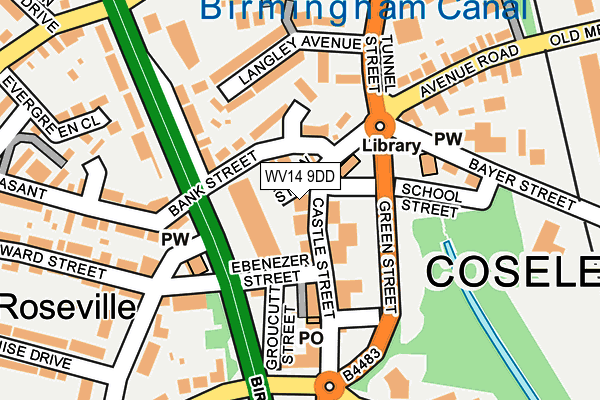
WV14 9DD is located in the Coseley East electoral ward, within the metropolitan district of Dudley and the English Parliamentary constituency of Wolverhampton South East. The Sub Integrated Care Board (ICB) Location is NHS Black Country ICB - D2P2L and the police force is West Midlands. This postcode has been in use since April 1986.


GetTheData
Source: OS OpenMap – Local (Ordnance Survey)
Source: OS VectorMap District (Ordnance Survey)
Licence: Open Government Licence (requires attribution)
| Easting | 394104 |
| Northing | 293733 |
| Latitude | 52.541420 |
| Longitude | -2.088365 |
GetTheData
Source: Open Postcode Geo
Licence: Open Government Licence
| Country | England |
| Postcode District | WV14 |
➜ See where WV14 is on a map ➜ Where is Coseley? | |
GetTheData
Source: Land Registry Price Paid Data
Licence: Open Government Licence
Elevation or altitude of WV14 9DD as distance above sea level:
| Metres | Feet | |
|---|---|---|
| Elevation | 170m | 558ft |
Elevation is measured from the approximate centre of the postcode, to the nearest point on an OS contour line from OS Terrain 50, which has contour spacing of ten vertical metres.
➜ How high above sea level am I? Find the elevation of your current position using your device's GPS.
GetTheData
Source: Open Postcode Elevation
Licence: Open Government Licence
| Ward | Coseley East |
| Constituency | Wolverhampton South East |
GetTheData
Source: ONS Postcode Database
Licence: Open Government Licence
| Roseville Square (Castle St) | Roseville | 64m |
| Canal Street (Green St) | Roseville | 82m |
| Bank St (Birmingham New Rd) | Roseville | 87m |
| Bank St (Birmingham New Rd) | Roseville | 152m |
| Vicarage Rd (Castle St) | Roseville | 152m |
| Coseley Station | 0.4km |
| Tipton Station | 2km |
| Dudley Port Station | 3.2km |
GetTheData
Source: NaPTAN
Licence: Open Government Licence
GetTheData
Source: ONS Postcode Database
Licence: Open Government Licence


➜ Get more ratings from the Food Standards Agency
GetTheData
Source: Food Standards Agency
Licence: FSA terms & conditions
| Last Collection | |||
|---|---|---|---|
| Location | Mon-Fri | Sat | Distance |
| Hall Park Street | 18:30 | 11:45 | 665m |
| Coppice | 17:30 | 11:00 | 758m |
| Dimmocks Avenue | 17:00 | 11:00 | 782m |
GetTheData
Source: Dracos
Licence: Creative Commons Attribution-ShareAlike
The below table lists the International Territorial Level (ITL) codes (formerly Nomenclature of Territorial Units for Statistics (NUTS) codes) and Local Administrative Units (LAU) codes for WV14 9DD:
| ITL 1 Code | Name |
|---|---|
| TLG | West Midlands (England) |
| ITL 2 Code | Name |
| TLG3 | West Midlands |
| ITL 3 Code | Name |
| TLG36 | Dudley |
| LAU 1 Code | Name |
| E08000027 | Dudley |
GetTheData
Source: ONS Postcode Directory
Licence: Open Government Licence
The below table lists the Census Output Area (OA), Lower Layer Super Output Area (LSOA), and Middle Layer Super Output Area (MSOA) for WV14 9DD:
| Code | Name | |
|---|---|---|
| OA | E00049401 | |
| LSOA | E01009768 | Dudley 004C |
| MSOA | E02002003 | Dudley 004 |
GetTheData
Source: ONS Postcode Directory
Licence: Open Government Licence
| WV14 9LT | Jevon Street | 26m |
| WV14 9DP | Castle Street | 59m |
| WV14 9ES | Castle Street | 62m |
| WV14 9DW | Castle Street | 66m |
| WV14 9JN | Bank Street | 82m |
| WV14 9LP | Ebenezer Street | 103m |
| WV14 9EP | Roseville Precinct | 115m |
| WV14 9JL | Birmingham New Road | 134m |
| WV14 9DQ | Langley Avenue | 134m |
| WV14 9JP | Bank Street | 143m |
GetTheData
Source: Open Postcode Geo; Land Registry Price Paid Data
Licence: Open Government Licence