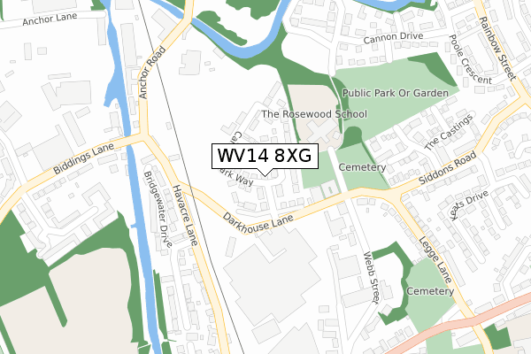
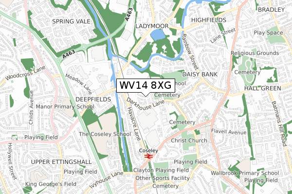
WV14 8XG is located in the Coseley East electoral ward, within the metropolitan district of Dudley and the English Parliamentary constituency of Wolverhampton South East. The Sub Integrated Care Board (ICB) Location is NHS Black Country ICB - D2P2L and the police force is West Midlands. This postcode has been in use since September 2019.


GetTheData
Source: OS Open Zoomstack (Ordnance Survey)
Licence: Open Government Licence (requires attribution)
Attribution: Contains OS data © Crown copyright and database right 2024
Source: Open Postcode Geo
Licence: Open Government Licence (requires attribution)
Attribution: Contains OS data © Crown copyright and database right 2024; Contains Royal Mail data © Royal Mail copyright and database right 2024; Source: Office for National Statistics licensed under the Open Government Licence v.3.0
| Easting | 394213 |
| Northing | 294697 |
| Latitude | 52.550103 |
| Longitude | -2.086770 |
GetTheData
Source: Open Postcode Geo
Licence: Open Government Licence
| Country | England |
| Postcode District | WV14 |
➜ See where WV14 is on a map ➜ Where is Coseley? | |
GetTheData
Source: Land Registry Price Paid Data
Licence: Open Government Licence
| Ward | Coseley East |
| Constituency | Wolverhampton South East |
GetTheData
Source: ONS Postcode Database
Licence: Open Government Licence
| Anchor Rd (Havacre Lane) | Coseley | 133m |
| Anchor Rd (Biddings Lane) | Coseley | 143m |
| Legge Lane (Siddons Rd) | Coseley | 375m |
| Meadow Lane (Biddings Lane) | Woodcross | 389m |
| Legge Lane (Siddons Rd) | Coseley | 413m |
| Loxdale (Midland Metro Stop) (Loxdale St) | Bradley | 1,802m |
| Coseley Station | 0.6km |
| Tipton Station | 2.6km |
| Dudley Port Station | 3.8km |
GetTheData
Source: NaPTAN
Licence: Open Government Licence
| Percentage of properties with Next Generation Access | 67.9% |
| Percentage of properties with Superfast Broadband | 67.9% |
| Percentage of properties with Ultrafast Broadband | 35.7% |
| Percentage of properties with Full Fibre Broadband | 0.0% |
Superfast Broadband is between 30Mbps and 300Mbps
Ultrafast Broadband is > 300Mbps
| Percentage of properties unable to receive 2Mbps | 0.0% |
| Percentage of properties unable to receive 5Mbps | 0.0% |
| Percentage of properties unable to receive 10Mbps | 0.0% |
| Percentage of properties unable to receive 30Mbps | 0.0% |
GetTheData
Source: Ofcom
Licence: Ofcom Terms of Use (requires attribution)
GetTheData
Source: ONS Postcode Database
Licence: Open Government Licence


➜ Get more ratings from the Food Standards Agency
GetTheData
Source: Food Standards Agency
Licence: FSA terms & conditions
| Last Collection | |||
|---|---|---|---|
| Location | Mon-Fri | Sat | Distance |
| Siddons Road | 17:00 | 12:00 | 325m |
| Deepfields Post Office | 16:45 | 11:45 | 402m |
| Poole Crescent | 16:45 | 12:00 | 490m |
GetTheData
Source: Dracos
Licence: Creative Commons Attribution-ShareAlike
The below table lists the International Territorial Level (ITL) codes (formerly Nomenclature of Territorial Units for Statistics (NUTS) codes) and Local Administrative Units (LAU) codes for WV14 8XG:
| ITL 1 Code | Name |
|---|---|
| TLG | West Midlands (England) |
| ITL 2 Code | Name |
| TLG3 | West Midlands |
| ITL 3 Code | Name |
| TLG36 | Dudley |
| LAU 1 Code | Name |
| E08000027 | Dudley |
GetTheData
Source: ONS Postcode Directory
Licence: Open Government Licence
The below table lists the Census Output Area (OA), Lower Layer Super Output Area (LSOA), and Middle Layer Super Output Area (MSOA) for WV14 8XG:
| Code | Name | |
|---|---|---|
| OA | E00049408 | |
| LSOA | E01009763 | Dudley 001A |
| MSOA | E02002000 | Dudley 001 |
GetTheData
Source: ONS Postcode Directory
Licence: Open Government Licence
| WV14 8XH | Darkhouse Lane | 216m |
| WV14 9PA | Bridgewater Drive | 244m |
| WV14 9NP | Havacre Lane | 272m |
| WV14 8GA | Anvil Crescent | 278m |
| WV14 8SL | The Crucible | 290m |
| WV14 9NN | Biddings Lane | 295m |
| WV14 8XL | Webb Street | 323m |
| WV14 8SF | Greensand Drive | 338m |
| WV14 8RN | Siddons Road | 345m |
| WV14 9PQ | Hinchliffe Avenue | 349m |
GetTheData
Source: Open Postcode Geo; Land Registry Price Paid Data
Licence: Open Government Licence