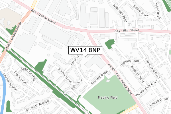
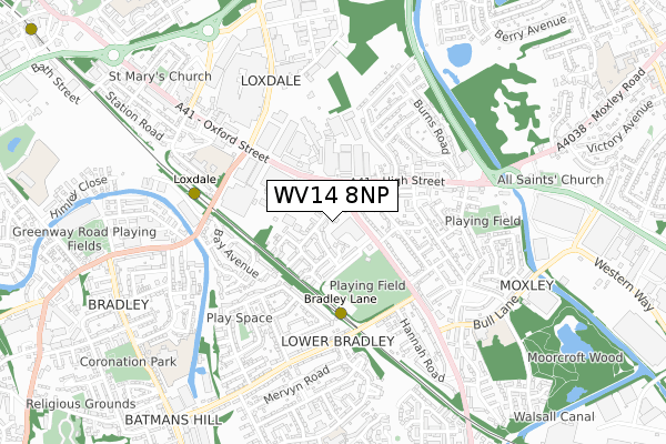
WV14 8NP is located in the Darlaston South electoral ward, within the metropolitan district of Walsall and the English Parliamentary constituency of Walsall South. The Sub Integrated Care Board (ICB) Location is NHS Black Country ICB - D2P2L and the police force is West Midlands. This postcode has been in use since June 2018.


GetTheData
Source: OS Open Zoomstack (Ordnance Survey)
Licence: Open Government Licence (requires attribution)
Attribution: Contains OS data © Crown copyright and database right 2024
Source: Open Postcode Geo
Licence: Open Government Licence (requires attribution)
Attribution: Contains OS data © Crown copyright and database right 2024; Contains Royal Mail data © Royal Mail copyright and database right 2024; Source: Office for National Statistics licensed under the Open Government Licence v.3.0
| Easting | 396147 |
| Northing | 295698 |
| Latitude | 52.559119 |
| Longitude | -2.058260 |
GetTheData
Source: Open Postcode Geo
Licence: Open Government Licence
| Country | England |
| Postcode District | WV14 |
➜ See where WV14 is on a map ➜ Where is Bilston? | |
GetTheData
Source: Land Registry Price Paid Data
Licence: Open Government Licence
| Ward | Darlaston South |
| Constituency | Walsall South |
GetTheData
Source: ONS Postcode Database
Licence: Open Government Licence
1, LAUREL GROVE, BILSTON, WV14 8NP 2018 2 NOV £235,995 |
2, LAUREL GROVE, BILSTON, WV14 8NP 2018 28 SEP £199,995 |
GetTheData
Source: HM Land Registry Price Paid Data
Licence: Contains HM Land Registry data © Crown copyright and database right 2024. This data is licensed under the Open Government Licence v3.0.
| Coles Of Bilston (Great Bridge Rd) | Loxdale | 79m |
| Coles Of Bilston (Great Bridge Rd) | Loxdale | 89m |
| Great Bridge Rd (Moxley Rd) | Lower Bradley | 166m |
| Great Bridge Rd (Moxley Rd) | Lower Bradley | 196m |
| Bradley Lane (Great Bridge Rd) | Loxdale | 295m |
| Bradley Lane (Midland Metro Stop) (Bradley Lane) | Lower Bradley | 388m |
| Loxdale (Midland Metro Stop) (Loxdale St) | Bradley | 497m |
| Bilston Central (Midland Metro Stop) (Church St) | Bilston | 1,353m |
| Coseley Station | 2.4km |
| Tipton Station | 3.2km |
| Dudley Port Station | 3.9km |
GetTheData
Source: NaPTAN
Licence: Open Government Licence
| Percentage of properties with Next Generation Access | 100.0% |
| Percentage of properties with Superfast Broadband | 100.0% |
| Percentage of properties with Ultrafast Broadband | 100.0% |
| Percentage of properties with Full Fibre Broadband | 0.0% |
Superfast Broadband is between 30Mbps and 300Mbps
Ultrafast Broadband is > 300Mbps
| Percentage of properties unable to receive 2Mbps | 0.0% |
| Percentage of properties unable to receive 5Mbps | 0.0% |
| Percentage of properties unable to receive 10Mbps | 0.0% |
| Percentage of properties unable to receive 30Mbps | 0.0% |
GetTheData
Source: Ofcom
Licence: Ofcom Terms of Use (requires attribution)
GetTheData
Source: ONS Postcode Database
Licence: Open Government Licence


➜ Get more ratings from the Food Standards Agency
GetTheData
Source: Food Standards Agency
Licence: FSA terms & conditions
| Last Collection | |||
|---|---|---|---|
| Location | Mon-Fri | Sat | Distance |
| Mount Pleasant | 18:30 | 11:30 | 1,356m |
| Moat Road | 17:30 | 11:00 | 1,469m |
| High Street Post Office | 19:00 | 11:45 | 1,599m |
GetTheData
Source: Dracos
Licence: Creative Commons Attribution-ShareAlike
The below table lists the International Territorial Level (ITL) codes (formerly Nomenclature of Territorial Units for Statistics (NUTS) codes) and Local Administrative Units (LAU) codes for WV14 8NP:
| ITL 1 Code | Name |
|---|---|
| TLG | West Midlands (England) |
| ITL 2 Code | Name |
| TLG3 | West Midlands |
| ITL 3 Code | Name |
| TLG38 | Walsall |
| LAU 1 Code | Name |
| E08000030 | Walsall |
GetTheData
Source: ONS Postcode Directory
Licence: Open Government Licence
The below table lists the Census Output Area (OA), Lower Layer Super Output Area (LSOA), and Middle Layer Super Output Area (MSOA) for WV14 8NP:
| Code | Name | |
|---|---|---|
| OA | E00168270 | |
| LSOA | E01010315 | Walsall 038E |
| MSOA | E02002147 | Walsall 038 |
GetTheData
Source: ONS Postcode Directory
Licence: Open Government Licence
| WV14 8NS | Great Bridge Road | 61m |
| WV14 8NU | Hemlock Way | 64m |
| WV14 8LA | Great Bridge Road | 128m |
| WV14 8QF | Sorbus Street | 153m |
| WV14 8LH | Kendrick Place | 196m |
| WV14 8LQ | Leighton Road | 208m |
| WS10 8RX | High Street | 258m |
| WS10 8SA | Engine Lane | 272m |
| WV14 8LG | Great Bridge Road | 278m |
| WS10 8SE | Castle View Close | 280m |
GetTheData
Source: Open Postcode Geo; Land Registry Price Paid Data
Licence: Open Government Licence