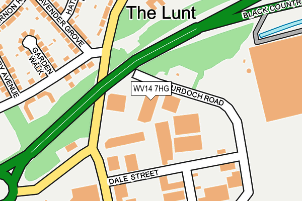
WV14 7HG is located in the Bilston South electoral ward, within the metropolitan district of Wolverhampton and the English Parliamentary constituency of Wolverhampton South East. The Sub Integrated Care Board (ICB) Location is NHS Black Country ICB - D2P2L and the police force is West Midlands. This postcode has been in use since September 1991.


GetTheData
Source: OS OpenMap – Local (Ordnance Survey)
Source: OS VectorMap District (Ordnance Survey)
Licence: Open Government Licence (requires attribution)
| Easting | 395983 |
| Northing | 296594 |
| Latitude | 52.567173 |
| Longitude | -2.060690 |
GetTheData
Source: Open Postcode Geo
Licence: Open Government Licence
| Country | England |
| Postcode District | WV14 |
➜ See where WV14 is on a map ➜ Where is Bilston? | |
GetTheData
Source: Land Registry Price Paid Data
Licence: Open Government Licence
Elevation or altitude of WV14 7HG as distance above sea level:
| Metres | Feet | |
|---|---|---|
| Elevation | 130m | 427ft |
Elevation is measured from the approximate centre of the postcode, to the nearest point on an OS contour line from OS Terrain 50, which has contour spacing of ten vertical metres.
➜ How high above sea level am I? Find the elevation of your current position using your device's GPS.
GetTheData
Source: Open Postcode Elevation
Licence: Open Government Licence
| Ward | Bilston South |
| Constituency | Wolverhampton South East |
GetTheData
Source: ONS Postcode Database
Licence: Open Government Licence
| St Chads Rd (Lunt Rd) | The Lunt | 268m |
| St Chads Rd (Lunt Rd) | The Lunt | 269m |
| Bilston Fc (Lunt Rd) | The Lunt | 330m |
| Bilston Fc (Lunt Rd) | The Lunt | 334m |
| Tryon Place (Beckett St) | St Chads | 515m |
| Loxdale (Midland Metro Stop) (Loxdale St) | Bradley | 880m |
| Bilston Central (Midland Metro Stop) (Church St) | Bilston | 974m |
| Bradley Lane (Midland Metro Stop) (Bradley Lane) | Lower Bradley | 1,299m |
| The Crescent (Midland Metro Stop) (The Crescent) | Bilston | 1,362m |
| Coseley Station | 3km |
| Tipton Station | 4.1km |
| Wolverhampton Station | 4.6km |
GetTheData
Source: NaPTAN
Licence: Open Government Licence
GetTheData
Source: ONS Postcode Database
Licence: Open Government Licence


➜ Get more ratings from the Food Standards Agency
GetTheData
Source: Food Standards Agency
Licence: FSA terms & conditions
| Last Collection | |||
|---|---|---|---|
| Location | Mon-Fri | Sat | Distance |
| Mount Pleasant | 18:30 | 11:30 | 757m |
| Wellington Road | 16:45 | 11:15 | 1,264m |
| Villiers Avenue Post Office | 17:00 | 11:45 | 1,343m |
GetTheData
Source: Dracos
Licence: Creative Commons Attribution-ShareAlike
The below table lists the International Territorial Level (ITL) codes (formerly Nomenclature of Territorial Units for Statistics (NUTS) codes) and Local Administrative Units (LAU) codes for WV14 7HG:
| ITL 1 Code | Name |
|---|---|
| TLG | West Midlands (England) |
| ITL 2 Code | Name |
| TLG3 | West Midlands |
| ITL 3 Code | Name |
| TLG39 | Wolverhampton |
| LAU 1 Code | Name |
| E08000031 | Wolverhampton |
GetTheData
Source: ONS Postcode Directory
Licence: Open Government Licence
The below table lists the Census Output Area (OA), Lower Layer Super Output Area (LSOA), and Middle Layer Super Output Area (MSOA) for WV14 7HG:
| Code | Name | |
|---|---|---|
| OA | E00167332 | |
| LSOA | E01010414 | Wolverhampton 027A |
| MSOA | E02002175 | Wolverhampton 027 |
GetTheData
Source: ONS Postcode Directory
Licence: Open Government Licence
| WV14 7HF | Lunt Road | 201m |
| WV14 7HE | Lavender Grove | 209m |
| WV14 7EY | Lunt Road | 245m |
| WV14 7HU | Garden Walk | 246m |
| WV14 7HT | Lunt Road | 246m |
| WV14 7HD | Hatherton Road | 249m |
| WV14 7HB | Lavender Grove | 285m |
| WV14 7EZ | Rosemary Avenue | 296m |
| WV14 7AF | Lonsdale Road | 300m |
| WV14 7AU | Marbury Drive | 308m |
GetTheData
Source: Open Postcode Geo; Land Registry Price Paid Data
Licence: Open Government Licence