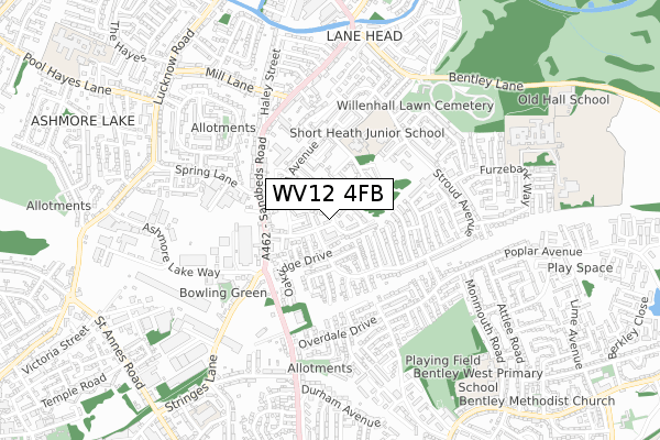
WV12 4FB is located in the Short Heath electoral ward, within the metropolitan district of Walsall and the English Parliamentary constituency of Walsall North. The Sub Integrated Care Board (ICB) Location is NHS Black Country ICB - D2P2L and the police force is West Midlands. This postcode has been in use since June 2019.


GetTheData
Source: OS Open Zoomstack (Ordnance Survey)
Licence: Open Government Licence (requires attribution)
Attribution: Contains OS data © Crown copyright and database right 2024
Source: Open Postcode Geo
Licence: Open Government Licence (requires attribution)
Attribution: Contains OS data © Crown copyright and database right 2024; Contains Royal Mail data © Royal Mail copyright and database right 2024; Source: Office for National Statistics licensed under the Open Government Licence v.3.0
| Easting | 397528 |
| Northing | 299737 |
| Latitude | 52.595438 |
| Longitude | -2.037921 |
GetTheData
Source: Open Postcode Geo
Licence: Open Government Licence
| Country | England |
| Postcode District | WV12 |
➜ See where WV12 is on a map ➜ Where is Willenhall? | |
GetTheData
Source: Land Registry Price Paid Data
Licence: Open Government Licence
| Ward | Short Heath |
| Constituency | Walsall North |
GetTheData
Source: ONS Postcode Database
Licence: Open Government Licence
| Ensbury Close (Stroud Ave) | Lodge Farm | 19m |
| Ensbury Close (Stroud Ave) | Lodge Farm | 131m |
| Ashmore Lake Way (Sandbeds Rd) | Lodge Farm | 239m |
| Wolverson Close (Stroud Ave) | Lodge Farm | 256m |
| Ashmore Lake Way (Sandbeds Rd) | Lodge Farm | 263m |
| Bloxwich Station | 3.1km |
| Bloxwich North Station | 3.6km |
| Walsall Station | 3.8km |
GetTheData
Source: NaPTAN
Licence: Open Government Licence
GetTheData
Source: ONS Postcode Database
Licence: Open Government Licence


➜ Get more ratings from the Food Standards Agency
GetTheData
Source: Food Standards Agency
Licence: FSA terms & conditions
| Last Collection | |||
|---|---|---|---|
| Location | Mon-Fri | Sat | Distance |
| Attlee Road | 17:15 | 12:00 | 815m |
| Lucknow Road | 16:45 | 12:30 | 885m |
| Morris Avenue | 17:15 | 12:00 | 1,056m |
GetTheData
Source: Dracos
Licence: Creative Commons Attribution-ShareAlike
The below table lists the International Territorial Level (ITL) codes (formerly Nomenclature of Territorial Units for Statistics (NUTS) codes) and Local Administrative Units (LAU) codes for WV12 4FB:
| ITL 1 Code | Name |
|---|---|
| TLG | West Midlands (England) |
| ITL 2 Code | Name |
| TLG3 | West Midlands |
| ITL 3 Code | Name |
| TLG38 | Walsall |
| LAU 1 Code | Name |
| E08000030 | Walsall |
GetTheData
Source: ONS Postcode Directory
Licence: Open Government Licence
The below table lists the Census Output Area (OA), Lower Layer Super Output Area (LSOA), and Middle Layer Super Output Area (MSOA) for WV12 4FB:
| Code | Name | |
|---|---|---|
| OA | E00052418 | |
| LSOA | E01010383 | Walsall 019D |
| MSOA | E02002128 | Walsall 019 |
GetTheData
Source: ONS Postcode Directory
Licence: Open Government Licence
| WV12 4DP | Benton Close | 48m |
| WV12 4ET | Stroud Avenue | 50m |
| WV12 4DN | Ensbury Close | 89m |
| WV12 4DY | Ernest Clarke Close | 98m |
| WV12 4DW | Rudge Close | 110m |
| WV12 4EU | Ensbury Close | 126m |
| WV12 4EJ | Oakridge Drive | 127m |
| WV12 4EW | Oakridge Close | 129m |
| WV12 4DD | Dursley Close | 130m |
| WV12 4ER | Whitminster Close | 157m |
GetTheData
Source: Open Postcode Geo; Land Registry Price Paid Data
Licence: Open Government Licence