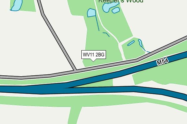
WV11 2BG is located in the Essington electoral ward, within the local authority district of South Staffordshire and the English Parliamentary constituency of South Staffordshire. The Sub Integrated Care Board (ICB) Location is NHS Staffordshire and Stoke-on-Trent ICB - 04Y and the police force is Staffordshire. This postcode has been in use since May 2016.


GetTheData
Source: OS OpenMap – Local (Ordnance Survey)
Source: OS VectorMap District (Ordnance Survey)
Licence: Open Government Licence (requires attribution)
| Easting | 395715 |
| Northing | 304394 |
| Latitude | 52.637276 |
| Longitude | -2.064753 |
GetTheData
Source: Open Postcode Geo
Licence: Open Government Licence
| Country | England |
| Postcode District | WV11 |
➜ See where WV11 is on a map | |
GetTheData
Source: Land Registry Price Paid Data
Licence: Open Government Licence
Elevation or altitude of WV11 2BG as distance above sea level:
| Metres | Feet | |
|---|---|---|
| Elevation | 170m | 558ft |
Elevation is measured from the approximate centre of the postcode, to the nearest point on an OS contour line from OS Terrain 50, which has contour spacing of ten vertical metres.
➜ How high above sea level am I? Find the elevation of your current position using your device's GPS.
GetTheData
Source: Open Postcode Elevation
Licence: Open Government Licence
| Ward | Essington |
| Constituency | South Staffordshire |
GetTheData
Source: ONS Postcode Database
Licence: Open Government Licence
| St Johns Primary School (Hobnock Rd) | Essington | 802m |
| St Johns Primary School (Hobnock Rd) | Essington | 810m |
| Hilton Park Services (M6) | Hilton | 856m |
| The Gables (Brownshore Lane) | Essington | 898m |
| The Gables (Brownshore Lane) | Essington | 922m |
| Bloxwich North Station | 3.4km |
| Landywood Station | 3.7km |
| Bloxwich Station | 4.2km |
GetTheData
Source: NaPTAN
Licence: Open Government Licence
GetTheData
Source: ONS Postcode Database
Licence: Open Government Licence


➜ Get more ratings from the Food Standards Agency
GetTheData
Source: Food Standards Agency
Licence: FSA terms & conditions
| Last Collection | |||
|---|---|---|---|
| Location | Mon-Fri | Sat | Distance |
| Ashmore Park Post Office | 17:15 | 12:00 | 2,627m |
| St Annes Road | 17:00 | 13:00 | 2,882m |
| Underhill Lane | 16:45 | 12:45 | 2,901m |
GetTheData
Source: Dracos
Licence: Creative Commons Attribution-ShareAlike
The below table lists the International Territorial Level (ITL) codes (formerly Nomenclature of Territorial Units for Statistics (NUTS) codes) and Local Administrative Units (LAU) codes for WV11 2BG:
| ITL 1 Code | Name |
|---|---|
| TLG | West Midlands (England) |
| ITL 2 Code | Name |
| TLG2 | Shropshire and Staffordshire |
| ITL 3 Code | Name |
| TLG24 | Staffordshire CC |
| LAU 1 Code | Name |
| E07000196 | South Staffordshire |
GetTheData
Source: ONS Postcode Directory
Licence: Open Government Licence
The below table lists the Census Output Area (OA), Lower Layer Super Output Area (LSOA), and Middle Layer Super Output Area (MSOA) for WV11 2BG:
| Code | Name | |
|---|---|---|
| OA | E00150988 | |
| LSOA | E01029633 | South Staffordshire 007B |
| MSOA | E02006180 | South Staffordshire 007 |
GetTheData
Source: ONS Postcode Directory
Licence: Open Government Licence
| WV11 2BA | Bognop Road | 734m |
| WV11 2TE | Charles Avenue | 735m |
| WV11 2TG | Vernon Close | 781m |
| WV11 2TQ | Danes Close | 785m |
| WV11 2RF | Hobnock Road | 796m |
| WV11 2TA | Swynnerton Drive | 801m |
| WV11 2TB | Swynnerton Drive | 887m |
| WV11 2TD | Tudor Court | 891m |
| WV11 2AL | Brownshore Lane | 910m |
| WV11 2AJ | Forrest Avenue | 940m |
GetTheData
Source: Open Postcode Geo; Land Registry Price Paid Data
Licence: Open Government Licence