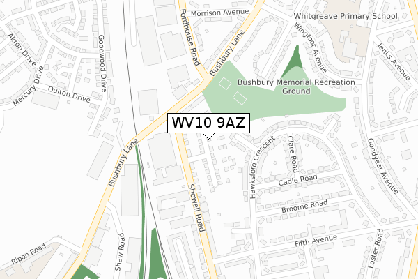
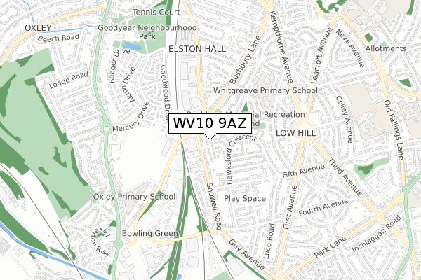
WV10 9AZ is located in the Bushbury South & Low Hill electoral ward, within the metropolitan district of Wolverhampton and the English Parliamentary constituency of Wolverhampton North East. The Sub Integrated Care Board (ICB) Location is NHS Black Country ICB - D2P2L and the police force is West Midlands. This postcode has been in use since August 2019.


GetTheData
Source: OS Open Zoomstack (Ordnance Survey)
Licence: Open Government Licence (requires attribution)
Attribution: Contains OS data © Crown copyright and database right 2025
Source: Open Postcode Geo
Licence: Open Government Licence (requires attribution)
Attribution: Contains OS data © Crown copyright and database right 2025; Contains Royal Mail data © Royal Mail copyright and database right 2025; Source: Office for National Statistics licensed under the Open Government Licence v.3.0
| Easting | 391851 |
| Northing | 301315 |
| Latitude | 52.609567 |
| Longitude | -2.121768 |
GetTheData
Source: Open Postcode Geo
Licence: Open Government Licence
| Country | England |
| Postcode District | WV10 |
➜ See where WV10 is on a map ➜ Where is Wolverhampton? | |
GetTheData
Source: Land Registry Price Paid Data
Licence: Open Government Licence
| Ward | Bushbury South & Low Hill |
| Constituency | Wolverhampton North East |
GetTheData
Source: ONS Postcode Database
Licence: Open Government Licence
2022 9 SEP £235,000 |
54, COMET DRIVE, WOLVERHAMPTON, WV10 9AZ 2020 22 DEC £217,500 |
53, COMET DRIVE, WOLVERHAMPTON, WV10 9AZ 2020 30 OCT £225,000 |
46, COMET DRIVE, WOLVERHAMPTON, WV10 9AZ 2020 14 AUG £225,000 |
45, COMET DRIVE, WOLVERHAMPTON, WV10 9AZ 2020 31 JUL £225,000 |
2020 25 JUN £189,995 |
38, COMET DRIVE, WOLVERHAMPTON, WV10 9AZ 2020 15 MAY £189,995 |
30, COMET DRIVE, WOLVERHAMPTON, WV10 9AZ 2020 12 MAR £187,500 |
25, COMET DRIVE, WOLVERHAMPTON, WV10 9AZ 2020 21 FEB £219,995 |
1, COMET DRIVE, WOLVERHAMPTON, WV10 9AZ 2019 28 NOV £190,000 |
GetTheData
Source: HM Land Registry Price Paid Data
Licence: Contains HM Land Registry data © Crown copyright and database right 2025. This data is licensed under the Open Government Licence v3.0.
| Fordhouse Rd (Bushbury Lane) | Low Hill | 161m |
| Fordhouse Rd (Bushbury Lane) | Low Hill | 179m |
| Ripon Rd (Bushbury Lane) | Low Hill | 364m |
| Morrison Avenue (Fordhouse Rd) | Low Hill | 399m |
| Ripon Rd (Bushbury Lane) | Low Hill | 430m |
| Wolverhampton Station | 2.4km |
| Bilbrook Station | 4.6km |
GetTheData
Source: NaPTAN
Licence: Open Government Licence
| Percentage of properties with Next Generation Access | 100.0% |
| Percentage of properties with Superfast Broadband | 100.0% |
| Percentage of properties with Ultrafast Broadband | 100.0% |
| Percentage of properties with Full Fibre Broadband | 100.0% |
Superfast Broadband is between 30Mbps and 300Mbps
Ultrafast Broadband is > 300Mbps
| Percentage of properties unable to receive 2Mbps | 0.0% |
| Percentage of properties unable to receive 5Mbps | 0.0% |
| Percentage of properties unable to receive 10Mbps | 0.0% |
| Percentage of properties unable to receive 30Mbps | 0.0% |
GetTheData
Source: Ofcom
Licence: Ofcom Terms of Use (requires attribution)
GetTheData
Source: ONS Postcode Database
Licence: Open Government Licence


➜ Get more ratings from the Food Standards Agency
GetTheData
Source: Food Standards Agency
Licence: FSA terms & conditions
| Last Collection | |||
|---|---|---|---|
| Location | Mon-Fri | Sat | Distance |
| Showell Road | 17:30 | 12:15 | 158m |
| Hammond Avenue | 17:30 | 12:00 | 563m |
| Ruskin Road | 16:45 | 12:00 | 579m |
GetTheData
Source: Dracos
Licence: Creative Commons Attribution-ShareAlike
The below table lists the International Territorial Level (ITL) codes (formerly Nomenclature of Territorial Units for Statistics (NUTS) codes) and Local Administrative Units (LAU) codes for WV10 9AZ:
| ITL 1 Code | Name |
|---|---|
| TLG | West Midlands (England) |
| ITL 2 Code | Name |
| TLG3 | West Midlands |
| ITL 3 Code | Name |
| TLG39 | Wolverhampton |
| LAU 1 Code | Name |
| E08000031 | Wolverhampton |
GetTheData
Source: ONS Postcode Directory
Licence: Open Government Licence
The below table lists the Census Output Area (OA), Lower Layer Super Output Area (LSOA), and Middle Layer Super Output Area (MSOA) for WV10 9AZ:
| Code | Name | |
|---|---|---|
| OA | E00052930 | |
| LSOA | E01010485 | Wolverhampton 007D |
| MSOA | E02002155 | Wolverhampton 007 |
GetTheData
Source: ONS Postcode Directory
Licence: Open Government Licence
| WV10 9SN | Hawksford Crescent | 83m |
| WV10 9LP | Showell Road | 95m |
| WV10 9SW | Hawksford Crescent | 118m |
| WV10 9SP | Hawksford Crescent | 141m |
| WV10 9SL | Clare Road | 177m |
| WV10 9TU | Bushbury Lane | 199m |
| WV10 9SJ | Cadle Road | 210m |
| WV10 9LR | Showell Road | 240m |
| WV10 9SS | Fifth Avenue | 245m |
| WV10 9TX | Bushbury Lane | 252m |
GetTheData
Source: Open Postcode Geo; Land Registry Price Paid Data
Licence: Open Government Licence