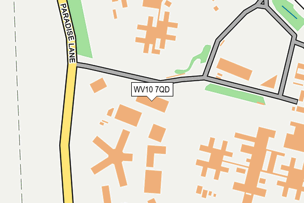
WV10 7QD is located in the Featherstone, Sharehill & Saredon electoral ward, within the local authority district of South Staffordshire and the English Parliamentary constituency of South Staffordshire. The Sub Integrated Care Board (ICB) Location is NHS Staffordshire and Stoke-on-Trent ICB - 05Q and the police force is Staffordshire. This postcode has been in use since February 2012.


GetTheData
Source: OS OpenMap – Local (Ordnance Survey)
Source: OS VectorMap District (Ordnance Survey)
Licence: Open Government Licence (requires attribution)
| Easting | 392451 |
| Northing | 305586 |
| Latitude | 52.647955 |
| Longitude | -2.113013 |
GetTheData
Source: Open Postcode Geo
Licence: Open Government Licence
| Country | England |
| Postcode District | WV10 |
➜ See where WV10 is on a map ➜ Where is Featherstone? | |
GetTheData
Source: Land Registry Price Paid Data
Licence: Open Government Licence
Elevation or altitude of WV10 7QD as distance above sea level:
| Metres | Feet | |
|---|---|---|
| Elevation | 110m | 361ft |
Elevation is measured from the approximate centre of the postcode, to the nearest point on an OS contour line from OS Terrain 50, which has contour spacing of ten vertical metres.
➜ How high above sea level am I? Find the elevation of your current position using your device's GPS.
GetTheData
Source: Open Postcode Elevation
Licence: Open Government Licence
| Ward | Featherstone, Sharehill & Saredon |
| Constituency | South Staffordshire |
GetTheData
Source: ONS Postcode Database
Licence: Open Government Licence
| Prison (Oaks Drive) | Brinsford | 357m |
| East Road (Oaks Drive) | Brinsford | 514m |
| East Road (Oaks Drive) | Brinsford | 522m |
| New Road (East Rd) | Slade Heath | 585m |
| New Road (East Road) | Slade Heath | 632m |
| Bilbrook Station | 5.6km |
GetTheData
Source: NaPTAN
Licence: Open Government Licence
GetTheData
Source: ONS Postcode Database
Licence: Open Government Licence

➜ Get more ratings from the Food Standards Agency
GetTheData
Source: Food Standards Agency
Licence: FSA terms & conditions
| Last Collection | |||
|---|---|---|---|
| Location | Mon-Fri | Sat | Distance |
| St Annes Road | 17:00 | 13:00 | 842m |
| Scotlands Post Office | 17:30 | 12:00 | 1,497m |
| Abbeyfield Road | 17:00 | 12:30 | 1,748m |
GetTheData
Source: Dracos
Licence: Creative Commons Attribution-ShareAlike
The below table lists the International Territorial Level (ITL) codes (formerly Nomenclature of Territorial Units for Statistics (NUTS) codes) and Local Administrative Units (LAU) codes for WV10 7QD:
| ITL 1 Code | Name |
|---|---|
| TLG | West Midlands (England) |
| ITL 2 Code | Name |
| TLG2 | Shropshire and Staffordshire |
| ITL 3 Code | Name |
| TLG24 | Staffordshire CC |
| LAU 1 Code | Name |
| E07000196 | South Staffordshire |
GetTheData
Source: ONS Postcode Directory
Licence: Open Government Licence
The below table lists the Census Output Area (OA), Lower Layer Super Output Area (LSOA), and Middle Layer Super Output Area (MSOA) for WV10 7QD:
| Code | Name | |
|---|---|---|
| OA | E00171615 | |
| LSOA | E01029637 | South Staffordshire 006D |
| MSOA | E02006179 | South Staffordshire 006 |
GetTheData
Source: ONS Postcode Directory
Licence: Open Government Licence
| WV10 7PX | Oaks Drive | 476m |
| WV10 7NE | Eden Court | 528m |
| WV10 7NP | East Road | 587m |
| WV10 7NZ | Paradise Lane | 791m |
| WV10 7PN | Dark Lane | 832m |
| WV10 7EP | Old Stafford Road | 943m |
| WV10 7EQ | Old Stafford Road | 976m |
| WV10 7PP | Old Stafford Road | 978m |
| WV10 7EN | Old Stafford Road | 980m |
| WV10 7SY | Harebell Close | 988m |
GetTheData
Source: Open Postcode Geo; Land Registry Price Paid Data
Licence: Open Government Licence