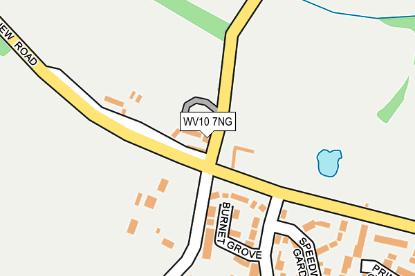
WV10 7NG is located in the Featherstone, Sharehill & Saredon electoral ward, within the local authority district of South Staffordshire and the English Parliamentary constituency of South Staffordshire. The Sub Integrated Care Board (ICB) Location is NHS Staffordshire and Stoke-on-Trent ICB - 05Q and the police force is Staffordshire. This postcode has been in use since June 1998.


GetTheData
Source: OS OpenMap – Local (Ordnance Survey)
Source: OS VectorMap District (Ordnance Survey)
Licence: Open Government Licence (requires attribution)
| Easting | 393631 |
| Northing | 305686 |
| Latitude | 52.648869 |
| Longitude | -2.095574 |
GetTheData
Source: Open Postcode Geo
Licence: Open Government Licence
| Country | England |
| Postcode District | WV10 |
➜ See where WV10 is on a map ➜ Where is Featherstone? | |
GetTheData
Source: Land Registry Price Paid Data
Licence: Open Government Licence
Elevation or altitude of WV10 7NG as distance above sea level:
| Metres | Feet | |
|---|---|---|
| Elevation | 130m | 427ft |
Elevation is measured from the approximate centre of the postcode, to the nearest point on an OS contour line from OS Terrain 50, which has contour spacing of ten vertical metres.
➜ How high above sea level am I? Find the elevation of your current position using your device's GPS.
GetTheData
Source: Open Postcode Elevation
Licence: Open Government Licence
| Ward | Featherstone, Sharehill & Saredon |
| Constituency | South Staffordshire |
GetTheData
Source: ONS Postcode Database
Licence: Open Government Licence
| Whitehouse Farm (New Road) | Featherstone | 93m |
| Whitehouse Farm (New Road) | Featherstone | 96m |
| Baneberry Drive (New Road) | Featherstone | 321m |
| Baneberry Drive (New Road) | Featherstone | 323m |
| Honeysuckle Drive (Baneberry Drive) | Featherstone | 369m |
| Cannock Station | 6.5km |
GetTheData
Source: NaPTAN
Licence: Open Government Licence
GetTheData
Source: ONS Postcode Database
Licence: Open Government Licence


➜ Get more ratings from the Food Standards Agency
GetTheData
Source: Food Standards Agency
Licence: FSA terms & conditions
| Last Collection | |||
|---|---|---|---|
| Location | Mon-Fri | Sat | Distance |
| St Annes Road | 17:00 | 13:00 | 1,126m |
| Abbeyfield Road | 17:00 | 12:30 | 2,060m |
| Cavalier Circus | 17:00 | 12:00 | 2,488m |
GetTheData
Source: Dracos
Licence: Creative Commons Attribution-ShareAlike
The below table lists the International Territorial Level (ITL) codes (formerly Nomenclature of Territorial Units for Statistics (NUTS) codes) and Local Administrative Units (LAU) codes for WV10 7NG:
| ITL 1 Code | Name |
|---|---|
| TLG | West Midlands (England) |
| ITL 2 Code | Name |
| TLG2 | Shropshire and Staffordshire |
| ITL 3 Code | Name |
| TLG24 | Staffordshire CC |
| LAU 1 Code | Name |
| E07000196 | South Staffordshire |
GetTheData
Source: ONS Postcode Directory
Licence: Open Government Licence
The below table lists the Census Output Area (OA), Lower Layer Super Output Area (LSOA), and Middle Layer Super Output Area (MSOA) for WV10 7NG:
| Code | Name | |
|---|---|---|
| OA | E00150998 | |
| LSOA | E01029636 | South Staffordshire 006C |
| MSOA | E02006179 | South Staffordshire 006 |
GetTheData
Source: ONS Postcode Directory
Licence: Open Government Licence
| WV10 7NW | New Road | 129m |
| WV10 7TT | Burnet Grove | 136m |
| WV10 7TU | Speedwell Gardens | 229m |
| WV10 7TS | Foxglove Close | 231m |
| WV10 7TX | Sorrel Close | 273m |
| WV10 7TR | Baneberry Drive | 300m |
| WV10 7TP | Larkspur Drive | 315m |
| WV10 7TZ | Primrose Gardens | 315m |
| WV10 7TN | Larkspur Drive | 338m |
| WV10 7TL | Teasel Grove | 353m |
GetTheData
Source: Open Postcode Geo; Land Registry Price Paid Data
Licence: Open Government Licence