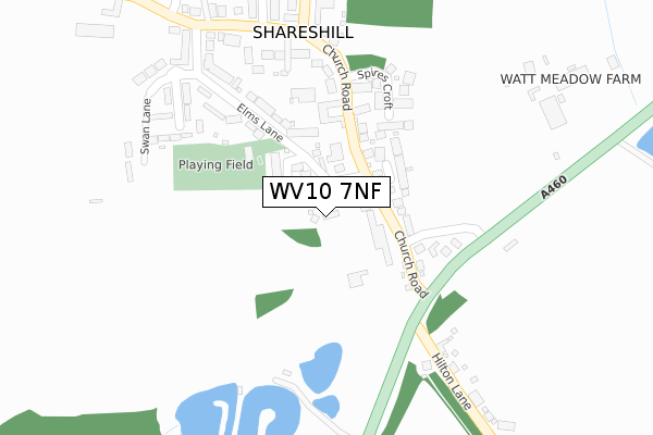
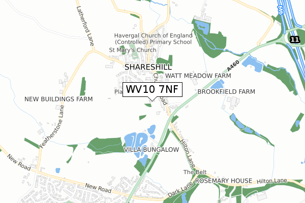
WV10 7NF is located in the Featherstone, Sharehill & Saredon electoral ward, within the local authority district of South Staffordshire and the English Parliamentary constituency of South Staffordshire. The Sub Integrated Care Board (ICB) Location is NHS Staffordshire and Stoke-on-Trent ICB - 05Q and the police force is Staffordshire. This postcode has been in use since December 2017.


GetTheData
Source: OS Open Zoomstack (Ordnance Survey)
Licence: Open Government Licence (requires attribution)
Attribution: Contains OS data © Crown copyright and database right 2024
Source: Open Postcode Geo
Licence: Open Government Licence (requires attribution)
Attribution: Contains OS data © Crown copyright and database right 2024; Contains Royal Mail data © Royal Mail copyright and database right 2024; Source: Office for National Statistics licensed under the Open Government Licence v.3.0
| Easting | 394582 |
| Northing | 306218 |
| Latitude | 52.653678 |
| Longitude | -2.081520 |
GetTheData
Source: Open Postcode Geo
Licence: Open Government Licence
| Country | England |
| Postcode District | WV10 |
➜ See where WV10 is on a map ➜ Where is Shareshill? | |
GetTheData
Source: Land Registry Price Paid Data
Licence: Open Government Licence
| Ward | Featherstone, Sharehill & Saredon |
| Constituency | South Staffordshire |
GetTheData
Source: ONS Postcode Database
Licence: Open Government Licence
2, LITTLEFIELD CLOSE, SHARESHILL, WOLVERHAMPTON, WV10 7NF 2024 10 MAY £687,000 |
1, LITTLEFIELD CLOSE, SHARESHILL, WOLVERHAMPTON, WV10 7NF 2022 6 MAY £625,000 |
2, LITTLEFIELD CLOSE, SHARESHILL, WOLVERHAMPTON, WV10 7NF 2018 26 SEP £375,000 |
4, LITTLEFIELD CLOSE, SHARESHILL, WOLVERHAMPTON, WV10 7NF 2018 27 JUN £400,000 |
1, LITTLEFIELD CLOSE, SHARESHILL, WOLVERHAMPTON, WV10 7NF 2018 15 MAR £410,000 |
3, LITTLEFIELD CLOSE, SHARESHILL, WOLVERHAMPTON, WV10 7NF 2018 12 JAN £425,000 |
GetTheData
Source: HM Land Registry Price Paid Data
Licence: Contains HM Land Registry data © Crown copyright and database right 2024. This data is licensed under the Open Government Licence v3.0.
| Church Road (Cannock Road) | Shareshill | 191m |
| Swan Lane (Elms Lane) | Shareshill | 217m |
| Church Road (Cannock Road) | Shareshill | 220m |
| Monument Drive (Cannock Road) | Featherstone | 695m |
| Monument Drive (Cannock Road) | Featherstone | 706m |
| Landywood Station | 4.1km |
| Bloxwich North Station | 5.3km |
| Cannock Station | 5.4km |
GetTheData
Source: NaPTAN
Licence: Open Government Licence
| Percentage of properties with Next Generation Access | 100.0% |
| Percentage of properties with Superfast Broadband | 100.0% |
| Percentage of properties with Ultrafast Broadband | 0.0% |
| Percentage of properties with Full Fibre Broadband | 0.0% |
Superfast Broadband is between 30Mbps and 300Mbps
Ultrafast Broadband is > 300Mbps
| Percentage of properties unable to receive 2Mbps | 0.0% |
| Percentage of properties unable to receive 5Mbps | 0.0% |
| Percentage of properties unable to receive 10Mbps | 0.0% |
| Percentage of properties unable to receive 30Mbps | 0.0% |
GetTheData
Source: Ofcom
Licence: Ofcom Terms of Use (requires attribution)
GetTheData
Source: ONS Postcode Database
Licence: Open Government Licence


➜ Get more ratings from the Food Standards Agency
GetTheData
Source: Food Standards Agency
Licence: FSA terms & conditions
| Last Collection | |||
|---|---|---|---|
| Location | Mon-Fri | Sat | Distance |
| St Annes Road | 17:00 | 13:00 | 2,188m |
| Abbeyfield Road | 17:00 | 12:30 | 3,029m |
| Anson Road | 16:00 | 10:00 | 3,115m |
GetTheData
Source: Dracos
Licence: Creative Commons Attribution-ShareAlike
The below table lists the International Territorial Level (ITL) codes (formerly Nomenclature of Territorial Units for Statistics (NUTS) codes) and Local Administrative Units (LAU) codes for WV10 7NF:
| ITL 1 Code | Name |
|---|---|
| TLG | West Midlands (England) |
| ITL 2 Code | Name |
| TLG2 | Shropshire and Staffordshire |
| ITL 3 Code | Name |
| TLG24 | Staffordshire CC |
| LAU 1 Code | Name |
| E07000196 | South Staffordshire |
GetTheData
Source: ONS Postcode Directory
Licence: Open Government Licence
The below table lists the Census Output Area (OA), Lower Layer Super Output Area (LSOA), and Middle Layer Super Output Area (MSOA) for WV10 7NF:
| Code | Name | |
|---|---|---|
| OA | E00151009 | |
| LSOA | E01029636 | South Staffordshire 006C |
| MSOA | E02006179 | South Staffordshire 006 |
GetTheData
Source: ONS Postcode Directory
Licence: Open Government Licence
| WV10 7JR | Church Road | 79m |
| WV10 7NA | Vernons Place | 107m |
| WV10 7JL | Pool Close | 134m |
| WV10 7JQ | Old Cannock Road | 154m |
| WV10 7JA | Havergal Place | 158m |
| WV10 7JS | Elms Lane | 168m |
| WV10 7JH | Spires Croft | 189m |
| WV10 7LH | Villa Close | 194m |
| WV10 7LD | Church Road | 238m |
| WV10 7JT | Elms Close | 286m |
GetTheData
Source: Open Postcode Geo; Land Registry Price Paid Data
Licence: Open Government Licence