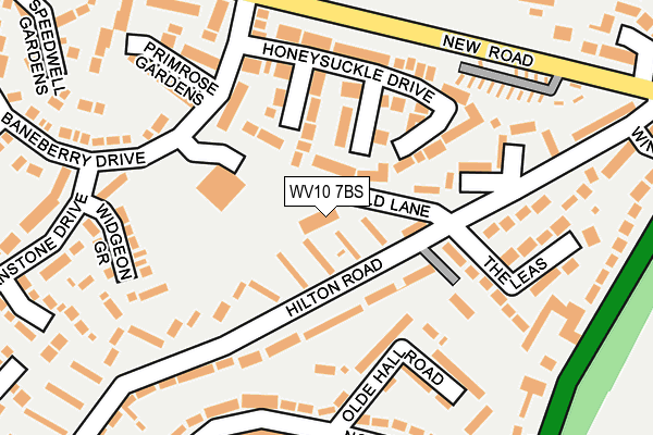
WV10 7BS lies on Old Lane in Featherstone, Wolverhampton. WV10 7BS is located in the Featherstone, Sharehill & Saredon electoral ward, within the local authority district of South Staffordshire and the English Parliamentary constituency of South Staffordshire. The Sub Integrated Care Board (ICB) Location is NHS Staffordshire and Stoke-on-Trent ICB - 05Q and the police force is Staffordshire. This postcode has been in use since January 1992.


GetTheData
Source: OS OpenMap – Local (Ordnance Survey)
Source: OS VectorMap District (Ordnance Survey)
Licence: Open Government Licence (requires attribution)
| Easting | 394037 |
| Northing | 305341 |
| Latitude | 52.645773 |
| Longitude | -2.089566 |
GetTheData
Source: Open Postcode Geo
Licence: Open Government Licence
| Street | Old Lane |
| Locality | Featherstone |
| Town/City | Wolverhampton |
| Country | England |
| Postcode District | WV10 |
➜ See where WV10 is on a map ➜ Where is Featherstone? | |
GetTheData
Source: Land Registry Price Paid Data
Licence: Open Government Licence
Elevation or altitude of WV10 7BS as distance above sea level:
| Metres | Feet | |
|---|---|---|
| Elevation | 130m | 427ft |
Elevation is measured from the approximate centre of the postcode, to the nearest point on an OS contour line from OS Terrain 50, which has contour spacing of ten vertical metres.
➜ How high above sea level am I? Find the elevation of your current position using your device's GPS.
GetTheData
Source: Open Postcode Elevation
Licence: Open Government Licence
| Ward | Featherstone, Sharehill & Saredon |
| Constituency | South Staffordshire |
GetTheData
Source: ONS Postcode Database
Licence: Open Government Licence
| Honeysuckle Drive (Baneberry Drive) | Featherstone | 161m |
| Honeysuckle Drive (Baneberry Drive) | Featherstone | 178m |
| Community Centre (Baneberry Drive) | Featherstone | 180m |
| Community Centre (Baneberry Drive) | Featherstone | 182m |
| Shepwell Gardens (New Road) | Featherstone | 231m |
| Landywood Station | 4.8km |
| Bloxwich North Station | 5.4km |
| Cannock Station | 6.4km |
GetTheData
Source: NaPTAN
Licence: Open Government Licence
GetTheData
Source: ONS Postcode Database
Licence: Open Government Licence


➜ Get more ratings from the Food Standards Agency
GetTheData
Source: Food Standards Agency
Licence: FSA terms & conditions
| Last Collection | |||
|---|---|---|---|
| Location | Mon-Fri | Sat | Distance |
| St Annes Road | 17:00 | 13:00 | 1,264m |
| Abbeyfield Road | 17:00 | 12:30 | 2,007m |
| Cavalier Circus | 17:00 | 12:00 | 2,472m |
GetTheData
Source: Dracos
Licence: Creative Commons Attribution-ShareAlike
The below table lists the International Territorial Level (ITL) codes (formerly Nomenclature of Territorial Units for Statistics (NUTS) codes) and Local Administrative Units (LAU) codes for WV10 7BS:
| ITL 1 Code | Name |
|---|---|
| TLG | West Midlands (England) |
| ITL 2 Code | Name |
| TLG2 | Shropshire and Staffordshire |
| ITL 3 Code | Name |
| TLG24 | Staffordshire CC |
| LAU 1 Code | Name |
| E07000196 | South Staffordshire |
GetTheData
Source: ONS Postcode Directory
Licence: Open Government Licence
The below table lists the Census Output Area (OA), Lower Layer Super Output Area (LSOA), and Middle Layer Super Output Area (MSOA) for WV10 7BS:
| Code | Name | |
|---|---|---|
| OA | E00151003 | |
| LSOA | E01029635 | South Staffordshire 007D |
| MSOA | E02006180 | South Staffordshire 007 |
GetTheData
Source: ONS Postcode Directory
Licence: Open Government Licence
| WV10 7TY | Cranesbill Close | 72m |
| WV10 7TE | Pennycress Gardens | 94m |
| WV10 7TD | Honeysuckle Drive | 122m |
| WV10 7BB | Olde Hall Road | 126m |
| WV10 7AN | Hilton Road | 151m |
| WV10 7AL | Hilton Road | 152m |
| WV10 7AJ | The Leas | 175m |
| WV10 7BD | Olde Hall Road | 194m |
| WV10 7UA | Widgeon Grove | 208m |
| WV10 7BA | North Crescent | 220m |
GetTheData
Source: Open Postcode Geo; Land Registry Price Paid Data
Licence: Open Government Licence