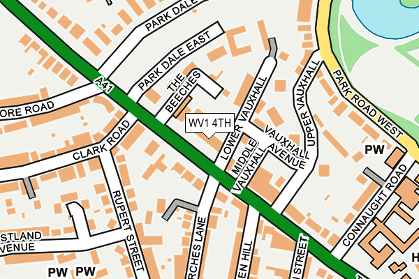
WV1 4TH is located in the Park electoral ward, within the metropolitan district of Wolverhampton and the English Parliamentary constituency of Wolverhampton South West. The Sub Integrated Care Board (ICB) Location is NHS Black Country ICB - D2P2L and the police force is West Midlands. This postcode has been in use since March 2017.


GetTheData
Source: OS OpenMap – Local (Ordnance Survey)
Source: OS VectorMap District (Ordnance Survey)
Licence: Open Government Licence (requires attribution)
| Easting | 390198 |
| Northing | 298972 |
| Latitude | 52.588476 |
| Longitude | -2.146108 |
GetTheData
Source: Open Postcode Geo
Licence: Open Government Licence
| Country | England |
| Postcode District | WV1 |
➜ See where WV1 is on a map ➜ Where is Wolverhampton? | |
GetTheData
Source: Land Registry Price Paid Data
Licence: Open Government Licence
| Ward | Park |
| Constituency | Wolverhampton South West |
GetTheData
Source: ONS Postcode Database
Licence: Open Government Licence
| The Beeches (Tettenhall Rd) | Whitmore Reans | 33m |
| The Beeches (Tettenhall Rd) | Whitmore Reans | 51m |
| Connaught Rd (Tettenhall Rd) | Merridale | 265m |
| Hartley St (Compton Rd) | Merridale | 291m |
| Hartley St (Compton Rd) | Merridale | 296m |
| Wolverhampton St George's (Midland Metro Stop) (Bilston St) | Wolverhampton | 1,560m |
| Wolverhampton Station | 1.8km |
| Bilbrook Station | 4.8km |
| Codsall Station | 5.7km |
GetTheData
Source: NaPTAN
Licence: Open Government Licence
GetTheData
Source: ONS Postcode Database
Licence: Open Government Licence


➜ Get more ratings from the Food Standards Agency
GetTheData
Source: Food Standards Agency
Licence: FSA terms & conditions
| Last Collection | |||
|---|---|---|---|
| Location | Mon-Fri | Sat | Distance |
| Parkdale | 19:00 | 12:30 | 89m |
| Connaught Road | 18:30 | 12:30 | 232m |
| Compton Road | 16:00 | 12:00 | 289m |
GetTheData
Source: Dracos
Licence: Creative Commons Attribution-ShareAlike
The below table lists the International Territorial Level (ITL) codes (formerly Nomenclature of Territorial Units for Statistics (NUTS) codes) and Local Administrative Units (LAU) codes for WV1 4TH:
| ITL 1 Code | Name |
|---|---|
| TLG | West Midlands (England) |
| ITL 2 Code | Name |
| TLG3 | West Midlands |
| ITL 3 Code | Name |
| TLG39 | Wolverhampton |
| LAU 1 Code | Name |
| E08000031 | Wolverhampton |
GetTheData
Source: ONS Postcode Directory
Licence: Open Government Licence
The below table lists the Census Output Area (OA), Lower Layer Super Output Area (LSOA), and Middle Layer Super Output Area (MSOA) for WV1 4TH:
| Code | Name | |
|---|---|---|
| OA | E00053067 | |
| LSOA | E01010512 | Wolverhampton 017E |
| MSOA | E02002165 | Wolverhampton 017 |
GetTheData
Source: ONS Postcode Directory
Licence: Open Government Licence
| WV3 9NQ | Tettenhall Road | 65m |
| WV1 4SP | Lower Vauxhall | 77m |
| WV1 4TA | Vauxhall Avenue | 84m |
| WV1 4TB | Tettenhall Road | 96m |
| WV3 9PN | Haden Hill | 104m |
| WV1 4TD | Park Dale | 108m |
| WV1 4SX | Upper Vauxhall | 119m |
| WV3 9NW | Clark Road | 142m |
| WV1 4SL | Tettenhall Road | 151m |
| WV3 9NE | Tettenhall Road | 153m |
GetTheData
Source: Open Postcode Geo; Land Registry Price Paid Data
Licence: Open Government Licence