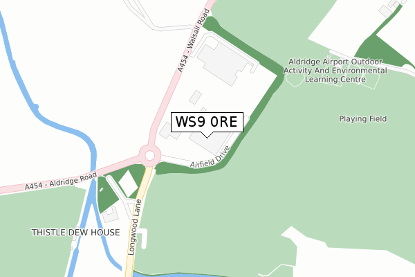
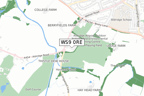
WS9 0RE is located in the Aldridge Central and South electoral ward, within the metropolitan district of Walsall and the English Parliamentary constituency of Aldridge-Brownhills. The Sub Integrated Care Board (ICB) Location is NHS Black Country ICB - D2P2L and the police force is West Midlands. This postcode has been in use since July 2018.


GetTheData
Source: OS Open Zoomstack (Ordnance Survey)
Licence: Open Government Licence (requires attribution)
Attribution: Contains OS data © Crown copyright and database right 2025
Source: Open Postcode Geo
Licence: Open Government Licence (requires attribution)
Attribution: Contains OS data © Crown copyright and database right 2025; Contains Royal Mail data © Royal Mail copyright and database right 2025; Source: Office for National Statistics licensed under the Open Government Licence v.3.0
| Easting | 404282 |
| Northing | 299325 |
| Latitude | 52.591724 |
| Longitude | -1.938218 |
GetTheData
Source: Open Postcode Geo
Licence: Open Government Licence
| Country | England |
| Postcode District | WS9 |
➜ See where WS9 is on a map | |
GetTheData
Source: Land Registry Price Paid Data
Licence: Open Government Licence
| Ward | Aldridge Central And South |
| Constituency | Aldridge-brownhills |
GetTheData
Source: ONS Postcode Database
Licence: Open Government Licence
| Airfield Drive (Walsall Rd) | Longwood | 169m |
| Airfield Drive (Walsall Rd) | Longwood | 173m |
| Longwood Bridge (Aldridge Rd) | Longwood | 394m |
| Longwood Bridge (Aldridge Rd) | Longwood | 396m |
| Bosty Lane (Walsall Rd) | Longwood | 460m |
| Walsall Station | 3.3km |
| Bescot Stadium Station | 4.8km |
| Tame Bridge Parkway Station | 5km |
GetTheData
Source: NaPTAN
Licence: Open Government Licence
GetTheData
Source: ONS Postcode Database
Licence: Open Government Licence


➜ Get more ratings from the Food Standards Agency
GetTheData
Source: Food Standards Agency
Licence: FSA terms & conditions
| Last Collection | |||
|---|---|---|---|
| Location | Mon-Fri | Sat | Distance |
| Gillity Village | 18:15 | 12:00 | 871m |
| Myatt Avenue | 17:15 | 11:00 | 983m |
| Sutton Road | 17:15 | 11:30 | 1,150m |
GetTheData
Source: Dracos
Licence: Creative Commons Attribution-ShareAlike
The below table lists the International Territorial Level (ITL) codes (formerly Nomenclature of Territorial Units for Statistics (NUTS) codes) and Local Administrative Units (LAU) codes for WS9 0RE:
| ITL 1 Code | Name |
|---|---|
| TLG | West Midlands (England) |
| ITL 2 Code | Name |
| TLG3 | West Midlands |
| ITL 3 Code | Name |
| TLG38 | Walsall |
| LAU 1 Code | Name |
| E08000030 | Walsall |
GetTheData
Source: ONS Postcode Directory
Licence: Open Government Licence
The below table lists the Census Output Area (OA), Lower Layer Super Output Area (LSOA), and Middle Layer Super Output Area (MSOA) for WS9 0RE:
| Code | Name | |
|---|---|---|
| OA | E00051797 | |
| LSOA | E01010246 | Walsall 022B |
| MSOA | E02002131 | Walsall 022 |
GetTheData
Source: ONS Postcode Directory
Licence: Open Government Licence
| WS9 0QA | Walsall Road | 451m |
| WS9 0QB | Walsall Road | 463m |
| WS9 0QF | Bosty Lane | 502m |
| WS9 0QE | Bosty Lane | 619m |
| WS9 0JU | Bosty Lane | 647m |
| WS9 0JT | Walsall Road | 691m |
| WS9 0BZ | Westbrook Avenue | 748m |
| WS9 0BB | Whitehouse Way | 749m |
| WS9 0DA | Westbrook Avenue | 774m |
| WS9 0BE | Walsall Road | 777m |
GetTheData
Source: Open Postcode Geo; Land Registry Price Paid Data
Licence: Open Government Licence