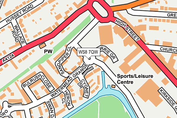
WS8 7QW is located in the Chasetown electoral ward, within the local authority district of Lichfield and the English Parliamentary constituency of Lichfield. The Sub Integrated Care Board (ICB) Location is NHS Staffordshire and Stoke-on-Trent ICB - 05Q and the police force is Staffordshire. This postcode has been in use since May 2017.


GetTheData
Source: OS OpenMap – Local (Ordnance Survey)
Source: OS VectorMap District (Ordnance Survey)
Licence: Open Government Licence (requires attribution)
| Easting | 404018 |
| Northing | 306661 |
| Latitude | 52.657675 |
| Longitude | -1.942028 |
GetTheData
Source: Open Postcode Geo
Licence: Open Government Licence
| Country | England |
| Postcode District | WS8 |
➜ See where WS8 is on a map ➜ Where is Brownhills? | |
GetTheData
Source: Land Registry Price Paid Data
Licence: Open Government Licence
| Ward | Chasetown |
| Constituency | Lichfield |
GetTheData
Source: ONS Postcode Database
Licence: Open Government Licence
| Hednesford Rd (Watling St) | Brownhills West | 262m |
| Chapel St (White Horse Rd) | Brownhills West | 281m |
| Watling St Primary School (The Parade) | Ogley Hay | 385m |
| Hednesford Rd (Watling St) | Brownhills West | 408m |
| Watling St Primary School (The Parade) | Ogley Hay | 426m |
| Bloxwich Station | 6.4km |
GetTheData
Source: NaPTAN
Licence: Open Government Licence
| Percentage of properties with Next Generation Access | 100.0% |
| Percentage of properties with Superfast Broadband | 100.0% |
| Percentage of properties with Ultrafast Broadband | 0.0% |
| Percentage of properties with Full Fibre Broadband | 0.0% |
Superfast Broadband is between 30Mbps and 300Mbps
Ultrafast Broadband is > 300Mbps
| Percentage of properties unable to receive 2Mbps | 0.0% |
| Percentage of properties unable to receive 5Mbps | 0.0% |
| Percentage of properties unable to receive 10Mbps | 0.0% |
| Percentage of properties unable to receive 30Mbps | 0.0% |
GetTheData
Source: Ofcom
Licence: Ofcom Terms of Use (requires attribution)
GetTheData
Source: ONS Postcode Database
Licence: Open Government Licence


➜ Get more ratings from the Food Standards Agency
GetTheData
Source: Food Standards Agency
Licence: FSA terms & conditions
| Last Collection | |||
|---|---|---|---|
| Location | Mon-Fri | Sat | Distance |
| Whitehorse Road | 16:00 | 11:15 | 302m |
| Watling Street | 16:00 | 11:15 | 690m |
| Shannon Drive | 16:00 | 11:15 | 797m |
GetTheData
Source: Dracos
Licence: Creative Commons Attribution-ShareAlike
The below table lists the International Territorial Level (ITL) codes (formerly Nomenclature of Territorial Units for Statistics (NUTS) codes) and Local Administrative Units (LAU) codes for WS8 7QW:
| ITL 1 Code | Name |
|---|---|
| TLG | West Midlands (England) |
| ITL 2 Code | Name |
| TLG2 | Shropshire and Staffordshire |
| ITL 3 Code | Name |
| TLG24 | Staffordshire CC |
| LAU 1 Code | Name |
| E07000194 | Lichfield |
GetTheData
Source: ONS Postcode Directory
Licence: Open Government Licence
The below table lists the Census Output Area (OA), Lower Layer Super Output Area (LSOA), and Middle Layer Super Output Area (MSOA) for WS8 7QW:
| Code | Name | |
|---|---|---|
| OA | E00150286 | |
| LSOA | E01029497 | Lichfield 006E |
| MSOA | E02006151 | Lichfield 006 |
GetTheData
Source: ONS Postcode Directory
Licence: Open Government Licence
| WS8 7HL | Pinewood Close | 177m |
| WS8 7LP | Watling Street | 208m |
| WS8 7LR | Watling Street | 309m |
| WS8 7NN | Roman Close | 333m |
| WS8 7NG | Lawnoaks Close | 341m |
| WS8 7PE | Whitehorse Road | 369m |
| WS8 7PF | Whitehorse Road | 382m |
| WS8 7LS | Hednesford Road | 396m |
| WS8 7LU | Watling Street | 425m |
| WS8 7NS | Chapel Street | 440m |
GetTheData
Source: Open Postcode Geo; Land Registry Price Paid Data
Licence: Open Government Licence