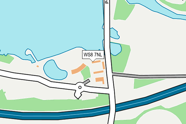
WS8 7NL is located in the Chasetown electoral ward, within the local authority district of Lichfield and the English Parliamentary constituency of Lichfield. The Sub Integrated Care Board (ICB) Location is NHS Staffordshire and Stoke-on-Trent ICB - 05Q and the police force is Staffordshire. This postcode has been in use since January 1980.


GetTheData
Source: OS OpenMap – Local (Ordnance Survey)
Source: OS VectorMap District (Ordnance Survey)
Licence: Open Government Licence (requires attribution)
| Easting | 404022 |
| Northing | 307139 |
| Latitude | 52.661956 |
| Longitude | -1.941970 |
GetTheData
Source: Open Postcode Geo
Licence: Open Government Licence
| Country | England |
| Postcode District | WS8 |
➜ See where WS8 is on a map | |
GetTheData
Source: Land Registry Price Paid Data
Licence: Open Government Licence
Elevation or altitude of WS8 7NL as distance above sea level:
| Metres | Feet | |
|---|---|---|
| Elevation | 150m | 492ft |
Elevation is measured from the approximate centre of the postcode, to the nearest point on an OS contour line from OS Terrain 50, which has contour spacing of ten vertical metres.
➜ How high above sea level am I? Find the elevation of your current position using your device's GPS.
GetTheData
Source: Open Postcode Elevation
Licence: Open Government Licence
| Ward | Chasetown |
| Constituency | Lichfield |
GetTheData
Source: ONS Postcode Database
Licence: Open Government Licence
| Hanbury Rd (White Horse Rd) | Brownhills | 506m |
| Chapel St (White Horse Rd) | Brownhills West | 616m |
| Poole Crescent (Hednesford Rd) | Brownhills West | 646m |
| Poole Crescent (Hednesford Rd) | Brownhills West | 656m |
| Shannon Drive (Wilkin Rd) | Brownhills West | 659m |
| Bloxwich Station | 6.8km |
GetTheData
Source: NaPTAN
Licence: Open Government Licence
GetTheData
Source: ONS Postcode Database
Licence: Open Government Licence


➜ Get more ratings from the Food Standards Agency
GetTheData
Source: Food Standards Agency
Licence: FSA terms & conditions
| Last Collection | |||
|---|---|---|---|
| Location | Mon-Fri | Sat | Distance |
| Whitehorse Road | 16:00 | 11:15 | 582m |
| Watling Street | 16:00 | 11:15 | 914m |
| Shannon Drive | 16:00 | 11:15 | 934m |
GetTheData
Source: Dracos
Licence: Creative Commons Attribution-ShareAlike
The below table lists the International Territorial Level (ITL) codes (formerly Nomenclature of Territorial Units for Statistics (NUTS) codes) and Local Administrative Units (LAU) codes for WS8 7NL:
| ITL 1 Code | Name |
|---|---|
| TLG | West Midlands (England) |
| ITL 2 Code | Name |
| TLG2 | Shropshire and Staffordshire |
| ITL 3 Code | Name |
| TLG24 | Staffordshire CC |
| LAU 1 Code | Name |
| E07000194 | Lichfield |
GetTheData
Source: ONS Postcode Directory
Licence: Open Government Licence
The below table lists the Census Output Area (OA), Lower Layer Super Output Area (LSOA), and Middle Layer Super Output Area (MSOA) for WS8 7NL:
| Code | Name | |
|---|---|---|
| OA | E00150286 | |
| LSOA | E01029497 | Lichfield 006E |
| MSOA | E02006151 | Lichfield 006 |
GetTheData
Source: ONS Postcode Directory
Licence: Open Government Licence
| WS8 7PE | Whitehorse Road | 522m |
| WS8 7PG | Whitehorse Road | 529m |
| WS8 7PF | Whitehorse Road | 554m |
| WS8 7LY | Poole Crescent | 562m |
| WS8 7NR | Wyrley Close | 578m |
| WS8 7HL | Pinewood Close | 590m |
| WS8 7PB | Hanbury Road | 598m |
| WS8 7NG | Lawnoaks Close | 599m |
| WS8 7PA | Anglesey Crescent | 600m |
| WS8 7LT | Hednesford Road | 623m |
GetTheData
Source: Open Postcode Geo; Land Registry Price Paid Data
Licence: Open Government Licence