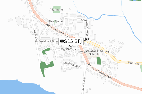
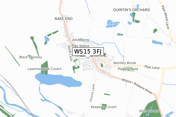
WS15 3FJ is located in the Colton & the Ridwares electoral ward, within the local authority district of Lichfield and the English Parliamentary constituency of Lichfield. The Sub Integrated Care Board (ICB) Location is NHS Staffordshire and Stoke-on-Trent ICB - 05D and the police force is Staffordshire. This postcode has been in use since October 2017.


GetTheData
Source: OS Open Zoomstack (Ordnance Survey)
Licence: Open Government Licence (requires attribution)
Attribution: Contains OS data © Crown copyright and database right 2025
Source: Open Postcode Geo
Licence: Open Government Licence (requires attribution)
Attribution: Contains OS data © Crown copyright and database right 2025; Contains Royal Mail data © Royal Mail copyright and database right 2025; Source: Office for National Statistics licensed under the Open Government Licence v.3.0
| Easting | 408094 |
| Northing | 317808 |
| Latitude | 52.757838 |
| Longitude | -1.881500 |
GetTheData
Source: Open Postcode Geo
Licence: Open Government Licence
| Country | England |
| Postcode District | WS15 |
➜ See where WS15 is on a map ➜ Where is Hill Ridware? | |
GetTheData
Source: Land Registry Price Paid Data
Licence: Open Government Licence
| Ward | Colton & The Ridwares |
| Constituency | Lichfield |
GetTheData
Source: ONS Postcode Database
Licence: Open Government Licence
2024 27 SEP £425,000 |
2022 20 JUN £535,000 |
2018 25 MAY £379,950 |
22, THE MALTINGS, HILL RIDWARE, RUGELEY, WS15 3FJ 2018 11 MAY £444,950 |
2018 11 MAY £444,950 |
20, THE MALTINGS, HILL RIDWARE, RUGELEY, WS15 3FJ 2018 27 APR £379,950 |
14, THE MALTINGS, HILL RIDWARE, RUGELEY, WS15 3FJ 2018 2 MAR £334,950 |
9, THE MALTINGS, HILL RIDWARE, RUGELEY, WS15 3FJ 2018 28 FEB £334,950 |
8, THE MALTINGS, HILL RIDWARE, RUGELEY, WS15 3FJ 2017 21 DEC £324,950 |
6, THE MALTINGS, HILL RIDWARE, RUGELEY, WS15 3FJ 2017 8 DEC £379,950 |
GetTheData
Source: HM Land Registry Price Paid Data
Licence: Contains HM Land Registry data © Crown copyright and database right 2025. This data is licensed under the Open Government Licence v3.0.
| Oaklands Close (Uttoxeter Rd) | Hill Ridware | 125m |
| Oaklands Close (Uttoxeter Road) | Hill Ridware | 155m |
| Sandford Close (Uttoxeter Road) | Hill Ridware | 389m |
| Wade Lane (Uttoxeter Road) | Hill Ridware | 391m |
| Sandford Close (Uttoxeter Road) | Hill Ridware | 409m |
| Rugeley Trent Valley Station | 3.5km |
| Rugeley Town Station | 3.8km |
GetTheData
Source: NaPTAN
Licence: Open Government Licence
| Percentage of properties with Next Generation Access | 100.0% |
| Percentage of properties with Superfast Broadband | 100.0% |
| Percentage of properties with Ultrafast Broadband | 100.0% |
| Percentage of properties with Full Fibre Broadband | 100.0% |
Superfast Broadband is between 30Mbps and 300Mbps
Ultrafast Broadband is > 300Mbps
| Percentage of properties unable to receive 2Mbps | 0.0% |
| Percentage of properties unable to receive 5Mbps | 0.0% |
| Percentage of properties unable to receive 10Mbps | 0.0% |
| Percentage of properties unable to receive 30Mbps | 0.0% |
GetTheData
Source: Ofcom
Licence: Ofcom Terms of Use (requires attribution)
GetTheData
Source: ONS Postcode Database
Licence: Open Government Licence


➜ Get more ratings from the Food Standards Agency
GetTheData
Source: Food Standards Agency
Licence: FSA terms & conditions
| Last Collection | |||
|---|---|---|---|
| Location | Mon-Fri | Sat | Distance |
| Hill Ridware | 16:45 | 08:30 | 172m |
| Mavesyn Ridware | 16:30 | 08:30 | 925m |
| Armitage Post Office | 17:30 | 09:30 | 1,823m |
GetTheData
Source: Dracos
Licence: Creative Commons Attribution-ShareAlike
The below table lists the International Territorial Level (ITL) codes (formerly Nomenclature of Territorial Units for Statistics (NUTS) codes) and Local Administrative Units (LAU) codes for WS15 3FJ:
| ITL 1 Code | Name |
|---|---|
| TLG | West Midlands (England) |
| ITL 2 Code | Name |
| TLG2 | Shropshire and Staffordshire |
| ITL 3 Code | Name |
| TLG24 | Staffordshire CC |
| LAU 1 Code | Name |
| E07000194 | Lichfield |
GetTheData
Source: ONS Postcode Directory
Licence: Open Government Licence
The below table lists the Census Output Area (OA), Lower Layer Super Output Area (LSOA), and Middle Layer Super Output Area (MSOA) for WS15 3FJ:
| Code | Name | |
|---|---|---|
| OA | E00150301 | |
| LSOA | E01029498 | Lichfield 001D |
| MSOA | E02006146 | Lichfield 001 |
GetTheData
Source: ONS Postcode Directory
Licence: Open Government Licence
| WS15 3QU | Uttoxeter Road | 92m |
| WS15 3QT | Uttoxeter Road | 110m |
| WS15 3RN | Hawkhurst Drive | 136m |
| WS15 3RA | Mavesyn Close | 150m |
| WS15 3RJ | Oaklands Close | 182m |
| WS15 3QW | Chadwick Crescent | 182m |
| WS15 3QN | School Lane | 189m |
| WS15 3RF | Wade Lane | 197m |
| WS15 3RD | Wade Close | 233m |
| WS15 3QX | Uttoxeter Road | 253m |
GetTheData
Source: Open Postcode Geo; Land Registry Price Paid Data
Licence: Open Government Licence