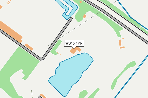
WS15 1PR is located in the Armitage with Handsacre electoral ward, within the local authority district of Lichfield and the English Parliamentary constituency of Lichfield. The Sub Integrated Care Board (ICB) Location is NHS Staffordshire and Stoke-on-Trent ICB - 04Y and the police force is Staffordshire. This postcode has been in use since January 1980.


GetTheData
Source: OS OpenMap – Local (Ordnance Survey)
Source: OS VectorMap District (Ordnance Survey)
Licence: Open Government Licence (requires attribution)
| Easting | 406263 |
| Northing | 317278 |
| Latitude | 52.753081 |
| Longitude | -1.908647 |
GetTheData
Source: Open Postcode Geo
Licence: Open Government Licence
| Country | England |
| Postcode District | WS15 |
➜ See where WS15 is on a map | |
GetTheData
Source: Land Registry Price Paid Data
Licence: Open Government Licence
Elevation or altitude of WS15 1PR as distance above sea level:
| Metres | Feet | |
|---|---|---|
| Elevation | 70m | 230ft |
Elevation is measured from the approximate centre of the postcode, to the nearest point on an OS contour line from OS Terrain 50, which has contour spacing of ten vertical metres.
➜ How high above sea level am I? Find the elevation of your current position using your device's GPS.
GetTheData
Source: Open Postcode Elevation
Licence: Open Government Licence
| Ward | Armitage With Handsacre |
| Constituency | Lichfield |
GetTheData
Source: ONS Postcode Database
Licence: Open Government Licence
| Ash Tree Ph (Armitage Rd) | Brereton | 770m |
| Ash Tree Ph (Armitage Rd) | Brereton | 784m |
| Hawkesyard Priory (Rugeley Road) | Breretonhill | 893m |
| Hawkesyard Priory (Rugeley Rd) | Breretonhill | 963m |
| Walnut Crescent (Lodge Road) | Brereton | 1,096m |
| Rugeley Town Station | 1.9km |
| Rugeley Trent Valley Station | 2.3km |
GetTheData
Source: NaPTAN
Licence: Open Government Licence
GetTheData
Source: ONS Postcode Database
Licence: Open Government Licence


➜ Get more ratings from the Food Standards Agency
GetTheData
Source: Food Standards Agency
Licence: FSA terms & conditions
| Last Collection | |||
|---|---|---|---|
| Location | Mon-Fri | Sat | Distance |
| Hill Ridware | 16:45 | 08:30 | 1,841m |
| Rugeley Post Office | 18:00 | 11:00 | 1,920m |
| Mavesyn Ridware | 16:30 | 08:30 | 1,929m |
GetTheData
Source: Dracos
Licence: Creative Commons Attribution-ShareAlike
| Risk of WS15 1PR flooding from rivers and sea | Low |
| ➜ WS15 1PR flood map | |
GetTheData
Source: Open Flood Risk by Postcode
Licence: Open Government Licence
The below table lists the International Territorial Level (ITL) codes (formerly Nomenclature of Territorial Units for Statistics (NUTS) codes) and Local Administrative Units (LAU) codes for WS15 1PR:
| ITL 1 Code | Name |
|---|---|
| TLG | West Midlands (England) |
| ITL 2 Code | Name |
| TLG2 | Shropshire and Staffordshire |
| ITL 3 Code | Name |
| TLG24 | Staffordshire CC |
| LAU 1 Code | Name |
| E07000194 | Lichfield |
GetTheData
Source: ONS Postcode Directory
Licence: Open Government Licence
The below table lists the Census Output Area (OA), Lower Layer Super Output Area (LSOA), and Middle Layer Super Output Area (MSOA) for WS15 1PR:
| Code | Name | |
|---|---|---|
| OA | E00150204 | |
| LSOA | E01029481 | Lichfield 001B |
| MSOA | E02006146 | Lichfield 001 |
GetTheData
Source: ONS Postcode Directory
Licence: Open Government Licence
| WS15 1SU | Langley Way | 243m |
| WS15 1SF | Bagnall Way | 339m |
| WS15 1SN | Holly Bank | 406m |
| WS15 1RH | Priest Moor Road | 457m |
| WS15 1QZ | Canon Lane | 476m |
| WS15 1SL | Crabtree Avenue | 481m |
| WS15 1FG | Brindley Road | 535m |
| WS15 1LQ | Priory Avenue | 537m |
| WS15 1FE | Ingathorpe Road | 542m |
| WS15 1SR | Salts Croft | 543m |
GetTheData
Source: Open Postcode Geo; Land Registry Price Paid Data
Licence: Open Government Licence