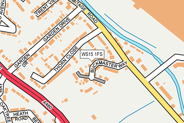
WS15 1FS is located in the Brereton and Ravenhill electoral ward, within the local authority district of Cannock Chase and the English Parliamentary constituency of Cannock Chase. The Sub Integrated Care Board (ICB) Location is NHS Staffordshire and Stoke-on-Trent ICB - 04Y and the police force is Staffordshire. This postcode has been in use since April 2017.


GetTheData
Source: OS OpenMap – Local (Ordnance Survey)
Source: OS VectorMap District (Ordnance Survey)
Licence: Open Government Licence (requires attribution)
| Easting | 405149 |
| Northing | 317008 |
| Latitude | 52.750682 |
| Longitude | -1.925150 |
GetTheData
Source: Open Postcode Geo
Licence: Open Government Licence
| Country | England |
| Postcode District | WS15 |
➜ See where WS15 is on a map ➜ Where is Rugeley? | |
GetTheData
Source: Land Registry Price Paid Data
Licence: Open Government Licence
| Ward | Brereton And Ravenhill |
| Constituency | Cannock Chase |
GetTheData
Source: ONS Postcode Database
Licence: Open Government Licence
2024 26 JUL £270,000 |
2021 1 OCT £307,500 |
2021 20 AUG £320,000 |
2021 26 FEB £302,000 |
2021 29 JAN £285,000 |
2020 8 SEP £268,000 |
2019 15 FEB £265,000 |
2018 14 DEC £289,995 |
2018 21 NOV £279,995 |
50, BUCKMASTER WAY, RUGELEY, WS15 1FS 2018 26 OCT £269,995 |
GetTheData
Source: HM Land Registry Price Paid Data
Licence: Contains HM Land Registry data © Crown copyright and database right 2025. This data is licensed under the Open Government Licence v3.0.
| Thorn Industrial Estate (Main Rd) | Brereton | 119m |
| Thorn Industrial Estate (Main Rd) | Brereton | 146m |
| Playground (Main Road) | Brereton | 192m |
| Playground (Main Road) | Brereton | 197m |
| Yew Tree Road (Coulthwaite Way) | Brereton | 319m |
| Rugeley Town Station | 0.9km |
| Rugeley Trent Valley Station | 2.1km |
GetTheData
Source: NaPTAN
Licence: Open Government Licence
| Percentage of properties with Next Generation Access | 100.0% |
| Percentage of properties with Superfast Broadband | 100.0% |
| Percentage of properties with Ultrafast Broadband | 100.0% |
| Percentage of properties with Full Fibre Broadband | 0.0% |
Superfast Broadband is between 30Mbps and 300Mbps
Ultrafast Broadband is > 300Mbps
| Median download speed | 100.0Mbps |
| Average download speed | 92.1Mbps |
| Maximum download speed | 200.00Mbps |
| Median upload speed | 1.0Mbps |
| Average upload speed | 3.6Mbps |
| Maximum upload speed | 14.44Mbps |
| Percentage of properties unable to receive 2Mbps | 0.0% |
| Percentage of properties unable to receive 5Mbps | 0.0% |
| Percentage of properties unable to receive 10Mbps | 0.0% |
| Percentage of properties unable to receive 30Mbps | 0.0% |
GetTheData
Source: Ofcom
Licence: Ofcom Terms of Use (requires attribution)
GetTheData
Source: ONS Postcode Database
Licence: Open Government Licence


➜ Get more ratings from the Food Standards Agency
GetTheData
Source: Food Standards Agency
Licence: FSA terms & conditions
| Last Collection | |||
|---|---|---|---|
| Location | Mon-Fri | Sat | Distance |
| Rugeley Post Office | 18:00 | 11:00 | 1,145m |
| Armitage Road | 17:30 | 07:30 | 1,341m |
| Hill Ridware | 16:45 | 08:30 | 2,982m |
GetTheData
Source: Dracos
Licence: Creative Commons Attribution-ShareAlike
The below table lists the International Territorial Level (ITL) codes (formerly Nomenclature of Territorial Units for Statistics (NUTS) codes) and Local Administrative Units (LAU) codes for WS15 1FS:
| ITL 1 Code | Name |
|---|---|
| TLG | West Midlands (England) |
| ITL 2 Code | Name |
| TLG2 | Shropshire and Staffordshire |
| ITL 3 Code | Name |
| TLG24 | Staffordshire CC |
| LAU 1 Code | Name |
| E07000192 | Cannock Chase |
GetTheData
Source: ONS Postcode Directory
Licence: Open Government Licence
The below table lists the Census Output Area (OA), Lower Layer Super Output Area (LSOA), and Middle Layer Super Output Area (MSOA) for WS15 1FS:
| Code | Name | |
|---|---|---|
| OA | E00149541 | |
| LSOA | E01029345 | Cannock Chase 003A |
| MSOA | E02006120 | Cannock Chase 003 |
GetTheData
Source: ONS Postcode Directory
Licence: Open Government Licence
| WS15 1TA | Thorn Close | 81m |
| WS15 1DT | Main Road | 161m |
| WS15 1BY | Armitage Road | 166m |
| WS15 1AQ | Beeches Road | 179m |
| WS15 1BX | Garden Drive | 183m |
| WS15 1DF | Armitage Road | 185m |
| WS15 1DH | Woodbury Walk | 213m |
| WS15 1PH | Armitage Road | 219m |
| WS15 1AH | Heath Road | 227m |
| WS15 1SQ | Coulthwaite Way | 244m |
GetTheData
Source: Open Postcode Geo; Land Registry Price Paid Data
Licence: Open Government Licence