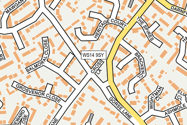
WS14 9SY lies on Cross Lane in Lichfield. WS14 9SY is located in the Boley Park electoral ward, within the local authority district of Lichfield and the English Parliamentary constituency of Lichfield. The Sub Integrated Care Board (ICB) Location is NHS Staffordshire and Stoke-on-Trent ICB - 05Q and the police force is Staffordshire. This postcode has been in use since July 1990.


GetTheData
Source: OS OpenMap – Local (Ordnance Survey)
Source: OS VectorMap District (Ordnance Survey)
Licence: Open Government Licence (requires attribution)
| Easting | 412966 |
| Northing | 308778 |
| Latitude | 52.676552 |
| Longitude | -1.809668 |
GetTheData
Source: Open Postcode Geo
Licence: Open Government Licence
| Street | Cross Lane |
| Town/City | Lichfield |
| Country | England |
| Postcode District | WS14 |
➜ See where WS14 is on a map ➜ Where is Lichfield? | |
GetTheData
Source: Land Registry Price Paid Data
Licence: Open Government Licence
Elevation or altitude of WS14 9SY as distance above sea level:
| Metres | Feet | |
|---|---|---|
| Elevation | 100m | 328ft |
Elevation is measured from the approximate centre of the postcode, to the nearest point on an OS contour line from OS Terrain 50, which has contour spacing of ten vertical metres.
➜ How high above sea level am I? Find the elevation of your current position using your device's GPS.
GetTheData
Source: Open Postcode Elevation
Licence: Open Government Licence
| Ward | Boley Park |
| Constituency | Lichfield |
GetTheData
Source: ONS Postcode Database
Licence: Open Government Licence
3, CROSS LANE, LICHFIELD, WS14 9SY 2004 10 AUG £338,500 |
3, CROSS LANE, LICHFIELD, WS14 9SY 2002 30 MAY £225,000 |
GetTheData
Source: HM Land Registry Price Paid Data
Licence: Contains HM Land Registry data © Crown copyright and database right 2025. This data is licensed under the Open Government Licence v3.0.
| Ashmole Close (Ryknild St) | Borrowcop Hill | 185m |
| The Spires (Ryknild Street) | Boley Park | 201m |
| Wheel Cottage (Tamworth Rd) | Borrowcop Hill | 439m |
| Wheel Cottage (Tamworth Rd) | Borrowcop Hill | 448m |
| Ryknild Street (Tamworth Rd) | Darnford | 476m |
| Lichfield City Station | 1.1km |
| Lichfield Trent Valley High Level Station | 1.3km |
| Lichfield Trent Valley Station | 1.3km |
GetTheData
Source: NaPTAN
Licence: Open Government Licence
| Percentage of properties with Next Generation Access | 100.0% |
| Percentage of properties with Superfast Broadband | 100.0% |
| Percentage of properties with Ultrafast Broadband | 66.7% |
| Percentage of properties with Full Fibre Broadband | 0.0% |
Superfast Broadband is between 30Mbps and 300Mbps
Ultrafast Broadband is > 300Mbps
| Percentage of properties unable to receive 2Mbps | 0.0% |
| Percentage of properties unable to receive 5Mbps | 0.0% |
| Percentage of properties unable to receive 10Mbps | 0.0% |
| Percentage of properties unable to receive 30Mbps | 0.0% |
GetTheData
Source: Ofcom
Licence: Ofcom Terms of Use (requires attribution)
GetTheData
Source: ONS Postcode Database
Licence: Open Government Licence

➜ Get more ratings from the Food Standards Agency
GetTheData
Source: Food Standards Agency
Licence: FSA terms & conditions
| Last Collection | |||
|---|---|---|---|
| Location | Mon-Fri | Sat | Distance |
| Tamworth Road | 18:00 | 11:00 | 507m |
| Boley Park | 18:00 | 11:00 | 524m |
| Henderson Close | 18:00 | 11:00 | 542m |
GetTheData
Source: Dracos
Licence: Creative Commons Attribution-ShareAlike
The below table lists the International Territorial Level (ITL) codes (formerly Nomenclature of Territorial Units for Statistics (NUTS) codes) and Local Administrative Units (LAU) codes for WS14 9SY:
| ITL 1 Code | Name |
|---|---|
| TLG | West Midlands (England) |
| ITL 2 Code | Name |
| TLG2 | Shropshire and Staffordshire |
| ITL 3 Code | Name |
| TLG24 | Staffordshire CC |
| LAU 1 Code | Name |
| E07000194 | Lichfield |
GetTheData
Source: ONS Postcode Directory
Licence: Open Government Licence
The below table lists the Census Output Area (OA), Lower Layer Super Output Area (LSOA), and Middle Layer Super Output Area (MSOA) for WS14 9SY:
| Code | Name | |
|---|---|---|
| OA | E00150227 | |
| LSOA | E01029483 | Lichfield 005A |
| MSOA | E02006150 | Lichfield 005 |
GetTheData
Source: ONS Postcode Directory
Licence: Open Government Licence
| WS14 9RU | Bracken Close | 129m |
| WS14 9ST | Heritage Court | 135m |
| WS14 9SP | Balmoral Close | 142m |
| WS14 9HL | Quarry Hills Lane | 173m |
| WS14 9HQ | Gorse Lane | 184m |
| WS14 9RP | The Spires | 214m |
| WS14 9SN | Tregony Rise | 219m |
| WS14 9SR | Grosvenor Close | 219m |
| WS14 9HP | Hunter Close | 239m |
| WS14 9RR | Wightman Close | 244m |
GetTheData
Source: Open Postcode Geo; Land Registry Price Paid Data
Licence: Open Government Licence