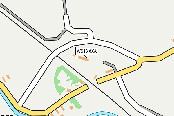
WS13 8XA is located in the Whittington & Streethay electoral ward, within the local authority district of Lichfield and the English Parliamentary constituency of Lichfield. The Sub Integrated Care Board (ICB) Location is NHS Staffordshire and Stoke-on-Trent ICB - 05Q and the police force is Staffordshire. This postcode has been in use since December 1997.


GetTheData
Source: OS OpenMap – Local (Ordnance Survey)
Source: OS VectorMap District (Ordnance Survey)
Licence: Open Government Licence (requires attribution)
| Easting | 417472 |
| Northing | 308228 |
| Latitude | 52.671482 |
| Longitude | -1.743053 |
GetTheData
Source: Open Postcode Geo
Licence: Open Government Licence
| Country | England |
| Postcode District | WS13 |
➜ See where WS13 is on a map ➜ Where is Hademore? | |
GetTheData
Source: Land Registry Price Paid Data
Licence: Open Government Licence
Elevation or altitude of WS13 8XA as distance above sea level:
| Metres | Feet | |
|---|---|---|
| Elevation | 70m | 230ft |
Elevation is measured from the approximate centre of the postcode, to the nearest point on an OS contour line from OS Terrain 50, which has contour spacing of ten vertical metres.
➜ How high above sea level am I? Find the elevation of your current position using your device's GPS.
GetTheData
Source: Open Postcode Elevation
Licence: Open Government Licence
| Ward | Whittington & Streethay |
| Constituency | Lichfield |
GetTheData
Source: ONS Postcode Database
Licence: Open Government Licence
| Back Lane (Main Street) | Whittington | 1,246m |
| Langton Crescent (Main Street) | Whittington | 1,289m |
| Langton Crescent (Main Street) | Whittington | 1,294m |
| The Dog Inn (Main Street) | Whittington | 1,379m |
| Blacksmith Lane (Back Lane) | Whittington | 1,382m |
| Lichfield Trent Valley Station | 4.2km |
| Lichfield Trent Valley High Level Station | 4.2km |
| Tamworth Station | 5.4km |
GetTheData
Source: NaPTAN
Licence: Open Government Licence
GetTheData
Source: ONS Postcode Database
Licence: Open Government Licence


➜ Get more ratings from the Food Standards Agency
GetTheData
Source: Food Standards Agency
Licence: FSA terms & conditions
| Last Collection | |||
|---|---|---|---|
| Location | Mon-Fri | Sat | Distance |
| Hademore | 17:00 | 07:30 | 184m |
| Whittington | 17:00 | 10:45 | 1,344m |
| Babbington Close | 17:00 | 07:00 | 1,371m |
GetTheData
Source: Dracos
Licence: Creative Commons Attribution-ShareAlike
The below table lists the International Territorial Level (ITL) codes (formerly Nomenclature of Territorial Units for Statistics (NUTS) codes) and Local Administrative Units (LAU) codes for WS13 8XA:
| ITL 1 Code | Name |
|---|---|
| TLG | West Midlands (England) |
| ITL 2 Code | Name |
| TLG2 | Shropshire and Staffordshire |
| ITL 3 Code | Name |
| TLG24 | Staffordshire CC |
| LAU 1 Code | Name |
| E07000194 | Lichfield |
GetTheData
Source: ONS Postcode Directory
Licence: Open Government Licence
The below table lists the Census Output Area (OA), Lower Layer Super Output Area (LSOA), and Middle Layer Super Output Area (MSOA) for WS13 8XA:
| Code | Name | |
|---|---|---|
| OA | E00150468 | |
| LSOA | E01029531 | Lichfield 008D |
| MSOA | E02006153 | Lichfield 008 |
GetTheData
Source: ONS Postcode Directory
Licence: Open Government Licence
| WS13 8PR | Fisherwick Road | 82m |
| WS14 9JN | Fisherwick Road | 397m |
| WS13 8PS | Fisherwick Road | 755m |
| WS14 9LJ | Fisherwick Road | 879m |
| WS14 9WA | Peregrine Close | 930m |
| WS14 9HT | Osprey Close | 932m |
| WS14 9PE | Kestrel Close | 947m |
| WS14 9LQ | Vicarage Lane | 968m |
| WS14 9NA | Spring Lane | 970m |
| WS14 9PF | Falcon Drive | 996m |
GetTheData
Source: Open Postcode Geo; Land Registry Price Paid Data
Licence: Open Government Licence