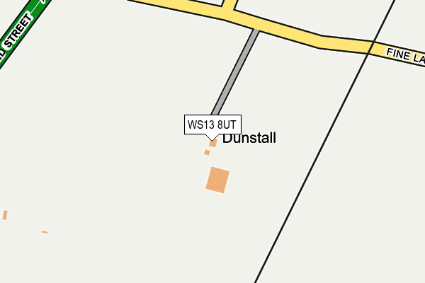
WS13 8UT is located in the Alrewas & Fradley electoral ward, within the local authority district of Lichfield and the English Parliamentary constituency of Lichfield. The Sub Integrated Care Board (ICB) Location is NHS Staffordshire and Stoke-on-Trent ICB - 05D and the police force is Staffordshire. This postcode has been in use since July 2017.


GetTheData
Source: OS OpenMap – Local (Ordnance Survey)
Source: OS VectorMap District (Ordnance Survey)
Licence: Open Government Licence (requires attribution)
| Easting | 416329 |
| Northing | 312681 |
| Latitude | 52.711565 |
| Longitude | -1.759730 |
GetTheData
Source: Open Postcode Geo
Licence: Open Government Licence
| Country | England |
| Postcode District | WS13 |
➜ See where WS13 is on a map | |
GetTheData
Source: Land Registry Price Paid Data
Licence: Open Government Licence
| Ward | Alrewas & Fradley |
| Constituency | Lichfield |
GetTheData
Source: ONS Postcode Database
Licence: Open Government Licence
| Bell Bridge (Ryknild Street) | Fradley | 358m |
| Alexander Close (Worthington Road) | Fradley | 593m |
| Jordan Close (Worthington Road) | Fradley | 616m |
| Rumbold Avenue (Worthington Road) | Fradley | 723m |
| Statfold Lane (Church Lane) | Fradley | 905m |
| Lichfield Trent Valley Station | 3.9km |
| Lichfield Trent Valley High Level Station | 3.9km |
| Lichfield City Station | 5.6km |
GetTheData
Source: NaPTAN
Licence: Open Government Licence
| Percentage of properties with Next Generation Access | 100.0% |
| Percentage of properties with Superfast Broadband | 0.0% |
| Percentage of properties with Ultrafast Broadband | 0.0% |
| Percentage of properties with Full Fibre Broadband | 0.0% |
Superfast Broadband is between 30Mbps and 300Mbps
Ultrafast Broadband is > 300Mbps
| Percentage of properties unable to receive 2Mbps | 0.0% |
| Percentage of properties unable to receive 5Mbps | 0.0% |
| Percentage of properties unable to receive 10Mbps | 0.0% |
| Percentage of properties unable to receive 30Mbps | 100.0% |
GetTheData
Source: Ofcom
Licence: Ofcom Terms of Use (requires attribution)
GetTheData
Source: ONS Postcode Database
Licence: Open Government Licence


➜ Get more ratings from the Food Standards Agency
GetTheData
Source: Food Standards Agency
Licence: FSA terms & conditions
| Last Collection | |||
|---|---|---|---|
| Location | Mon-Fri | Sat | Distance |
| Harvey Road | 16:15 | 10:15 | 694m |
| Wellington Crescent | 17:00 | 10:30 | 1,603m |
| Alrewas | 16:00 | 08:00 | 2,232m |
GetTheData
Source: Dracos
Licence: Creative Commons Attribution-ShareAlike
The below table lists the International Territorial Level (ITL) codes (formerly Nomenclature of Territorial Units for Statistics (NUTS) codes) and Local Administrative Units (LAU) codes for WS13 8UT:
| ITL 1 Code | Name |
|---|---|
| TLG | West Midlands (England) |
| ITL 2 Code | Name |
| TLG2 | Shropshire and Staffordshire |
| ITL 3 Code | Name |
| TLG24 | Staffordshire CC |
| LAU 1 Code | Name |
| E07000194 | Lichfield |
GetTheData
Source: ONS Postcode Directory
Licence: Open Government Licence
The below table lists the Census Output Area (OA), Lower Layer Super Output Area (LSOA), and Middle Layer Super Output Area (MSOA) for WS13 8UT:
| Code | Name | |
|---|---|---|
| OA | E00168392 | |
| LSOA | E01029479 | Lichfield 002C |
| MSOA | E02006147 | Lichfield 002 |
GetTheData
Source: ONS Postcode Directory
Licence: Open Government Licence
| WS13 8RL | Brookhay Lane | 393m |
| WS13 8RE | Rykneld Street | 462m |
| WS13 8SG | Pettiford Close | 473m |
| WS13 8PJ | Rykneld Street | 478m |
| WS13 8PF | Jackman Road | 500m |
| WS13 8PW | Jackman Close | 508m |
| WS13 8SH | Alexander Close | 546m |
| WS13 8SQ | Milne Avenue | 564m |
| WS13 8PQ | Jordan Close | 568m |
| WS13 8RD | Rykneld Street | 637m |
GetTheData
Source: Open Postcode Geo; Land Registry Price Paid Data
Licence: Open Government Licence