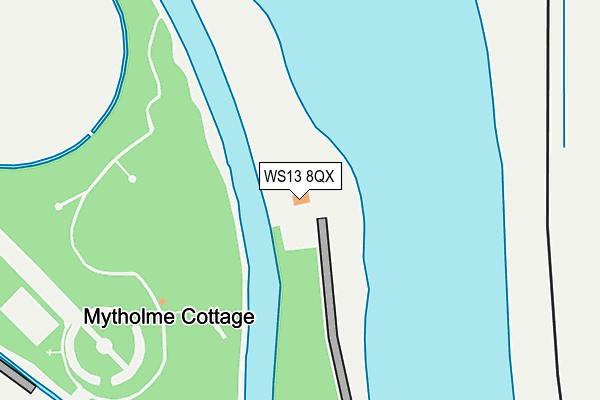
WS13 8QX is located in the Mease Valley electoral ward, within the local authority district of Lichfield and the English Parliamentary constituency of Tamworth. The Sub Integrated Care Board (ICB) Location is NHS Staffordshire and Stoke-on-Trent ICB - 05Q and the police force is Staffordshire. This postcode has been in use since January 1980.


GetTheData
Source: OS OpenMap – Local (Ordnance Survey)
Source: OS VectorMap District (Ordnance Survey)
Licence: Open Government Licence (requires attribution)
| Easting | 418789 |
| Northing | 314277 |
| Latitude | 52.725816 |
| Longitude | -1.723234 |
GetTheData
Source: Open Postcode Geo
Licence: Open Government Licence
| Country | England |
| Postcode District | WS13 |
➜ See where WS13 is on a map | |
GetTheData
Source: Land Registry Price Paid Data
Licence: Open Government Licence
Elevation or altitude of WS13 8QX as distance above sea level:
| Metres | Feet | |
|---|---|---|
| Elevation | 50m | 164ft |
Elevation is measured from the approximate centre of the postcode, to the nearest point on an OS contour line from OS Terrain 50, which has contour spacing of ten vertical metres.
➜ How high above sea level am I? Find the elevation of your current position using your device's GPS.
GetTheData
Source: Open Postcode Elevation
Licence: Open Government Licence
| Ward | Mease Valley |
| Constituency | Tamworth |
GetTheData
Source: ONS Postcode Database
Licence: Open Government Licence
| The National Memorial Arboretum (Croxall Road) | Alrewas | 604m |
| Rykneld Street (A513) | Alrewas | 1,213m |
| Rykneld Street (A513) | Alrewas | 1,216m |
| Main Street (Ryknild Street) | Alrewas | 1,336m |
| Burton Road (Main St) | Alrewas | 1,404m |
GetTheData
Source: NaPTAN
Licence: Open Government Licence
GetTheData
Source: ONS Postcode Database
Licence: Open Government Licence


➜ Get more ratings from the Food Standards Agency
GetTheData
Source: Food Standards Agency
Licence: FSA terms & conditions
| Last Collection | |||
|---|---|---|---|
| Location | Mon-Fri | Sat | Distance |
| National Arboretum | 17:00 | 625m | |
| Alrewas | 16:00 | 08:00 | 1,343m |
| Park Road | 16:00 | 09:00 | 1,705m |
GetTheData
Source: Dracos
Licence: Creative Commons Attribution-ShareAlike
| Risk of WS13 8QX flooding from rivers and sea | Medium |
| ➜ WS13 8QX flood map | |
GetTheData
Source: Open Flood Risk by Postcode
Licence: Open Government Licence
The below table lists the International Territorial Level (ITL) codes (formerly Nomenclature of Territorial Units for Statistics (NUTS) codes) and Local Administrative Units (LAU) codes for WS13 8QX:
| ITL 1 Code | Name |
|---|---|
| TLG | West Midlands (England) |
| ITL 2 Code | Name |
| TLG2 | Shropshire and Staffordshire |
| ITL 3 Code | Name |
| TLG24 | Staffordshire CC |
| LAU 1 Code | Name |
| E07000194 | Lichfield |
GetTheData
Source: ONS Postcode Directory
Licence: Open Government Licence
The below table lists the Census Output Area (OA), Lower Layer Super Output Area (LSOA), and Middle Layer Super Output Area (MSOA) for WS13 8QX:
| Code | Name | |
|---|---|---|
| OA | E00150396 | |
| LSOA | E01029516 | Lichfield 008A |
| MSOA | E02006153 | Lichfield 008 |
GetTheData
Source: ONS Postcode Directory
Licence: Open Government Licence
| WS13 8QU | 788m | |
| WS13 8QZ | 1088m | |
| DE13 7BD | Croxall Road | 1228m |
| DE13 7BA | Burton Road | 1292m |
| DE13 7BB | Burton Road | 1335m |
| DE13 7AW | Salters Green Way | 1358m |
| DE13 7AX | Rykneld Street | 1379m |
| DE13 7AU | Micklehome Drive | 1416m |
| DE13 7AY | Deepmore Close | 1435m |
| DE13 7EB | Burway Meadow | 1456m |
GetTheData
Source: Open Postcode Geo; Land Registry Price Paid Data
Licence: Open Government Licence