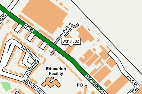
WS13 6UZ is located in the Stowe electoral ward, within the local authority district of Lichfield and the English Parliamentary constituency of Lichfield. The Sub Integrated Care Board (ICB) Location is NHS Staffordshire and Stoke-on-Trent ICB - 05Q and the police force is Staffordshire. This postcode has been in use since March 2009.


GetTheData
Source: OS OpenMap – Local (Ordnance Survey)
Source: OS VectorMap District (Ordnance Survey)
Licence: Open Government Licence (requires attribution)
| Easting | 412943 |
| Northing | 310394 |
| Latitude | 52.691080 |
| Longitude | -1.809945 |
GetTheData
Source: Open Postcode Geo
Licence: Open Government Licence
| Country | England |
| Postcode District | WS13 |
➜ See where WS13 is on a map ➜ Where is Lichfield? | |
GetTheData
Source: Land Registry Price Paid Data
Licence: Open Government Licence
Elevation or altitude of WS13 6UZ as distance above sea level:
| Metres | Feet | |
|---|---|---|
| Elevation | 90m | 295ft |
Elevation is measured from the approximate centre of the postcode, to the nearest point on an OS contour line from OS Terrain 50, which has contour spacing of ten vertical metres.
➜ How high above sea level am I? Find the elevation of your current position using your device's GPS.
GetTheData
Source: Open Postcode Elevation
Licence: Open Government Licence
| Ward | Stowe |
| Constituency | Lichfield |
GetTheData
Source: ONS Postcode Database
Licence: Open Government Licence
| Hermes Road (Eastern Avenue) | Trent Valley | 87m |
| Hermes Road (Eastern Avenue) | Trent Valley | 98m |
| Vulcan Road (Eastern Avenue) | Trent Valley | 259m |
| Vulcan Road (Eastern Avenue) | Trent Valley | 322m |
| Brownsfield Road (Eastern Avenue) | Netherstowe | 352m |
| Lichfield Trent Valley High Level Station | 0.8km |
| Lichfield Trent Valley Station | 0.8km |
| Lichfield City Station | 1.6km |
GetTheData
Source: NaPTAN
Licence: Open Government Licence
GetTheData
Source: ONS Postcode Database
Licence: Open Government Licence


➜ Get more ratings from the Food Standards Agency
GetTheData
Source: Food Standards Agency
Licence: FSA terms & conditions
| Last Collection | |||
|---|---|---|---|
| Location | Mon-Fri | Sat | Distance |
| Trent Valley Post Office Box | 18:15 | 11:00 | 181m |
| Scotch Orchard | 17:45 | 11:00 | 408m |
| Autumn Drive | 18:00 | 11:00 | 535m |
GetTheData
Source: Dracos
Licence: Creative Commons Attribution-ShareAlike
The below table lists the International Territorial Level (ITL) codes (formerly Nomenclature of Territorial Units for Statistics (NUTS) codes) and Local Administrative Units (LAU) codes for WS13 6UZ:
| ITL 1 Code | Name |
|---|---|
| TLG | West Midlands (England) |
| ITL 2 Code | Name |
| TLG2 | Shropshire and Staffordshire |
| ITL 3 Code | Name |
| TLG24 | Staffordshire CC |
| LAU 1 Code | Name |
| E07000194 | Lichfield |
GetTheData
Source: ONS Postcode Directory
Licence: Open Government Licence
The below table lists the Census Output Area (OA), Lower Layer Super Output Area (LSOA), and Middle Layer Super Output Area (MSOA) for WS13 6UZ:
| Code | Name | |
|---|---|---|
| OA | E00150445 | |
| LSOA | E01029525 | Lichfield 005G |
| MSOA | E02006150 | Lichfield 005 |
GetTheData
Source: ONS Postcode Directory
Licence: Open Government Licence
| WS13 6RL | Eastern Avenue | 92m |
| WS13 6RN | Eastern Avenue | 141m |
| WS13 6DB | Furnivall Crescent | 195m |
| WS13 6TD | Hobs Road | 217m |
| WS13 6DD | Furnivall Crescent | 221m |
| WS13 6DE | Scotch Orchard | 246m |
| WS13 6TB | Hobs Road | 277m |
| WS13 6TF | Manley Road | 280m |
| WS13 6BZ | Scotch Orchard | 312m |
| WS13 6DG | Mallicot Close | 316m |
GetTheData
Source: Open Postcode Geo; Land Registry Price Paid Data
Licence: Open Government Licence