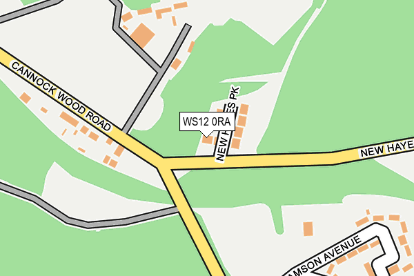
WS12 0RA is located in the Rawnsley electoral ward, within the local authority district of Cannock Chase and the English Parliamentary constituency of Cannock Chase. The Sub Integrated Care Board (ICB) Location is NHS Staffordshire and Stoke-on-Trent ICB - 04Y and the police force is Staffordshire. This postcode has been in use since August 2015.


GetTheData
Source: OS OpenMap – Local (Ordnance Survey)
Source: OS VectorMap District (Ordnance Survey)
Licence: Open Government Licence (requires attribution)
| Easting | 403146 |
| Northing | 311971 |
| Latitude | 52.705416 |
| Longitude | -1.954872 |
GetTheData
Source: Open Postcode Geo
Licence: Open Government Licence
| Country | England |
| Postcode District | WS12 |
➜ See where WS12 is on a map | |
GetTheData
Source: Land Registry Price Paid Data
Licence: Open Government Licence
Elevation or altitude of WS12 0RA as distance above sea level:
| Metres | Feet | |
|---|---|---|
| Elevation | 200m | 656ft |
Elevation is measured from the approximate centre of the postcode, to the nearest point on an OS contour line from OS Terrain 50, which has contour spacing of ten vertical metres.
➜ How high above sea level am I? Find the elevation of your current position using your device's GPS.
GetTheData
Source: Open Postcode Elevation
Licence: Open Government Licence
| Ward | Rawnsley |
| Constituency | Cannock Chase |
GetTheData
Source: ONS Postcode Database
Licence: Open Government Licence
| Williamson Avenue (Sevens Road) | Prospect Village | 247m |
| Ironstone Road (Sevens Road) | Prospect Village | 473m |
| Longstaff Avenue (Ironstone Road) | Prospect Village | 494m |
| Longstaff Avenue (Ironstone Road) | Prospect Village | 507m |
| New Hayes Road (Ironstone Road) | Prospect Village | 539m |
| Hednesford Station | 3.2km |
| Cannock Station | 5km |
GetTheData
Source: NaPTAN
Licence: Open Government Licence
GetTheData
Source: ONS Postcode Database
Licence: Open Government Licence


➜ Get more ratings from the Food Standards Agency
GetTheData
Source: Food Standards Agency
Licence: FSA terms & conditions
| Last Collection | |||
|---|---|---|---|
| Location | Mon-Fri | Sat | Distance |
| Cannock Wood Street | 17:30 | 11:00 | 826m |
| Wimblebury Road | 17:00 | 10:45 | 1,601m |
| Gentleshaw Old Post Office | 16:30 | 10:15 | 1,701m |
GetTheData
Source: Dracos
Licence: Creative Commons Attribution-ShareAlike
The below table lists the International Territorial Level (ITL) codes (formerly Nomenclature of Territorial Units for Statistics (NUTS) codes) and Local Administrative Units (LAU) codes for WS12 0RA:
| ITL 1 Code | Name |
|---|---|
| TLG | West Midlands (England) |
| ITL 2 Code | Name |
| TLG2 | Shropshire and Staffordshire |
| ITL 3 Code | Name |
| TLG24 | Staffordshire CC |
| LAU 1 Code | Name |
| E07000192 | Cannock Chase |
GetTheData
Source: ONS Postcode Directory
Licence: Open Government Licence
The below table lists the Census Output Area (OA), Lower Layer Super Output Area (LSOA), and Middle Layer Super Output Area (MSOA) for WS12 0RA:
| Code | Name | |
|---|---|---|
| OA | E00149791 | |
| LSOA | E01029398 | Cannock Chase 006B |
| MSOA | E02006123 | Cannock Chase 006 |
GetTheData
Source: ONS Postcode Directory
Licence: Open Government Licence
| WS12 0QJ | New Hayes Park | 24m |
| WS12 0PZ | Cannock Wood Road | 168m |
| WS12 0QF | Williamson Avenue | 262m |
| WS12 0QG | Summerside Avenue | 321m |
| WS12 0RG | Pagets Chase | 337m |
| WS12 0QE | Longstaff Avenue | 351m |
| WS12 0PF | Danby Drive | 395m |
| WS12 0QA | Sevens Road | 411m |
| WS12 0PX | Briars Way | 439m |
| WS12 0QB | Ironstone Road | 465m |
GetTheData
Source: Open Postcode Geo; Land Registry Price Paid Data
Licence: Open Government Licence