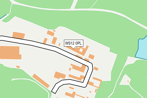
WS12 0PL lies on Cannock Wood Industrial Estate in Cannock. WS12 0PL is located in the Rawnsley electoral ward, within the local authority district of Cannock Chase and the English Parliamentary constituency of Cannock Chase. The Sub Integrated Care Board (ICB) Location is NHS Staffordshire and Stoke-on-Trent ICB - 04Y and the police force is Staffordshire. This postcode has been in use since March 2003.


GetTheData
Source: OS OpenMap – Local (Ordnance Survey)
Source: OS VectorMap District (Ordnance Survey)
Licence: Open Government Licence (requires attribution)
| Easting | 403336 |
| Northing | 312712 |
| Latitude | 52.712077 |
| Longitude | -1.952052 |
GetTheData
Source: Open Postcode Geo
Licence: Open Government Licence
| Street | Cannock Wood Industrial Estate |
| Town/City | Cannock |
| Country | England |
| Postcode District | WS12 |
➜ See where WS12 is on a map ➜ Where is Hazelslade? | |
GetTheData
Source: Land Registry Price Paid Data
Licence: Open Government Licence
Elevation or altitude of WS12 0PL as distance above sea level:
| Metres | Feet | |
|---|---|---|
| Elevation | 210m | 689ft |
Elevation is measured from the approximate centre of the postcode, to the nearest point on an OS contour line from OS Terrain 50, which has contour spacing of ten vertical metres.
➜ How high above sea level am I? Find the elevation of your current position using your device's GPS.
GetTheData
Source: Open Postcode Elevation
Licence: Open Government Licence
| Ward | Rawnsley |
| Constituency | Cannock Chase |
GetTheData
Source: ONS Postcode Database
Licence: Open Government Licence
| New Hayes Road (Ironstone Road) | Prospect Village | 775m |
| New Hayes Road (Ironstone Road) | Prospect Village | 815m |
| Littleworth Road (Cannock Wood St) | Rawnsley | 824m |
| Valley Road (Cannock Wood Street) | Hazelslade | 901m |
| Valley Road (Cannock Wood Street) | Hazelslade | 934m |
| Hednesford Station | 3.4km |
| Rugeley Town Station | 4.8km |
| Cannock Station | 5.5km |
GetTheData
Source: NaPTAN
Licence: Open Government Licence
GetTheData
Source: ONS Postcode Database
Licence: Open Government Licence


➜ Get more ratings from the Food Standards Agency
GetTheData
Source: Food Standards Agency
Licence: FSA terms & conditions
| Last Collection | |||
|---|---|---|---|
| Location | Mon-Fri | Sat | Distance |
| Cannock Wood Street | 17:30 | 11:00 | 843m |
| Gentleshaw Old Post Office | 16:30 | 10:15 | 1,285m |
| Wimblebury Road | 17:00 | 10:45 | 1,992m |
GetTheData
Source: Dracos
Licence: Creative Commons Attribution-ShareAlike
The below table lists the International Territorial Level (ITL) codes (formerly Nomenclature of Territorial Units for Statistics (NUTS) codes) and Local Administrative Units (LAU) codes for WS12 0PL:
| ITL 1 Code | Name |
|---|---|
| TLG | West Midlands (England) |
| ITL 2 Code | Name |
| TLG2 | Shropshire and Staffordshire |
| ITL 3 Code | Name |
| TLG24 | Staffordshire CC |
| LAU 1 Code | Name |
| E07000192 | Cannock Chase |
GetTheData
Source: ONS Postcode Directory
Licence: Open Government Licence
The below table lists the Census Output Area (OA), Lower Layer Super Output Area (LSOA), and Middle Layer Super Output Area (MSOA) for WS12 0PL:
| Code | Name | |
|---|---|---|
| OA | E00149791 | |
| LSOA | E01029398 | Cannock Chase 006B |
| MSOA | E02006123 | Cannock Chase 006 |
GetTheData
Source: ONS Postcode Directory
Licence: Open Government Licence
| WS12 0QJ | New Hayes Park | 742m |
| WS15 4SD | Holly Hill Road | 760m |
| WS12 0PZ | Cannock Wood Road | 816m |
| WS12 0PW | Cannock Wood Street | 852m |
| WS15 4SE | Chapel Lane | 886m |
| WS12 0PU | Old Park Road | 895m |
| WS12 0QG | Summerside Avenue | 897m |
| WS15 4SB | Cumberledge Hill | 905m |
| WS12 0QF | Williamson Avenue | 920m |
| WS12 0NZ | Chetwynd Park | 945m |
GetTheData
Source: Open Postcode Geo; Land Registry Price Paid Data
Licence: Open Government Licence