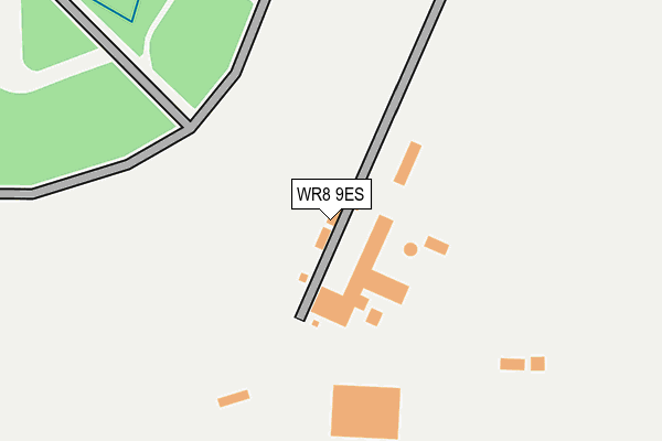
WR8 9ES is located in the Eckington electoral ward, within the local authority district of Wychavon and the English Parliamentary constituency of West Worcestershire. The Sub Integrated Care Board (ICB) Location is NHS Herefordshire and Worcestershire ICB - 18C and the police force is West Mercia. This postcode has been in use since January 2008.


GetTheData
Source: OS OpenMap – Local (Ordnance Survey)
Source: OS VectorMap District (Ordnance Survey)
Licence: Open Government Licence (requires attribution)
| Easting | 389942 |
| Northing | 244172 |
| Latitude | 52.095796 |
| Longitude | -2.148233 |
GetTheData
Source: Open Postcode Geo
Licence: Open Government Licence
| Country | England |
| Postcode District | WR8 |
➜ See where WR8 is on a map | |
GetTheData
Source: Land Registry Price Paid Data
Licence: Open Government Licence
Elevation or altitude of WR8 9ES as distance above sea level:
| Metres | Feet | |
|---|---|---|
| Elevation | 20m | 66ft |
Elevation is measured from the approximate centre of the postcode, to the nearest point on an OS contour line from OS Terrain 50, which has contour spacing of ten vertical metres.
➜ How high above sea level am I? Find the elevation of your current position using your device's GPS.
GetTheData
Source: Open Postcode Elevation
Licence: Open Government Licence
| Ward | Eckington |
| Constituency | West Worcestershire |
GetTheData
Source: ONS Postcode Database
Licence: Open Government Licence
| Church Farm (St Peters Lane) | Besford | 1,315m |
| Croome Park Entrance (Rebecca Road) | Croome Park | 1,427m |
| Croome Park Coach Park (Rebecca Road) | Croome Park | 1,547m |
| Besford Court (Ladywood Road) | Besford | 1,721m |
| Besford Court (Ladywood Road) | Besford | 1,739m |
GetTheData
Source: NaPTAN
Licence: Open Government Licence
GetTheData
Source: ONS Postcode Database
Licence: Open Government Licence

➜ Get more ratings from the Food Standards Agency
GetTheData
Source: Food Standards Agency
Licence: FSA terms & conditions
| Last Collection | |||
|---|---|---|---|
| Location | Mon-Fri | Sat | Distance |
| Besford | 16:45 | 07:00 | 1,738m |
| Woodmancote | 16:15 | 09:45 | 1,812m |
| Dunstall Common | 16:00 | 07:15 | 1,996m |
GetTheData
Source: Dracos
Licence: Creative Commons Attribution-ShareAlike
The below table lists the International Territorial Level (ITL) codes (formerly Nomenclature of Territorial Units for Statistics (NUTS) codes) and Local Administrative Units (LAU) codes for WR8 9ES:
| ITL 1 Code | Name |
|---|---|
| TLG | West Midlands (England) |
| ITL 2 Code | Name |
| TLG1 | Herefordshire, Worcestershire and Warwickshire |
| ITL 3 Code | Name |
| TLG12 | Worcestershire CC |
| LAU 1 Code | Name |
| E07000238 | Wychavon |
GetTheData
Source: ONS Postcode Directory
Licence: Open Government Licence
The below table lists the Census Output Area (OA), Lower Layer Super Output Area (LSOA), and Middle Layer Super Output Area (MSOA) for WR8 9ES:
| Code | Name | |
|---|---|---|
| OA | E00165111 | |
| LSOA | E01032372 | Wychavon 019C |
| MSOA | E02006766 | Wychavon 019 |
GetTheData
Source: ONS Postcode Directory
Licence: Open Government Licence
| WR8 9BY | The Granary | 1121m |
| WR8 9AT | Harewell Lane | 1272m |
| WR8 9AS | Croome Road | 1279m |
| WR8 9AP | St Peters Lane | 1289m |
| WR8 9AZ | Croome Dabitot | 1405m |
| WR8 9DW | Croome Dabitot | 1452m |
| WR8 9DF | Dunstall | 1580m |
| WR8 9BN | Woodmancote | 1614m |
| WR8 9BW | Woodmancote | 1703m |
| WR8 9AH | Lower Drive | 1743m |
GetTheData
Source: Open Postcode Geo; Land Registry Price Paid Data
Licence: Open Government Licence