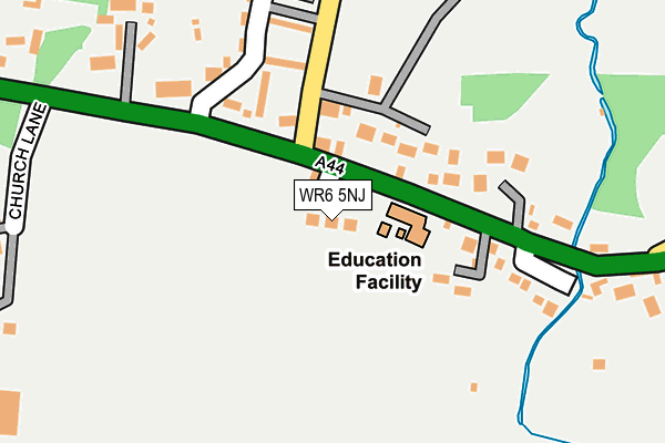
WR6 5NJ is located in the Martley electoral ward, within the local authority district of Malvern Hills and the English Parliamentary constituency of West Worcestershire. The Sub Integrated Care Board (ICB) Location is NHS Herefordshire and Worcestershire ICB - 18C and the police force is West Mercia. This postcode has been in use since April 2017.


GetTheData
Source: OS OpenMap – Local (Ordnance Survey)
Source: OS VectorMap District (Ordnance Survey)
Licence: Open Government Licence (requires attribution)
| Easting | 375874 |
| Northing | 255183 |
| Latitude | 52.194363 |
| Longitude | -2.354368 |
GetTheData
Source: Open Postcode Geo
Licence: Open Government Licence
| Country | England |
| Postcode District | WR6 |
➜ See where WR6 is on a map | |
GetTheData
Source: Land Registry Price Paid Data
Licence: Open Government Licence
| Ward | Martley |
| Constituency | West Worcestershire |
GetTheData
Source: ONS Postcode Database
Licence: Open Government Licence
| Primary School (A44) | Broadwas | 38m |
| Post Box (A44) | Broadwas | 65m |
| Post Box (A44) | Broadwas | 74m |
| Taberness Close (A44) | Broad Green | 220m |
| Shelter (Little Green) | Broad Green | 997m |
GetTheData
Source: NaPTAN
Licence: Open Government Licence
| Percentage of properties with Next Generation Access | 100.0% |
| Percentage of properties with Superfast Broadband | 100.0% |
| Percentage of properties with Ultrafast Broadband | 0.0% |
| Percentage of properties with Full Fibre Broadband | 0.0% |
Superfast Broadband is between 30Mbps and 300Mbps
Ultrafast Broadband is > 300Mbps
| Median download speed | 68.3Mbps |
| Average download speed | 62.5Mbps |
| Maximum download speed | 79.89Mbps |
| Median upload speed | 19.1Mbps |
| Average upload speed | 15.1Mbps |
| Maximum upload speed | 20.00Mbps |
| Percentage of properties unable to receive 2Mbps | 0.0% |
| Percentage of properties unable to receive 5Mbps | 0.0% |
| Percentage of properties unable to receive 10Mbps | 0.0% |
| Percentage of properties unable to receive 30Mbps | 0.0% |
GetTheData
Source: Ofcom
Licence: Ofcom Terms of Use (requires attribution)
GetTheData
Source: ONS Postcode Database
Licence: Open Government Licence

➜ Get more ratings from the Food Standards Agency
GetTheData
Source: Food Standards Agency
Licence: FSA terms & conditions
| Last Collection | |||
|---|---|---|---|
| Location | Mon-Fri | Sat | Distance |
| Broadwas P.o. | 17:15 | 11:15 | 55m |
| Broad Green | 17:00 | 08:00 | 1,350m |
| Banners Brook | 17:00 | 11:15 | 2,006m |
GetTheData
Source: Dracos
Licence: Creative Commons Attribution-ShareAlike
The below table lists the International Territorial Level (ITL) codes (formerly Nomenclature of Territorial Units for Statistics (NUTS) codes) and Local Administrative Units (LAU) codes for WR6 5NJ:
| ITL 1 Code | Name |
|---|---|
| TLG | West Midlands (England) |
| ITL 2 Code | Name |
| TLG1 | Herefordshire, Worcestershire and Warwickshire |
| ITL 3 Code | Name |
| TLG12 | Worcestershire CC |
| LAU 1 Code | Name |
| E07000235 | Malvern Hills |
GetTheData
Source: ONS Postcode Directory
Licence: Open Government Licence
The below table lists the Census Output Area (OA), Lower Layer Super Output Area (LSOA), and Middle Layer Super Output Area (MSOA) for WR6 5NJ:
| Code | Name | |
|---|---|---|
| OA | E00164149 | |
| LSOA | E01032182 | Malvern Hills 003C |
| MSOA | E02006712 | Malvern Hills 003 |
GetTheData
Source: ONS Postcode Directory
Licence: Open Government Licence
| WR6 5NE | 73m | |
| WR6 5NF | Taberness Close | 179m |
| WR6 5NQ | Church Lane | 385m |
| WR6 5NG | Stoney Ley | 551m |
| WR6 5NH | Little Green | 712m |
| WR6 5NL | Weston Hill Cottages | 720m |
| WR6 5NN | Little Green | 1028m |
| WR6 5NZ | Doddenham | 1266m |
| WR6 5NW | Broadgreen | 1452m |
| WR6 5QN | Lulsley | 1494m |
GetTheData
Source: Open Postcode Geo; Land Registry Price Paid Data
Licence: Open Government Licence