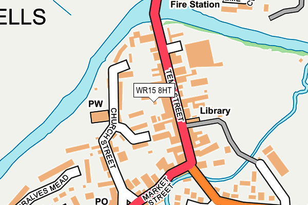
WR15 8HT is located in the Tenbury electoral ward, within the local authority district of Malvern Hills and the English Parliamentary constituency of West Worcestershire. The Sub Integrated Care Board (ICB) Location is NHS Herefordshire and Worcestershire ICB - 18C and the police force is West Mercia. This postcode has been in use since February 1990.


GetTheData
Source: OS OpenMap – Local (Ordnance Survey)
Source: OS VectorMap District (Ordnance Survey)
Licence: Open Government Licence (requires attribution)
| Easting | 359554 |
| Northing | 268405 |
| Latitude | 52.312255 |
| Longitude | -2.594702 |
GetTheData
Source: Open Postcode Geo
Licence: Open Government Licence
| Country | England |
| Postcode District | WR15 |
➜ See where WR15 is on a map ➜ Where is Tenbury Wells? | |
GetTheData
Source: Land Registry Price Paid Data
Licence: Open Government Licence
Elevation or altitude of WR15 8HT as distance above sea level:
| Metres | Feet | |
|---|---|---|
| Elevation | 50m | 164ft |
Elevation is measured from the approximate centre of the postcode, to the nearest point on an OS contour line from OS Terrain 50, which has contour spacing of ten vertical metres.
➜ How high above sea level am I? Find the elevation of your current position using your device's GPS.
GetTheData
Source: Open Postcode Elevation
Licence: Open Government Licence
| Ward | Tenbury |
| Constituency | West Worcestershire |
GetTheData
Source: ONS Postcode Database
Licence: Open Government Licence
| Regal (Teme Street) | Tenbury Wells | 36m |
| Regal (Teme Street) | Tenbury Wells | 47m |
| Cattle Market Car Park Temporary Stop (Teme Street) | Tenbury Wells | 107m |
| Swan Garage Temporary Stop (A456) | Tenbury Wells | 243m |
| Swimming Baths (Kyrewood Road) | Tenbury Wells | 312m |
GetTheData
Source: NaPTAN
Licence: Open Government Licence
GetTheData
Source: ONS Postcode Database
Licence: Open Government Licence


➜ Get more ratings from the Food Standards Agency
GetTheData
Source: Food Standards Agency
Licence: FSA terms & conditions
| Last Collection | |||
|---|---|---|---|
| Location | Mon-Fri | Sat | Distance |
| Tenbury Wells P.o. | 17:15 | 11:45 | 60m |
| Cross Street | 16:30 | 10:30 | 247m |
| Foresters Road | 16:30 | 08:30 | 556m |
GetTheData
Source: Dracos
Licence: Creative Commons Attribution-ShareAlike
| Risk of WR15 8HT flooding from rivers and sea | High |
| ➜ WR15 8HT flood map | |
GetTheData
Source: Open Flood Risk by Postcode
Licence: Open Government Licence
The below table lists the International Territorial Level (ITL) codes (formerly Nomenclature of Territorial Units for Statistics (NUTS) codes) and Local Administrative Units (LAU) codes for WR15 8HT:
| ITL 1 Code | Name |
|---|---|
| TLG | West Midlands (England) |
| ITL 2 Code | Name |
| TLG1 | Herefordshire, Worcestershire and Warwickshire |
| ITL 3 Code | Name |
| TLG12 | Worcestershire CC |
| LAU 1 Code | Name |
| E07000235 | Malvern Hills |
GetTheData
Source: ONS Postcode Directory
Licence: Open Government Licence
The below table lists the Census Output Area (OA), Lower Layer Super Output Area (LSOA), and Middle Layer Super Output Area (MSOA) for WR15 8HT:
| Code | Name | |
|---|---|---|
| OA | E00164323 | |
| LSOA | E01032214 | Malvern Hills 001D |
| MSOA | E02006710 | Malvern Hills 001 |
GetTheData
Source: ONS Postcode Directory
Licence: Open Government Licence
| WR15 8AE | Teme Street | 48m |
| WR15 8BT | Scotland Place | 57m |
| WR15 8AA | Teme Street | 67m |
| WR15 8BB | Teme Street | 84m |
| WR15 8AQ | Teme Street | 85m |
| WR15 8HZ | Vinery Mews | 96m |
| WR15 8BP | Church Street | 104m |
| WR15 8BA | Teme Street | 110m |
| WR15 8DX | The Mews | 116m |
| WR15 8BQ | Market Street | 152m |
GetTheData
Source: Open Postcode Geo; Land Registry Price Paid Data
Licence: Open Government Licence