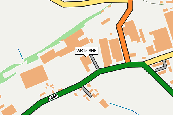
WR15 8HE is located in the Clee electoral ward, within the unitary authority of Shropshire and the English Parliamentary constituency of Ludlow. The Sub Integrated Care Board (ICB) Location is NHS Shropshire, Telford and Wrekin ICB - M2L0M and the police force is West Mercia. This postcode has been in use since June 2000.


GetTheData
Source: OS OpenMap – Local (Ordnance Survey)
Source: OS VectorMap District (Ordnance Survey)
Licence: Open Government Licence (requires attribution)
| Easting | 359143 |
| Northing | 268826 |
| Latitude | 52.316023 |
| Longitude | -2.600779 |
GetTheData
Source: Open Postcode Geo
Licence: Open Government Licence
| Country | England |
| Postcode District | WR15 |
➜ See where WR15 is on a map ➜ Where is Burford? | |
GetTheData
Source: Land Registry Price Paid Data
Licence: Open Government Licence
Elevation or altitude of WR15 8HE as distance above sea level:
| Metres | Feet | |
|---|---|---|
| Elevation | 60m | 197ft |
Elevation is measured from the approximate centre of the postcode, to the nearest point on an OS contour line from OS Terrain 50, which has contour spacing of ten vertical metres.
➜ How high above sea level am I? Find the elevation of your current position using your device's GPS.
GetTheData
Source: Open Postcode Elevation
Licence: Open Government Licence
| Ward | Clee |
| Constituency | Ludlow |
GetTheData
Source: ONS Postcode Database
Licence: Open Government Licence
| Rose And Crown Inn (A456) | Burford | 158m |
| Rose And Crown Inn (A456) | Burford | 159m |
| No. 8 (Stanbrook Road) | Burford | 449m |
| Swan Garage Temporary Stop (A456) | Tenbury Wells | 470m |
| No. 42 (Stanbrook Road) | Burford | 471m |
GetTheData
Source: NaPTAN
Licence: Open Government Licence
Estimated total energy consumption in WR15 8HE by fuel type, 2015.
| Consumption (kWh) | 31,042 |
|---|---|
| Meter count | 8 |
| Mean (kWh/meter) | 3,880 |
| Median (kWh/meter) | 327 |
GetTheData
Source: Postcode level gas estimates: 2015 (experimental)
Source: Postcode level electricity estimates: 2015 (experimental)
Licence: Open Government Licence
GetTheData
Source: ONS Postcode Database
Licence: Open Government Licence


➜ Get more ratings from the Food Standards Agency
GetTheData
Source: Food Standards Agency
Licence: FSA terms & conditions
| Last Collection | |||
|---|---|---|---|
| Location | Mon-Fri | Sat | Distance |
| Clee Hill Road | 16:45 | 08:30 | 169m |
| Tenbury Wells P.o. | 17:15 | 11:45 | 643m |
| Foresters Road | 16:30 | 08:30 | 716m |
GetTheData
Source: Dracos
Licence: Creative Commons Attribution-ShareAlike
The below table lists the International Territorial Level (ITL) codes (formerly Nomenclature of Territorial Units for Statistics (NUTS) codes) and Local Administrative Units (LAU) codes for WR15 8HE:
| ITL 1 Code | Name |
|---|---|
| TLG | West Midlands (England) |
| ITL 2 Code | Name |
| TLG2 | Shropshire and Staffordshire |
| ITL 3 Code | Name |
| TLG22 | Shropshire |
| LAU 1 Code | Name |
| E06000051 | Shropshire |
GetTheData
Source: ONS Postcode Directory
Licence: Open Government Licence
The below table lists the Census Output Area (OA), Lower Layer Super Output Area (LSOA), and Middle Layer Super Output Area (MSOA) for WR15 8HE:
| Code | Name | |
|---|---|---|
| OA | E00147661 | |
| LSOA | E01028995 | Shropshire 039A |
| MSOA | E02006046 | Shropshire 039 |
GetTheData
Source: ONS Postcode Directory
Licence: Open Government Licence
| WR15 8HD | Lineage Court | 120m |
| WR15 8HA | 147m | |
| WR15 8AJ | Boraston Lane | 196m |
| WR15 8RD | Old Bowling Green Close | 252m |
| WR15 8AH | 366m | |
| WR15 8LB | Archers Way | 371m |
| WR15 8UD | Swan Close | 410m |
| WR15 8AN | Stanbrook Road | 472m |
| WR15 8DX | The Mews | 474m |
| WR15 8QF | Swan Court | 475m |
GetTheData
Source: Open Postcode Geo; Land Registry Price Paid Data
Licence: Open Government Licence