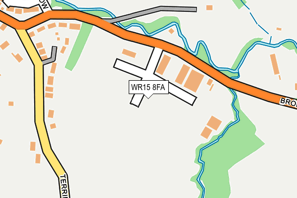
WR15 8FA is located in the Tenbury electoral ward, within the local authority district of Malvern Hills and the English Parliamentary constituency of West Worcestershire. The Sub Integrated Care Board (ICB) Location is NHS Herefordshire and Worcestershire ICB - 18C and the police force is West Mercia. This postcode has been in use since January 1993.


GetTheData
Source: OS OpenMap – Local (Ordnance Survey)
Source: OS VectorMap District (Ordnance Survey)
Licence: Open Government Licence (requires attribution)
| Easting | 360059 |
| Northing | 267250 |
| Latitude | 52.301923 |
| Longitude | -2.587155 |
GetTheData
Source: Open Postcode Geo
Licence: Open Government Licence
| Country | England |
| Postcode District | WR15 |
➜ See where WR15 is on a map ➜ Where is Tenbury Wells? | |
GetTheData
Source: Land Registry Price Paid Data
Licence: Open Government Licence
Elevation or altitude of WR15 8FA as distance above sea level:
| Metres | Feet | |
|---|---|---|
| Elevation | 60m | 197ft |
Elevation is measured from the approximate centre of the postcode, to the nearest point on an OS contour line from OS Terrain 50, which has contour spacing of ten vertical metres.
➜ How high above sea level am I? Find the elevation of your current position using your device's GPS.
GetTheData
Source: Open Postcode Elevation
Licence: Open Government Licence
| Ward | Tenbury |
| Constituency | West Worcestershire |
GetTheData
Source: ONS Postcode Database
Licence: Open Government Licence
| Business Park (Bromyard Road) | Tenbury Wells | 53m |
| Business Park (Bromyard Road) | Tenbury Wells | 58m |
| The Crescent | Tenbury Wells | 491m |
| Supermarket (Bromyard Road) | Tenbury Wells | 655m |
| Supermarket (Bromyard Road) | Tenbury Wells | 683m |
GetTheData
Source: NaPTAN
Licence: Open Government Licence
GetTheData
Source: ONS Postcode Database
Licence: Open Government Licence


➜ Get more ratings from the Food Standards Agency
GetTheData
Source: Food Standards Agency
Licence: FSA terms & conditions
| Last Collection | |||
|---|---|---|---|
| Location | Mon-Fri | Sat | Distance |
| Bromyard Road | 16:15 | 10:30 | 291m |
| Terrills Lane | 16:15 | 11:45 | 291m |
| Kyrewood | 16:30 | 10:45 | 709m |
GetTheData
Source: Dracos
Licence: Creative Commons Attribution-ShareAlike
The below table lists the International Territorial Level (ITL) codes (formerly Nomenclature of Territorial Units for Statistics (NUTS) codes) and Local Administrative Units (LAU) codes for WR15 8FA:
| ITL 1 Code | Name |
|---|---|
| TLG | West Midlands (England) |
| ITL 2 Code | Name |
| TLG1 | Herefordshire, Worcestershire and Warwickshire |
| ITL 3 Code | Name |
| TLG12 | Worcestershire CC |
| LAU 1 Code | Name |
| E07000235 | Malvern Hills |
GetTheData
Source: ONS Postcode Directory
Licence: Open Government Licence
The below table lists the Census Output Area (OA), Lower Layer Super Output Area (LSOA), and Middle Layer Super Output Area (MSOA) for WR15 8FA:
| Code | Name | |
|---|---|---|
| OA | E00164322 | |
| LSOA | E01032213 | Malvern Hills 001C |
| MSOA | E02006710 | Malvern Hills 001 |
GetTheData
Source: ONS Postcode Directory
Licence: Open Government Licence
| WR15 8DD | Terrills Lane | 223m |
| WR15 8DB | Bromyard Road | 223m |
| WR15 8HX | Mill Meadow | 341m |
| WR15 8FB | The Oaklands | 365m |
| WR15 8DJ | The Crescent | 376m |
| WR15 8DA | Bromyard Road | 417m |
| WR15 8DS | Oakbridge Court | 440m |
| WR15 8DG | The Crescent | 490m |
| WR15 8BX | Kyreside | 516m |
| WR15 8DF | Crescent Place | 520m |
GetTheData
Source: Open Postcode Geo; Land Registry Price Paid Data
Licence: Open Government Licence