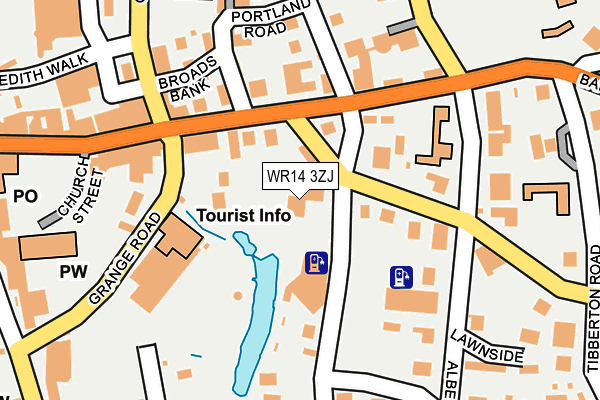
WR14 3ZJ is located in the Great Malvern electoral ward, within the local authority district of Malvern Hills and the English Parliamentary constituency of West Worcestershire. The Sub Integrated Care Board (ICB) Location is NHS Herefordshire and Worcestershire ICB - 18C and the police force is West Mercia. This postcode has been in use since June 1999.


GetTheData
Source: OS OpenMap – Local (Ordnance Survey)
Source: OS VectorMap District (Ordnance Survey)
Licence: Open Government Licence (requires attribution)
| Easting | 377848 |
| Northing | 245893 |
| Latitude | 52.110914 |
| Longitude | -2.324883 |
GetTheData
Source: Open Postcode Geo
Licence: Open Government Licence
| Country | England |
| Postcode District | WR14 |
➜ See where WR14 is on a map ➜ Where is Great Malvern? | |
GetTheData
Source: Land Registry Price Paid Data
Licence: Open Government Licence
Elevation or altitude of WR14 3ZJ as distance above sea level:
| Metres | Feet | |
|---|---|---|
| Elevation | 110m | 361ft |
Elevation is measured from the approximate centre of the postcode, to the nearest point on an OS contour line from OS Terrain 50, which has contour spacing of ten vertical metres.
➜ How high above sea level am I? Find the elevation of your current position using your device's GPS.
GetTheData
Source: Open Postcode Elevation
Licence: Open Government Licence
| Ward | Great Malvern |
| Constituency | West Worcestershire |
GetTheData
Source: ONS Postcode Database
Licence: Open Government Licence
| Church Street | Great Malvern | 95m |
| Church Street | Great Malvern | 130m |
| Theatre (Grange Road) | Great Malvern | 167m |
| Gold Hill Care Home (Avenue Road) | Great Malvern | 206m |
| Gold Hill Care Home (Avenue Road) | Great Malvern | 239m |
| Great Malvern Station | 0.5km |
| Malvern Link Station | 1.7km |
| Colwall Station | 4.1km |
GetTheData
Source: NaPTAN
Licence: Open Government Licence
GetTheData
Source: ONS Postcode Database
Licence: Open Government Licence


➜ Get more ratings from the Food Standards Agency
GetTheData
Source: Food Standards Agency
Licence: FSA terms & conditions
| Last Collection | |||
|---|---|---|---|
| Location | Mon-Fri | Sat | Distance |
| Church Street | 17:45 | 11:30 | 118m |
| Church Street | 17:45 | 11:30 | 119m |
| Albert Road South | 17:30 | 11:30 | 263m |
GetTheData
Source: Dracos
Licence: Creative Commons Attribution-ShareAlike
The below table lists the International Territorial Level (ITL) codes (formerly Nomenclature of Territorial Units for Statistics (NUTS) codes) and Local Administrative Units (LAU) codes for WR14 3ZJ:
| ITL 1 Code | Name |
|---|---|
| TLG | West Midlands (England) |
| ITL 2 Code | Name |
| TLG1 | Herefordshire, Worcestershire and Warwickshire |
| ITL 3 Code | Name |
| TLG12 | Worcestershire CC |
| LAU 1 Code | Name |
| E07000235 | Malvern Hills |
GetTheData
Source: ONS Postcode Directory
Licence: Open Government Licence
The below table lists the Census Output Area (OA), Lower Layer Super Output Area (LSOA), and Middle Layer Super Output Area (MSOA) for WR14 3ZJ:
| Code | Name | |
|---|---|---|
| OA | E00164294 | |
| LSOA | E01032209 | Malvern Hills 010B |
| MSOA | E02006719 | Malvern Hills 010 |
GetTheData
Source: ONS Postcode Directory
Licence: Open Government Licence
| WR14 2AZ | Church Street | 87m |
| WR14 3AG | Avenue Road | 91m |
| WR14 3HA | Grange Road | 92m |
| WR14 2AL | Church Street | 114m |
| WR14 2BA | Church Street | 116m |
| WR14 2AJ | Church Street | 146m |
| WR14 2GE | Victoria Road | 160m |
| WR14 2HN | Graham Road | 170m |
| WR14 3EY | Grange Road | 176m |
| WR14 2TA | Portland Road | 180m |
GetTheData
Source: Open Postcode Geo; Land Registry Price Paid Data
Licence: Open Government Licence