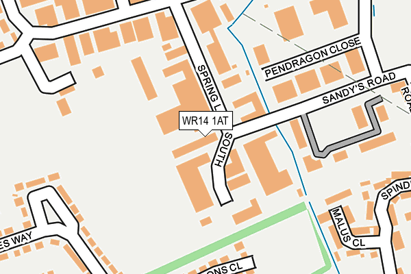
WR14 1AT lies on Spring Lane South in Malvern. WR14 1AT is located in the Link electoral ward, within the local authority district of Malvern Hills and the English Parliamentary constituency of West Worcestershire. The Sub Integrated Care Board (ICB) Location is NHS Herefordshire and Worcestershire ICB - 18C and the police force is West Mercia. This postcode has been in use since February 1990.


GetTheData
Source: OS OpenMap – Local (Ordnance Survey)
Source: OS VectorMap District (Ordnance Survey)
Licence: Open Government Licence (requires attribution)
| Easting | 379171 |
| Northing | 247384 |
| Latitude | 52.124381 |
| Longitude | -2.305652 |
GetTheData
Source: Open Postcode Geo
Licence: Open Government Licence
| Street | Spring Lane South |
| Town/City | Malvern |
| Country | England |
| Postcode District | WR14 |
➜ See where WR14 is on a map ➜ Where is Great Malvern? | |
GetTheData
Source: Land Registry Price Paid Data
Licence: Open Government Licence
Elevation or altitude of WR14 1AT as distance above sea level:
| Metres | Feet | |
|---|---|---|
| Elevation | 50m | 164ft |
Elevation is measured from the approximate centre of the postcode, to the nearest point on an OS contour line from OS Terrain 50, which has contour spacing of ten vertical metres.
➜ How high above sea level am I? Find the elevation of your current position using your device's GPS.
GetTheData
Source: Open Postcode Elevation
Licence: Open Government Licence
| Ward | Link |
| Constituency | West Worcestershire |
GetTheData
Source: ONS Postcode Database
Licence: Open Government Licence
T J MOULDINGS LTD, SPRING LANE SOUTH, MALVERN, WR14 1AT 1999 31 MAR £150,000 |
GetTheData
Source: HM Land Registry Price Paid Data
Licence: Contains HM Land Registry data © Crown copyright and database right 2025. This data is licensed under the Open Government Licence v3.0.
| Whiteacres Medical Centre (Sandy's Road) | Enigma Park | 345m |
| Betony Road Southbound (Betony Road) | Enigma Park | 357m |
| Betony Road Northbound (Betony Road) | Enigma Park | 386m |
| Whiteacres Medical Centre (Sandy's Road) | Enigma Park | 391m |
| Morgan Works (Pickersleigh Avenue) | Malvern Link | 438m |
| Malvern Link Station | 1km |
| Great Malvern Station | 1.9km |
| Colwall Station | 6.1km |
GetTheData
Source: NaPTAN
Licence: Open Government Licence
| Median download speed | 67.0Mbps |
| Average download speed | 54.5Mbps |
| Maximum download speed | 80.00Mbps |
| Median upload speed | 20.0Mbps |
| Average upload speed | 15.4Mbps |
| Maximum upload speed | 20.00Mbps |
GetTheData
Source: Ofcom
Licence: Ofcom Terms of Use (requires attribution)
GetTheData
Source: ONS Postcode Database
Licence: Open Government Licence

➜ Get more ratings from the Food Standards Agency
GetTheData
Source: Food Standards Agency
Licence: FSA terms & conditions
| Last Collection | |||
|---|---|---|---|
| Location | Mon-Fri | Sat | Distance |
| Sandys Road Business Box | 18:45 | 170m | |
| Maybank | 17:30 | 11:30 | 377m |
| Pickersleigh Avenue | 17:30 | 11:15 | 440m |
GetTheData
Source: Dracos
Licence: Creative Commons Attribution-ShareAlike
The below table lists the International Territorial Level (ITL) codes (formerly Nomenclature of Territorial Units for Statistics (NUTS) codes) and Local Administrative Units (LAU) codes for WR14 1AT:
| ITL 1 Code | Name |
|---|---|
| TLG | West Midlands (England) |
| ITL 2 Code | Name |
| TLG1 | Herefordshire, Worcestershire and Warwickshire |
| ITL 3 Code | Name |
| TLG12 | Worcestershire CC |
| LAU 1 Code | Name |
| E07000235 | Malvern Hills |
GetTheData
Source: ONS Postcode Directory
Licence: Open Government Licence
The below table lists the Census Output Area (OA), Lower Layer Super Output Area (LSOA), and Middle Layer Super Output Area (MSOA) for WR14 1AT:
| Code | Name | |
|---|---|---|
| OA | E00164213 | |
| LSOA | E01032196 | Malvern Hills 004C |
| MSOA | E02006713 | Malvern Hills 004 |
GetTheData
Source: ONS Postcode Directory
Licence: Open Government Licence
| WR14 1JJ | Sandys Road | 217m |
| WR14 2UX | Ramsons Close | 226m |
| WR14 2LZ | Charles Way | 233m |
| WR14 2WD | Malus Close | 235m |
| WR14 2UT | Arum Close | 287m |
| WR14 2WB | Spindle Road | 287m |
| WR14 2US | May Bank | 289m |
| WR14 2NA | Charles Way | 291m |
| WR14 2UU | Whitethorn Grove | 319m |
| WR14 2WE | Mansfield Road | 331m |
GetTheData
Source: Open Postcode Geo; Land Registry Price Paid Data
Licence: Open Government Licence