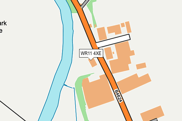
WR11 4XE is located in the Evesham North electoral ward, within the local authority district of Wychavon and the English Parliamentary constituency of Mid Worcestershire. The Sub Integrated Care Board (ICB) Location is NHS Herefordshire and Worcestershire ICB - 18C and the police force is West Mercia. This postcode has been in use since January 1993.


GetTheData
Source: OS OpenMap – Local (Ordnance Survey)
Source: OS VectorMap District (Ordnance Survey)
Licence: Open Government Licence (requires attribution)
| Easting | 403384 |
| Northing | 244955 |
| Latitude | 52.102920 |
| Longitude | -1.952009 |
GetTheData
Source: Open Postcode Geo
Licence: Open Government Licence
| Country | England |
| Postcode District | WR11 |
➜ See where WR11 is on a map ➜ Where is Evesham? | |
GetTheData
Source: Land Registry Price Paid Data
Licence: Open Government Licence
Elevation or altitude of WR11 4XE as distance above sea level:
| Metres | Feet | |
|---|---|---|
| Elevation | 30m | 98ft |
Elevation is measured from the approximate centre of the postcode, to the nearest point on an OS contour line from OS Terrain 50, which has contour spacing of ten vertical metres.
➜ How high above sea level am I? Find the elevation of your current position using your device's GPS.
GetTheData
Source: Open Postcode Elevation
Licence: Open Government Licence
| Ward | Evesham North |
| Constituency | Mid Worcestershire |
GetTheData
Source: ONS Postcode Database
Licence: Open Government Licence
| Tesco (Worcester Road) | Greenhill | 143m |
| Tesco (Worcester Road) | Greenhill | 144m |
| Tesco (Approach Road) | Greenhill | 245m |
| St. Egwins School (Worcester Road) | Greenhill | 443m |
| Collinsfield (Greenhill) | Greenhill | 526m |
| Evesham Station | 0.6km |
GetTheData
Source: NaPTAN
Licence: Open Government Licence
GetTheData
Source: ONS Postcode Database
Licence: Open Government Licence


➜ Get more ratings from the Food Standards Agency
GetTheData
Source: Food Standards Agency
Licence: FSA terms & conditions
| Last Collection | |||
|---|---|---|---|
| Location | Mon-Fri | Sat | Distance |
| Green Hill | 17:15 | 11:00 | 569m |
| Lower Green Hill | 17:30 | 11:00 | 615m |
| Croft Road | 17:15 | 11:00 | 675m |
GetTheData
Source: Dracos
Licence: Creative Commons Attribution-ShareAlike
The below table lists the International Territorial Level (ITL) codes (formerly Nomenclature of Territorial Units for Statistics (NUTS) codes) and Local Administrative Units (LAU) codes for WR11 4XE:
| ITL 1 Code | Name |
|---|---|
| TLG | West Midlands (England) |
| ITL 2 Code | Name |
| TLG1 | Herefordshire, Worcestershire and Warwickshire |
| ITL 3 Code | Name |
| TLG12 | Worcestershire CC |
| LAU 1 Code | Name |
| E07000238 | Wychavon |
GetTheData
Source: ONS Postcode Directory
Licence: Open Government Licence
The below table lists the Census Output Area (OA), Lower Layer Super Output Area (LSOA), and Middle Layer Super Output Area (MSOA) for WR11 4XE:
| Code | Name | |
|---|---|---|
| OA | E00165134 | |
| LSOA | E01032376 | Wychavon 015A |
| MSOA | E02006762 | Wychavon 015 |
GetTheData
Source: ONS Postcode Directory
Licence: Open Government Licence
| WR11 4TA | Worcester Road | 305m |
| WR11 4LJ | St Christopher Court | 316m |
| WR11 4LL | St Christopher Court | 316m |
| WR11 4JT | Briar Close Business Park | 458m |
| WR11 4JU | Worcester Road | 465m |
| WR11 4LX | Greenhill | 510m |
| WR11 4NA | Greenhill | 526m |
| WR11 4NN | Goodalls Grove | 553m |
| WR11 4JF | Shepherds Pool | 554m |
| WR11 4LR | Greenhill | 583m |
GetTheData
Source: Open Postcode Geo; Land Registry Price Paid Data
Licence: Open Government Licence