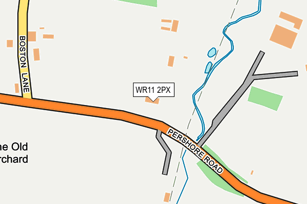
WR11 2PX is located in the Fladbury electoral ward, within the local authority district of Wychavon and the English Parliamentary constituency of Mid Worcestershire. The Sub Integrated Care Board (ICB) Location is NHS Herefordshire and Worcestershire ICB - 18C and the police force is West Mercia. This postcode has been in use since October 2004.


GetTheData
Source: OS OpenMap – Local (Ordnance Survey)
Source: OS VectorMap District (Ordnance Survey)
Licence: Open Government Licence (requires attribution)
| Easting | 401658 |
| Northing | 243612 |
| Latitude | 52.090853 |
| Longitude | -1.977214 |
GetTheData
Source: Open Postcode Geo
Licence: Open Government Licence
| Country | England |
| Postcode District | WR11 |
➜ See where WR11 is on a map | |
GetTheData
Source: Land Registry Price Paid Data
Licence: Open Government Licence
Elevation or altitude of WR11 2PX as distance above sea level:
| Metres | Feet | |
|---|---|---|
| Elevation | 40m | 131ft |
Elevation is measured from the approximate centre of the postcode, to the nearest point on an OS contour line from OS Terrain 50, which has contour spacing of ten vertical metres.
➜ How high above sea level am I? Find the elevation of your current position using your device's GPS.
GetTheData
Source: Open Postcode Elevation
Licence: Open Government Licence
| Ward | Fladbury |
| Constituency | Mid Worcestershire |
GetTheData
Source: ONS Postcode Database
Licence: Open Government Licence
| Boston Lane (B4084) | Hampton | 230m |
| Berryfield Road (Pershore Road) | Hampton | 661m |
| Berryfield Road (Pershore Road) | Hampton | 662m |
| Evendene Road Terminus (Evendene Road) | Hampton | 682m |
| Charlton Close (Evendene Road) | Hampton | 694m |
| Evesham Station | 2.2km |
GetTheData
Source: NaPTAN
Licence: Open Government Licence
GetTheData
Source: ONS Postcode Database
Licence: Open Government Licence


➜ Get more ratings from the Food Standards Agency
GetTheData
Source: Food Standards Agency
Licence: FSA terms & conditions
| Last Collection | |||
|---|---|---|---|
| Location | Mon-Fri | Sat | Distance |
| Haselor | 16:00 | 10:00 | 371m |
| Evendene Road | 17:30 | 11:00 | 910m |
| Martin Avenue | 17:15 | 11:00 | 946m |
GetTheData
Source: Dracos
Licence: Creative Commons Attribution-ShareAlike
The below table lists the International Territorial Level (ITL) codes (formerly Nomenclature of Territorial Units for Statistics (NUTS) codes) and Local Administrative Units (LAU) codes for WR11 2PX:
| ITL 1 Code | Name |
|---|---|
| TLG | West Midlands (England) |
| ITL 2 Code | Name |
| TLG1 | Herefordshire, Worcestershire and Warwickshire |
| ITL 3 Code | Name |
| TLG12 | Worcestershire CC |
| LAU 1 Code | Name |
| E07000238 | Wychavon |
GetTheData
Source: ONS Postcode Directory
Licence: Open Government Licence
The below table lists the Census Output Area (OA), Lower Layer Super Output Area (LSOA), and Middle Layer Super Output Area (MSOA) for WR11 2PX:
| Code | Name | |
|---|---|---|
| OA | E00165162 | |
| LSOA | E01032382 | Wychavon 010B |
| MSOA | E02006757 | Wychavon 010 |
GetTheData
Source: ONS Postcode Directory
Licence: Open Government Licence
| WR11 2PL | Pershore Road | 311m |
| WR11 2RA | Haselor Lane | 350m |
| WR11 2RD | Boston Lane | 439m |
| WR11 2AA | Stewart Close | 465m |
| WR11 2AT | Merry Brook Heights | 473m |
| WR11 2QE | Charlton Close | 542m |
| WR11 2QF | Merrybrook | 556m |
| WR11 2PB | Hillside Close | 582m |
| WR11 2QA | Evendene Road | 697m |
| WR11 2QD | Berryfield Road | 710m |
GetTheData
Source: Open Postcode Geo; Land Registry Price Paid Data
Licence: Open Government Licence