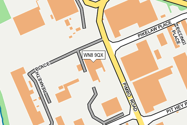
WN8 9QX is located in the Up Holland electoral ward, within the local authority district of West Lancashire and the English Parliamentary constituency of West Lancashire. The Sub Integrated Care Board (ICB) Location is NHS Lancashire and South Cumbria ICB - 02G and the police force is Lancashire. This postcode has been in use since August 1993.


GetTheData
Source: OS OpenMap – Local (Ordnance Survey)
Source: OS VectorMap District (Ordnance Survey)
Licence: Open Government Licence (requires attribution)
| Easting | 349065 |
| Northing | 404227 |
| Latitude | 53.532232 |
| Longitude | -2.769910 |
GetTheData
Source: Open Postcode Geo
Licence: Open Government Licence
| Country | England |
| Postcode District | WN8 |
➜ See where WN8 is on a map ➜ Where is Skelmersdale? | |
GetTheData
Source: Land Registry Price Paid Data
Licence: Open Government Licence
Elevation or altitude of WN8 9QX as distance above sea level:
| Metres | Feet | |
|---|---|---|
| Elevation | 60m | 197ft |
Elevation is measured from the approximate centre of the postcode, to the nearest point on an OS contour line from OS Terrain 50, which has contour spacing of ten vertical metres.
➜ How high above sea level am I? Find the elevation of your current position using your device's GPS.
GetTheData
Source: Open Postcode Elevation
Licence: Open Government Licence
| Ward | Up Holland |
| Constituency | West Lancashire |
GetTheData
Source: ONS Postcode Database
Licence: Open Government Licence
| Pikelaw Place (Pimbo Road) | Pimbo | 201m |
| Pepsico (Pimbo Road) | Pimbo | 392m |
| Industrial Park (Potter Place) | Pimbo | 612m |
| Bearncroft (Digmoor Road) | Digmoor | 647m |
| Bearncroft (Digmoor Road) | Digmoor | 703m |
| Upholland Station | 1.9km |
| Rainford Station | 2.1km |
| Orrell Station | 4.1km |
GetTheData
Source: NaPTAN
Licence: Open Government Licence
GetTheData
Source: ONS Postcode Database
Licence: Open Government Licence


➜ Get more ratings from the Food Standards Agency
GetTheData
Source: Food Standards Agency
Licence: FSA terms & conditions
| Last Collection | |||
|---|---|---|---|
| Location | Mon-Fri | Sat | Distance |
| Martins Lane | 17:30 | 11:00 | 786m |
| 83 Banksbarn | 17:35 | 11:00 | 788m |
| Skelmersdale Delivery Office | 19:00 | 12:00 | 1,555m |
GetTheData
Source: Dracos
Licence: Creative Commons Attribution-ShareAlike
The below table lists the International Territorial Level (ITL) codes (formerly Nomenclature of Territorial Units for Statistics (NUTS) codes) and Local Administrative Units (LAU) codes for WN8 9QX:
| ITL 1 Code | Name |
|---|---|
| TLD | North West (England) |
| ITL 2 Code | Name |
| TLD4 | Lancashire |
| ITL 3 Code | Name |
| TLD47 | Chorley and West Lancashire |
| LAU 1 Code | Name |
| E07000127 | West Lancashire |
GetTheData
Source: ONS Postcode Directory
Licence: Open Government Licence
The below table lists the Census Output Area (OA), Lower Layer Super Output Area (LSOA), and Middle Layer Super Output Area (MSOA) for WN8 9QX:
| Code | Name | |
|---|---|---|
| OA | E00129568 | |
| LSOA | E01025535 | West Lancashire 015B |
| MSOA | E02005318 | West Lancashire 015 |
GetTheData
Source: ONS Postcode Directory
Licence: Open Government Licence
| WN8 9PL | Paddock Road | 229m |
| WN8 9QH | Paxton Place | 464m |
| WN8 9PY | Nipe Lane | 540m |
| WN8 9LZ | Alderley | 598m |
| WN8 9NA | Alderley | 608m |
| WN8 9NB | Alderley | 628m |
| WN8 9LY | Alderley | 664m |
| WN8 9NE | Abbeystead | 674m |
| WN8 9HQ | Belfield | 680m |
| WN8 9LX | Acregate | 710m |
GetTheData
Source: Open Postcode Geo; Land Registry Price Paid Data
Licence: Open Government Licence