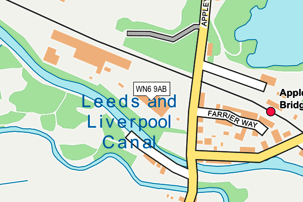
WN6 9AB is located in the Rural North East electoral ward, within the local authority district of West Lancashire and the English Parliamentary constituency of West Lancashire. The Sub Integrated Care Board (ICB) Location is NHS Lancashire and South Cumbria ICB - 02G and the police force is Lancashire. This postcode has been in use since January 1980.


GetTheData
Source: OS OpenMap – Local (Ordnance Survey)
Source: OS VectorMap District (Ordnance Survey)
Licence: Open Government Licence (requires attribution)
| Easting | 352235 |
| Northing | 409374 |
| Latitude | 53.578773 |
| Longitude | -2.722879 |
GetTheData
Source: Open Postcode Geo
Licence: Open Government Licence
| Country | England |
| Postcode District | WN6 |
➜ See where WN6 is on a map ➜ Where is Shevington Vale? | |
GetTheData
Source: Land Registry Price Paid Data
Licence: Open Government Licence
Elevation or altitude of WN6 9AB as distance above sea level:
| Metres | Feet | |
|---|---|---|
| Elevation | 30m | 98ft |
Elevation is measured from the approximate centre of the postcode, to the nearest point on an OS contour line from OS Terrain 50, which has contour spacing of ten vertical metres.
➜ How high above sea level am I? Find the elevation of your current position using your device's GPS.
GetTheData
Source: Open Postcode Elevation
Licence: Open Government Licence
| Ward | Rural North East |
| Constituency | West Lancashire |
GetTheData
Source: ONS Postcode Database
Licence: Open Government Licence
| Rail Station (Appley Lane North) | Appley Bridge | 119m |
| Railway Station (Appley Lane North) | Appley Bridge | 134m |
| Mill Lane | Appley Bridge | 152m |
| Mill Lane | Appley Bridge | 184m |
| Heys Street (Appley Lane South) | Appley Bridge | 340m |
| Appley Bridge Station | 0.2km |
| Gathurst Station | 2.9km |
| Parbold Station | 3.4km |
GetTheData
Source: NaPTAN
Licence: Open Government Licence
GetTheData
Source: ONS Postcode Database
Licence: Open Government Licence


➜ Get more ratings from the Food Standards Agency
GetTheData
Source: Food Standards Agency
Licence: FSA terms & conditions
| Last Collection | |||
|---|---|---|---|
| Location | Mon-Fri | Sat | Distance |
| Shevington P O | 18:35 | 12:25 | 2,084m |
| 12 Roby Mill | 18:30 | 11:00 | 2,122m |
| Ashurst Beacon | 16:40 | 11:00 | 2,723m |
GetTheData
Source: Dracos
Licence: Creative Commons Attribution-ShareAlike
The below table lists the International Territorial Level (ITL) codes (formerly Nomenclature of Territorial Units for Statistics (NUTS) codes) and Local Administrative Units (LAU) codes for WN6 9AB:
| ITL 1 Code | Name |
|---|---|
| TLD | North West (England) |
| ITL 2 Code | Name |
| TLD4 | Lancashire |
| ITL 3 Code | Name |
| TLD47 | Chorley and West Lancashire |
| LAU 1 Code | Name |
| E07000127 | West Lancashire |
GetTheData
Source: ONS Postcode Directory
Licence: Open Government Licence
The below table lists the Census Output Area (OA), Lower Layer Super Output Area (LSOA), and Middle Layer Super Output Area (MSOA) for WN6 9AB:
| Code | Name | |
|---|---|---|
| OA | E00129599 | |
| LSOA | E01025539 | West Lancashire 005E |
| MSOA | E02005308 | West Lancashire 005 |
GetTheData
Source: ONS Postcode Directory
Licence: Open Government Licence
| WN6 9AD | Appley Lane North | 99m |
| WN6 9AW | Canal Bank | 121m |
| WN6 9AN | Appley Lane North | 121m |
| WN6 9AZ | Farrier Way | 184m |
| WN6 9AY | Coronet Close | 191m |
| WN6 9DA | Mill Lane | 202m |
| WN6 9AP | Appley Lane North | 238m |
| WN6 9AS | Heyes Street | 308m |
| WN6 9BH | Stonemill Rise | 424m |
| WN6 9AT | Speakmans Drive | 436m |
GetTheData
Source: Open Postcode Geo; Land Registry Price Paid Data
Licence: Open Government Licence