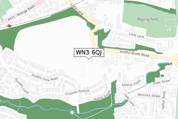
WN3 6QJ is located in the Worsley Mesnes electoral ward, within the metropolitan district of Wigan and the English Parliamentary constituency of Makerfield. The Sub Integrated Care Board (ICB) Location is NHS Greater Manchester ICB - 02H and the police force is Greater Manchester. This postcode has been in use since May 2019.


GetTheData
Source: OS Open Zoomstack (Ordnance Survey)
Licence: Open Government Licence (requires attribution)
Attribution: Contains OS data © Crown copyright and database right 2025
Source: Open Postcode Geo
Licence: Open Government Licence (requires attribution)
Attribution: Contains OS data © Crown copyright and database right 2025; Contains Royal Mail data © Royal Mail copyright and database right 2025; Source: Office for National Statistics licensed under the Open Government Licence v.3.0
| Easting | 356179 |
| Northing | 403786 |
| Latitude | 53.528910 |
| Longitude | -2.662531 |
GetTheData
Source: Open Postcode Geo
Licence: Open Government Licence
| Country | England |
| Postcode District | WN3 |
➜ See where WN3 is on a map ➜ Where is Wigan? | |
GetTheData
Source: Land Registry Price Paid Data
Licence: Open Government Licence
| Ward | Worsley Mesnes |
| Constituency | Makerfield |
GetTheData
Source: ONS Postcode Database
Licence: Open Government Licence
| Billinge Rd/Hillary Ave (Billinge Rd) | Pemberton | 419m |
| Billinge Rd/Hillary Ave (Billinge Rd) | Pemberton | 429m |
| Warrington Rd/St Pauls Ave (Warrington Rd) | Goose Green | 501m |
| Warrington Rd/Little Ln (Warrington Rd) | Goose Green | 504m |
| Clap Gate Lane (South Bound) (Clap Gate Lane) | Goose Green | 513m |
| Pemberton Station | 0.5km |
| Wigan North Western Station | 2.5km |
| Wigan Wallgate Station | 2.6km |
GetTheData
Source: NaPTAN
Licence: Open Government Licence
GetTheData
Source: ONS Postcode Database
Licence: Open Government Licence


➜ Get more ratings from the Food Standards Agency
GetTheData
Source: Food Standards Agency
Licence: FSA terms & conditions
| Last Collection | |||
|---|---|---|---|
| Location | Mon-Fri | Sat | Distance |
| Frederick Street | 18:00 | 11:00 | 976m |
| Lamberhead Green P O | 18:55 | 12:25 | 1,052m |
| Tanhouse Drive | 18:00 | 12:20 | 1,229m |
GetTheData
Source: Dracos
Licence: Creative Commons Attribution-ShareAlike
The below table lists the International Territorial Level (ITL) codes (formerly Nomenclature of Territorial Units for Statistics (NUTS) codes) and Local Administrative Units (LAU) codes for WN3 6QJ:
| ITL 1 Code | Name |
|---|---|
| TLD | North West (England) |
| ITL 2 Code | Name |
| TLD3 | Greater Manchester |
| ITL 3 Code | Name |
| TLD36 | Greater Manchester North West |
| LAU 1 Code | Name |
| E08000010 | Wigan |
GetTheData
Source: ONS Postcode Directory
Licence: Open Government Licence
The below table lists the Census Output Area (OA), Lower Layer Super Output Area (LSOA), and Middle Layer Super Output Area (MSOA) for WN3 6QJ:
| Code | Name | |
|---|---|---|
| OA | E00032445 | |
| LSOA | E01006400 | Wigan 021D |
| MSOA | E02001307 | Wigan 021 |
GetTheData
Source: ONS Postcode Directory
Licence: Open Government Licence
| WN3 6GR | Crossley Avenue | 164m |
| WN3 6NY | Appleton Grove | 202m |
| WN3 6PX | Little Lane | 224m |
| WN3 6GJ | Findley Cook Road | 264m |
| WN3 6RA | Palatine Close | 268m |
| WN3 6RG | Lady Lane | 277m |
| WN3 6PR | Beecham Court | 278m |
| WN3 6RE | Salwick Close | 291m |
| WN3 6PZ | Little Lane | 310m |
| WN3 6GP | Watkin Close | 334m |
GetTheData
Source: Open Postcode Geo; Land Registry Price Paid Data
Licence: Open Government Licence