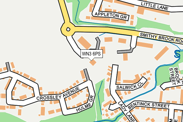
WN3 6PS is located in the Worsley Mesnes electoral ward, within the metropolitan district of Wigan and the English Parliamentary constituency of Makerfield. The Sub Integrated Care Board (ICB) Location is NHS Greater Manchester ICB - 02H and the police force is Greater Manchester. This postcode has been in use since May 2007.


GetTheData
Source: OS OpenMap – Local (Ordnance Survey)
Source: OS VectorMap District (Ordnance Survey)
Licence: Open Government Licence (requires attribution)
| Easting | 356269 |
| Northing | 403789 |
| Latitude | 53.528944 |
| Longitude | -2.661174 |
GetTheData
Source: Open Postcode Geo
Licence: Open Government Licence
| Country | England |
| Postcode District | WN3 |
➜ See where WN3 is on a map ➜ Where is Wigan? | |
GetTheData
Source: Land Registry Price Paid Data
Licence: Open Government Licence
Elevation or altitude of WN3 6PS as distance above sea level:
| Metres | Feet | |
|---|---|---|
| Elevation | 50m | 164ft |
Elevation is measured from the approximate centre of the postcode, to the nearest point on an OS contour line from OS Terrain 50, which has contour spacing of ten vertical metres.
➜ How high above sea level am I? Find the elevation of your current position using your device's GPS.
GetTheData
Source: Open Postcode Elevation
Licence: Open Government Licence
| Ward | Worsley Mesnes |
| Constituency | Makerfield |
GetTheData
Source: ONS Postcode Database
Licence: Open Government Licence
| Warrington Rd/St Pauls Ave (Warrington Rd) | Goose Green | 413m |
| Warrington Rd/Little Ln (Warrington Rd) | Goose Green | 415m |
| Warrington Rd/Little Ln (Warrington Rd) | Goose Green | 439m |
| Warrington Rd/St Pauls Ave (Warrington Rd) | Goose Green | 462m |
| Billinge Rd/Hillary Ave (Billinge Rd) | Pemberton | 474m |
| Pemberton Station | 0.6km |
| Wigan North Western Station | 2.5km |
| Wigan Wallgate Station | 2.6km |
GetTheData
Source: NaPTAN
Licence: Open Government Licence
GetTheData
Source: ONS Postcode Database
Licence: Open Government Licence


➜ Get more ratings from the Food Standards Agency
GetTheData
Source: Food Standards Agency
Licence: FSA terms & conditions
| Last Collection | |||
|---|---|---|---|
| Location | Mon-Fri | Sat | Distance |
| Frederick Street | 18:00 | 11:00 | 1,002m |
| Lamberhead Green P O | 18:55 | 12:25 | 1,120m |
| Tanhouse Drive | 18:00 | 12:20 | 1,285m |
GetTheData
Source: Dracos
Licence: Creative Commons Attribution-ShareAlike
The below table lists the International Territorial Level (ITL) codes (formerly Nomenclature of Territorial Units for Statistics (NUTS) codes) and Local Administrative Units (LAU) codes for WN3 6PS:
| ITL 1 Code | Name |
|---|---|
| TLD | North West (England) |
| ITL 2 Code | Name |
| TLD3 | Greater Manchester |
| ITL 3 Code | Name |
| TLD36 | Greater Manchester North West |
| LAU 1 Code | Name |
| E08000010 | Wigan |
GetTheData
Source: ONS Postcode Directory
Licence: Open Government Licence
The below table lists the Census Output Area (OA), Lower Layer Super Output Area (LSOA), and Middle Layer Super Output Area (MSOA) for WN3 6PS:
| Code | Name | |
|---|---|---|
| OA | E00032461 | |
| LSOA | E01006404 | Wigan 015C |
| MSOA | E02001301 | Wigan 015 |
GetTheData
Source: ONS Postcode Directory
Licence: Open Government Licence
| WN3 6NY | Appleton Grove | 133m |
| WN3 6PR | Beecham Court | 188m |
| WN3 6PX | Little Lane | 200m |
| WN3 6GR | Crossley Avenue | 202m |
| WN3 6RE | Salwick Close | 214m |
| WN3 6RG | Lady Lane | 218m |
| WN3 6RA | Palatine Close | 219m |
| WN3 6PZ | Little Lane | 227m |
| WN3 6RB | Bentinck Street | 326m |
| WN3 6RH | Cromer Road | 333m |
GetTheData
Source: Open Postcode Geo; Land Registry Price Paid Data
Licence: Open Government Licence